
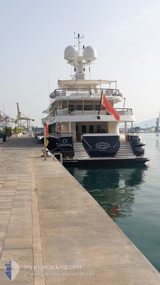
DENIKI
Yacht
Current Trip
| Time Travelled | 27 mins |
|---|---|
| Remaining Time | 4 h, 33 mins |
| Distance Travelled | 5.82 nm |
| Remaining Distance | 63.82 nm |
| AVG Speed | 13.7 Knots |
| MAX Speed | 14.1 Knots |
| AVG Wind | 6.7 knots |
| MAX Wind | 8 knots |
| MIN Temp | 15.6°C / 60.08°F |
| MAX Temp | 16.7°C / 62.06°F |
| Draught | 3.3 m |
| Position Received | 1 m ago |
Current Position
| Longitude | 2.56224° |
|---|---|
| Latitude | 39.47688° |
| Status | Under way using engine |
| Speed | 13.6 Knots |
| Course | 222.7° |
| Area | Balearic Sea |
| Station | T-AIS |
| Position Received | 1 m ago |
Info
Information
The current position of DENIKI is in Balearic Sea with coordinates 39.47688° / 2.56224° as reported on 2024-04-19 10:40 by AIS to our vessel tracker app. The vessel's current speed is 13.6 Knots and is heading at the port of IBIZA. The estimated time of arrival as calculated by MyShipTracking vessel tracking app is 2024-04-19 15:14 LT
The vessel DENIKI (IMO: 1009077, MMSI: 229852000) is a Yacht that was built in 2007 ( 17 years old ). It's sailing under the flag of [MT] Malta.
In this page you can find informations about the vessels current position, last detected port calls, and current voyage information. If the vessels is not in coverage by AIS you will find the latest position.
The current position of DENIKI is detected by our AIS receivers and we are not responsible for the reliability of the data. The last position was recorded while the vessel was in Coverage by the Ais receivers of our vessel tracking app.
The current draught of DENIKI as reported by AIS is 3.3 meters
Weather
| Temperature | 15.5°C / 59.9°F |
|---|---|
| Wind Speed | 5 knots |
| Direction | 228° SW |
| Pressure | 1023.5 hPa |
| Humidity | 45.9 % |
| Cloud Coverage | 6 % |
Featured Company
Last Port Calls
| Port | Arrival | Departure | Time In Port |
|---|---|---|---|
| 2024-04-16 05:54 | 2024-04-19 10:14 | 3 d | |
| 2024-04-15 16:57 | |||
| 2024-02-19 10:33 | 2024-03-12 18:24 | 22 d | |
| 2024-02-19 09:18 |
Last Trips
| Origin | Departure | Destination | Arrival | Distance | |
|---|---|---|---|---|---|
| 2024-04-15 18:57 | 2024-04-16 07:54 | 69.90 nm | |||
| 2024-02-19 10:18 | 2024-02-19 11:33 | 15.83 nm |
Events
| Time | Event | Details | Position / Dest | Info |
|---|---|---|---|---|
| 2024-04-19 10:14 | PORT DEPARTURE |
|
39.55151 / 2.64255
ES PMI > ES IBZ
|
Speed: 5.6 kn Course: 177° |
| 2024-04-19 10:03 | START Moving |
39.56430 / 2.63466
[ES] PALMA DE MALLORCA
|
Speed: 5.1 kn Course: 244° |
|
| 2024-04-19 06:54 | STOP Moving |
39.56471 / 2.63708
[ES] PALMA DE MALLORCA
|
Speed: 0.2 kn Course: 136° |
|
| 2024-04-19 06:49 | START Moving |
39.56171 / 2.63117
[ES] PALMA DE MALLORCA
|
Speed: 5 kn Course: 51° |
|
| 2024-04-19 06:30 | Status Changed | Under way using engine Moored |
39.55992 / 2.62932
[ES] PALMA DE MALLORCA
|
Speed: Course: 8° |
| 2024-04-19 06:13 | Destination Changed | ES PMI > ES IBZ ES IBZ > ES PMI |
39.55990 / 2.62932
[ES] PALMA DE MALLORCA
|
Speed: Course: 8° |
| 2024-04-19 06:13 | ETA Changed | 2024/04/19 16:30 2024/04/16 08:00 |
39.55990 / 2.62932
[ES] PALMA DE MALLORCA
|
Speed: Course: 8° |
| 2024-04-16 06:21 | Status Changed | Moored Under way using engine |
39.55989 / 2.62932
[ES] PALMA DE MALLORCA
|
Speed: Course: 8° |
| 2024-04-16 06:07 | STOP Moving |
39.56072 / 2.62912
[ES] PALMA DE MALLORCA
|
Speed: 0.3 kn Course: 311° |
|
| 2024-04-16 05:54 | PORT ARRIVAL |
|
39.55666 / 2.64203
[ES] PALMA DE MALLORCA
|
Speed: 8.9 kn Course: 312.7° |