
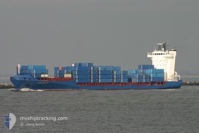
DENEB
Container Ship
Current Trip
| Time Travelled | 3 days |
|---|---|
| Remaining Time | --- |
| Distance Travelled | 801.56 nm |
| Remaining Distance | --- |
| AVG Speed | 12.6 Knots |
| MAX Speed | 14.8 Knots |
| AVG Wind | 10.7 knots |
| MAX Wind | 21.3 knots |
| MIN Temp | 10.5°C / 50.9°F |
| MAX Temp | 27.8°C / 82.04°F |
| Draught | 7.2 m |
| Position Received | 23 h, 58 m ago |
Current Position
| Longitude | -81.86006° |
|---|---|
| Latitude | 23.51876° |
| Status | Under way using engine |
| Speed | 13.2 Knots |
| Course | 235.8° |
| Area | North Atlantic Ocean |
| Station | T-AIS |
| Position Received | 23 h, 58 m ago |
Info
Information
The current position of DENEB is in North Atlantic Ocean with coordinates 23.51876° / -81.86006° as reported on 2024-04-15 18:48 by AIS to our vessel tracker app. The vessel's current speed is 13.2 Knots
The vessel DENEB (IMO: 9344241, MMSI: 304941000) is a Container Ship that was built in 2006 ( 18 years old ). It's sailing under the flag of [AG] Antigua Barbuda.
In this page you can find informations about the vessels current position, last detected port calls, and current voyage information. If the vessels is not in coverage by AIS you will find the latest position.
The current position of DENEB is detected by our AIS receivers and we are not responsible for the reliability of the data. The last position was recorded while the vessel was in Coverage by the Ais receivers of our vessel tracking app.
The current draught of DENEB as reported by AIS is 7.2 meters
Weather
| Temperature | 24.6°C / 76.28°F |
|---|---|
| Wind Speed | 22 knots |
| Direction | 52° NE |
| Pressure | 1016 hPa |
| Humidity | 76 % |
| Cloud Coverage | 51 % |
Featured Company
Last Port Calls
| Port | Arrival | Departure | Time In Port |
|---|---|---|---|
| 2024-04-12 18:55 | 2024-04-13 10:57 | 16 h | |
| 2024-04-10 10:53 | 2024-04-10 22:27 | 11 h | |
| 2024-04-07 12:39 | 2024-04-08 04:24 | 15 h | |
| 2024-04-07 12:16 | 2024-04-07 12:24 | 7 m | |
| 2024-04-04 13:09 | 2024-04-04 22:24 | 9 h | |
| 2024-04-03 19:35 | 2024-04-04 05:19 | 9 h | |
| 2024-04-01 09:06 | 2024-04-01 23:24 | 14 h | |
| 2024-03-29 00:04 | 2024-03-29 18:32 | 18 h | |
| 2024-03-26 10:39 | 2024-03-27 22:25 | 1 d | |
| 2024-03-22 11:35 | 2024-03-22 20:55 | 9 h |
Most Visited Ports (Last year)
| Port | Arrivals | |
|---|---|---|
| 55 | ||
| 48 | ||
| 17 | ||
| 16 | ||
| 13 | ||
| 10 |
Last Trips
| Origin | Departure | Destination | Arrival | Distance | |
|---|---|---|---|---|---|
| 2024-04-10 18:27 | 2024-04-12 14:55 | 433.31 nm | |||
| 2024-04-08 00:24 | 2024-04-10 06:53 | 325.76 nm | |||
| 2024-04-07 08:24 | 2024-04-07 08:39 | 0.74 nm | |||
| 2024-04-04 16:24 | 2024-04-07 08:16 | 840.53 nm | |||
| 2024-04-03 23:19 | 2024-04-04 07:09 | 78.28 nm | |||
| 2024-04-01 19:24 | 2024-04-03 13:35 | 595.77 nm | |||
| 2024-03-29 14:32 | 2024-04-01 05:06 | 774.84 nm | |||
| 2024-03-27 18:25 | 2024-03-28 20:04 | 314.08 nm | |||
| 2024-03-22 14:55 | 2024-03-26 06:39 | 1162.96 nm | |||
| 2024-03-16 06:19 | 2024-03-22 05:35 | 1361.07 nm |
Events
| Time | Event | Details | Position / Dest | Info |
|---|---|---|---|---|
| 2024-04-15 18:49 | Status Changed | Default Under way using engine |
23.51594 / -81.86461
CUMAR
|
Speed: 13.2 kn Course: 235.8° |
| 2024-04-15 18:48 | Status Changed | Under way using engine Default |
23.51876 / -81.86006
CUMAR
|
Speed: 13.3 kn Course: 236° |
| 2024-04-15 18:48 | IN Coverage |
23.51876 / -81.86006
North Atlantic Ocean
CUMAR
|
Speed: 13.2 kn Course: 235.8° |
|
| 2024-04-15 18:48 | OUT of Coverage |
23.51876 / -81.86006
North Atlantic Ocean
CUMAR
|
Speed: 13.2 kn Course: 235.8° |
|
| 2024-04-15 18:48 | Detected in Sea | Cuban part of the North Atlantic Ocean |
23.51876 / -81.86006
North Atlantic Ocean
CUMAR
|
Speed: 13.2 kn Course: 235.8° |
| 2024-04-15 04:46 | Status Changed | Default Under way using engine |
25.42620 / -79.58474
CUMAR
|
Speed: 12.5 kn Course: 189.7° |
| 2024-04-15 04:37 | OUT of Coverage |
25.45826 / -79.57832
North Atlantic Ocean
CUMAR
|
Speed: 12.5 kn Course: 189.7° |
|
| 2024-04-15 02:25 | Status Changed | Under way using engine Default |
25.90125 / -79.48494
CUMAR
|
Speed: 12.1 kn Course: 190° |
| 2024-04-15 01:34 | Status Changed | Default Under way using engine |
26.07312 / -79.46062
CUMAR
|
Speed: 12.2 kn Course: 187.8° |
| 2024-04-15 01:13 | Status Changed | Under way using engine Default |
26.14542 / -79.44820
CUMAR
|
Speed: 12.7 kn Course: 183° |