
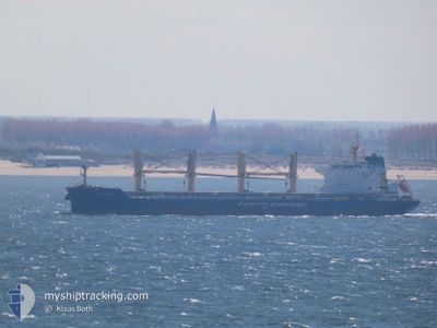
DE SHENG HAI
Cargo
Current Trip
| Time Travelled | 15 days |
|---|---|
| Remaining Time | 9 h, 38 mins |
| Distance Travelled | 4659.46 nm |
| Remaining Distance | 122.57 nm |
| AVG Speed | 12.1 Knots |
| MAX Speed | 15.8 Knots |
| AVG Wind | 14.9 knots |
| MAX Wind | 25 knots |
| MIN Temp | 17.9°C / 64.22°F |
| MAX Temp | 27.7°C / 81.86°F |
| Draught | 10.5 m |
| Position Received | Now |
Current Position
| Longitude | -11.89648° |
|---|---|
| Latitude | 30.39805° |
| Status | Under way using engine |
| Speed | 12.3 Knots |
| Course | 89.8° |
| Area | North Atlantic Ocean |
| Station | T-AIS |
| Position Received | Now |
Info
Information
The current position of DE SHENG HAI is in North Atlantic Ocean with coordinates 30.39805° / -11.89648° as reported on 2024-04-16 17:53 by AIS to our vessel tracker app. The vessel's current speed is 12.3 Knots and is heading at the port of AGADIR. The estimated time of arrival as calculated by MyShipTracking vessel tracking app is 2024-04-17 03:32 LT
The vessel DE SHENG HAI (IMO: 9751315, MMSI: 477002800) is a Cargo It's sailing under the flag of [HK] Hong Kong.
In this page you can find informations about the vessels current position, last detected port calls, and current voyage information. If the vessels is not in coverage by AIS you will find the latest position.
The current position of DE SHENG HAI is detected by our AIS receivers and we are not responsible for the reliability of the data. The last position was recorded while the vessel was in Coverage by the Ais receivers of our vessel tracking app.
The current draught of DE SHENG HAI as reported by AIS is 10.5 meters
Weather
| Temperature | 19.3°C / 66.74°F |
|---|---|
| Wind Speed | 17 knots |
| Direction | 4° N |
| Pressure | 1015.1 hPa |
| Humidity | 86.4 % |
| Cloud Coverage | 64 % |
Featured Company
Last Port Calls
| Port | Arrival | Departure | Time In Port |
|---|---|---|---|
| 2024-03-30 12:19 | 2024-04-01 04:11 | 1 d | |
| 2024-03-23 09:33 | 2024-03-27 23:35 | 4 d | |
| 2024-03-13 09:30 | 2024-03-15 06:09 | 1 d | |
| 2024-03-06 07:56 | 2024-03-11 20:40 | 5 d | |
| 2024-02-27 23:41 | 2024-03-04 01:57 | 5 d | |
| 2024-02-22 19:01 | 2024-02-25 01:55 | 2 d | |
| 2024-02-22 18:28 | 2024-02-22 18:45 | 16 m |
Most Visited Ports (Last year)
| Port | Arrivals | |
|---|---|---|
| 3 | ||
| 2 | ||
| 2 | ||
| 2 | ||
| 1 | ||
| 1 |
Last Trips
| Origin | Departure | Destination | Arrival | Distance | |
|---|---|---|---|---|---|
| 2024-03-27 17:35 | 2024-03-30 07:19 | 644.76 nm | |||
| 2024-03-15 01:09 | 2024-03-23 03:33 | 779.28 nm | |||
| 2024-03-11 15:40 | 2024-03-13 04:30 | 436.49 nm | |||
| 2024-03-03 19:57 | 2024-03-06 01:56 | 413.32 nm | |||
| 2024-02-24 20:55 | 2024-02-27 17:41 | 805.54 nm | |||
| 2024-02-22 13:45 | 2024-02-22 14:01 | 0.64 nm | |||
| 2024-01-31 14:50 | 2024-02-22 13:28 | 5973.24 nm |
Events
| Time | Event | Details | Position / Dest | Info |
|---|---|---|---|---|
| 2024-04-16 16:00 | Status Changed | Under way using engine Default |
30.39810 / -12.34974
MA AGA
|
Speed: 12.4 kn Course: 92° |
| 2024-04-16 15:57 | Status Changed | Default Under way using engine |
30.39838 / -12.36236
MA AGA
|
Speed: 12.3 kn Course: 92.5° |
| 2024-04-16 07:56 | Draught Changed | 10.5 10.4 |
30.40194 / -14.26632
MA AGA
|
Speed: 12.8 kn Course: 89.8° |
| 2024-04-16 07:56 | ETA Changed | 2024/04/17 03:00 2024/04/17 05:00 |
30.40194 / -14.26632
MA AGA
|
Speed: 12.8 kn Course: 89.8° |
| 2024-04-16 07:50 | Draught Changed | 10.4 10.5 |
30.40189 / -14.28803
MA AGA
|
Speed: 12.9 kn Course: 90.2° |
| 2024-04-16 07:17 | Detected in Sea | Spanish (Canary Islands) part of the North Atlantic Ocean |
30.40176 / -14.42211
North Atlantic Ocean
MA AGA
|
Speed: 12.8 kn Course: 89.8° |
| 2024-04-15 17:11 | Detected in Sea | Portuguese (Madeira) part of the North Atlantic Ocean |
30.40405 / -17.77503
North Atlantic Ocean
MA AGA
|
Speed: 12.5 kn Course: 90.5° |
| 2024-04-15 15:05 | Status Changed | Under way using engine Default |
30.40291 / -18.27410
MA AGA
|
Speed: 12.3 kn Course: 89° |
| 2024-04-15 14:53 | Status Changed | Default Under way using engine |
30.40249 / -18.32057
MA AGA
|
Speed: 12.3 kn Course: 90.1° |
| 2024-04-15 14:46 | Status Changed | Under way using engine Default |
30.40227 / -18.34690
MA AGA
|
Speed: 12.4 kn Course: 91° |