
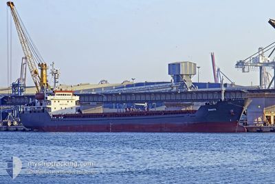
M V DAKOTA
Bulk Carrier
Current Trip
| Trip Time | --- |
|---|---|
| Trip Distance | --- |
| AVG Speed | --- |
| MAX Speed | --- |
| Draught | --- |
| AVG Wind | --- |
| MAX Wind | --- |
| MIN Temp | --- |
| MAX Temp | --- |
| Position Received | 8 d ago |
Current Position
| Longitude | 0.29470° |
|---|---|
| Latitude | 36.77813° |
| Status | Under way using engine |
| Speed | 8.2 Knots |
| Course | 82° |
| Area | Mediterranean Sea - Western Basin |
| Station | T-AIS |
| Position Received | 8 d ago |
Info
Information
The current position of M V DAKOTA is in Mediterranean Sea - Western Basin with coordinates 36.77813° / 0.29470° as reported on 2024-04-12 01:39 by AIS to our vessel tracker app. The vessel's current speed is 8.2 Knots and is currently inside the port of RAVENNA.
The vessel M V DAKOTA (IMO: 9349980, MMSI: 248038000) is a Bulk Carrier that was built in 2006 ( 18 years old ). It's sailing under the flag of [MT] Malta.
In this page you can find informations about the vessels current position, last detected port calls, and current voyage information. If the vessels is not in coverage by AIS you will find the latest position.
The current position of M V DAKOTA is detected by our AIS receivers and we are not responsible for the reliability of the data. The last position was recorded while the vessel was in Coverage by the Ais receivers of our vessel tracking app.
The current draught of M V DAKOTA as reported by AIS is 7 meters
Weather
| Temperature | 9.4°C / 48.92°F |
|---|---|
| Wind Speed | 7 knots |
| Direction | 271° W |
| Pressure | 1007.5 hPa |
| Humidity | 68.2 % |
| Cloud Coverage | 100 % |
Featured Company
Last Port Calls
| Port | Arrival | Departure | Time In Port |
|---|---|---|---|
| 2024-04-06 16:08 | 2024-04-09 05:21 | 2 d | |
| 2024-03-23 16:31 | 2024-04-03 04:59 | 10 d | |
| 2024-03-10 16:29 | |||
| 2024-03-10 05:21 | |||
| 2024-02-19 10:45 | 2024-02-27 09:32 | 7 d | |
| 2024-02-14 17:23 | 2024-02-17 17:34 | 3 d | |
| 2024-02-05 22:32 | 2024-02-08 12:13 | 2 d |
Most Visited Ports (Last year)
| Port | Arrivals | |
|---|---|---|
| 4 | ||
| 3 | ||
| 3 | ||
| 2 | ||
| 2 | ||
| 2 |
Last Trips
| Origin | Departure | Destination | Arrival | Distance | |
|---|---|---|---|---|---|
| 2024-04-03 06:59 | 2024-04-06 17:08 | 320.19 nm | |||
| 2024-03-10 07:21 | 2024-03-10 18:29 | 9.81 nm | |||
| 2024-02-17 18:34 | 2024-02-19 11:45 | 314.40 nm | |||
| 2024-02-08 14:13 | 2024-02-14 18:23 | 1008.95 nm | |||
| 2024-01-26 19:10 | 2024-02-06 00:32 | 332.22 nm |
Events
| Time | Event | Details | Position / Dest | Info |
|---|---|---|---|---|
| 2024-04-12 02:08 | Status Changed | Default Under way using engine |
36.79540 / .40765
RAVENNA
|
Speed: 8.2 kn Course: 82° |
| 2024-04-12 01:39 | OUT of Coverage |
36.77813 / .29470
Mediterranean Sea - Western Basin
RAVENNA
|
Speed: 8.2 kn Course: 82° |
|
| 2024-04-12 00:55 | Status Changed | Under way using engine Default |
36.76268 / .19257
RAVENNA
|
Speed: 8 kn Course: 75° |
| 2024-04-12 00:45 | Status Changed | Default Under way using engine |
36.75834 / .17833
RAVENNA
|
Speed: 8.2 kn Course: 77° |
| 2024-04-12 00:14 | IN Coverage |
36.73487 / .05627
Mediterranean Sea - Western Basin
RAVENNA
|
Speed: 8.2 kn Course: 77° |
|
| 2024-04-11 23:12 | OUT of Coverage |
36.70213 / -.12403
Mediterranean Sea - Western Basin
RAVENNA
|
Speed: 8.5 kn Course: 77° |
|
| 2024-04-11 21:07 | Status Changed | Under way using engine Default |
36.63760 / -.52840
RAVENNA
|
Speed: 9 kn Course: 87° |
| 2024-04-11 20:45 | Status Changed | Default Under way using engine |
36.63667 / -.54500
RAVENNA
|
Speed: 9.1 kn Course: 78° |
| 2024-04-11 18:23 | Detected in Sea | Algerian part of the Mediterranean Sea - Western Basin |
36.55918 / -1.00797
Mediterranean Sea - Western Basin
RAVENNA
|
Speed: 8.4 kn Course: 78° |
| 2024-04-11 15:59 | IN Coverage |
36.48430 / -1.47240
Mediterranean Sea - Western Basin
RAVENNA
|
Speed: 9.9 kn Course: 79° |