
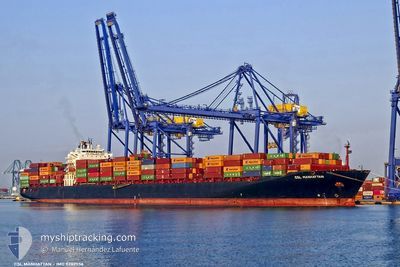
CSL MANHATTAN
Container Ship
Current Trip
| Time Travelled | 2 days |
|---|---|
| Remaining Time | 11 h, 45 mins |
| Distance Travelled | 906.65 nm |
| Remaining Distance | 564.82 nm |
| AVG Speed | 17.7 Knots |
| MAX Speed | 18.9 Knots |
| AVG Wind | 15.4 knots |
| MAX Wind | 31.9 knots |
| MIN Temp | 15°C / 59°F |
| MAX Temp | 22.4°C / 72.32°F |
| Draught | 8.2 m |
| Position Received | 1 d ago |
Current Position
| Longitude | 14.12272° |
|---|---|
| Latitude | 36.68076° |
| Status | Under way using engine |
| Speed | 16.1 Knots |
| Course | 295.9° |
| Area | Mediterranean Sea - Eastern Basin |
| Station | T-AIS |
| Position Received | 1 d ago |
Info
Information
The current position of CSL MANHATTAN is in Mediterranean Sea - Eastern Basin with coordinates 36.68076° / 14.12272° as reported on 2024-04-17 07:45 by AIS to our vessel tracker app. The vessel's current speed is 16.1 Knots and is heading at the port of BARCELONA. The estimated time of arrival as calculated by MyShipTracking vessel tracking app is 2024-04-18 21:28 LT
The vessel CSL MANHATTAN (IMO: 9289556, MMSI: 636016853) is a Container Ship that was built in 2005 ( 19 years old ). It's sailing under the flag of [LR] Liberia.
In this page you can find informations about the vessels current position, last detected port calls, and current voyage information. If the vessels is not in coverage by AIS you will find the latest position.
The current position of CSL MANHATTAN is detected by our AIS receivers and we are not responsible for the reliability of the data. The last position was recorded while the vessel was in Coverage by the Ais receivers of our vessel tracking app.
The current draught of CSL MANHATTAN as reported by AIS is 8.2 meters
Weather
| Temperature | 15.3°C / 59.54°F |
|---|---|
| Wind Speed | 17 knots |
| Direction | 315° NW |
| Pressure | 1014 hPa |
| Humidity | 60.6 % |
| Cloud Coverage | 5 % |
Featured Company
Last Port Calls
| Port | Arrival | Departure | Time In Port |
|---|---|---|---|
| 2024-04-14 14:12 | 2024-04-15 12:07 | 21 h | |
| 2024-04-08 21:02 | 2024-04-09 22:11 | 1 d | |
| 2024-03-11 08:52 | 2024-03-11 17:05 | 8 h | |
| 2024-03-02 19:38 | 2024-03-03 03:48 | 8 h | |
| 2024-02-29 01:53 | 2024-02-29 16:30 | 14 h | |
| 2024-02-25 13:06 | 2024-02-27 01:07 | 1 d | |
| 2024-02-20 05:09 | 2024-02-21 15:20 | 1 d | |
| 2024-02-14 11:36 | 2024-02-15 06:09 | 18 h | |
| 2024-02-12 17:30 | 2024-02-13 09:50 | 16 h | |
| 2024-02-07 23:00 | 2024-02-08 22:07 | 23 h |
Last Trips
| Origin | Departure | Destination | Arrival | Distance | |
|---|---|---|---|---|---|
| 2024-04-10 00:11 | 2024-04-14 16:12 | 1408.14 nm | |||
| 2024-03-11 22:35 | 2024-04-08 23:02 | 10157.14 nm | |||
| 2024-03-03 11:48 | 2024-03-11 14:22 | 3051.08 nm | |||
| 2024-03-01 00:30 | 2024-03-03 03:38 | 823.00 nm | |||
| 2024-02-27 09:07 | 2024-02-29 09:53 | 549.04 nm | |||
| 2024-02-21 23:20 | 2024-02-25 21:06 | 1459.53 nm | |||
| 2024-02-15 14:09 | 2024-02-20 13:09 | 1337.77 nm | |||
| 2024-02-13 17:50 | 2024-02-14 19:36 | 210.70 nm | |||
| 2024-02-09 03:37 | 2024-02-13 01:30 | 1397.75 nm | |||
| 2024-02-07 06:16 | 2024-02-08 04:30 | 335.79 nm |
Events
| Time | Event | Details | Position / Dest | Info |
|---|---|---|---|---|
| 2024-04-17 07:55 | Status Changed | Default Under way using engine |
36.70125 / 14.07185
BARCELONA
|
Speed: 16.1 kn Course: 295.9° |
| 2024-04-17 07:45 | OUT of Coverage |
36.68076 / 14.12272
Mediterranean Sea - Eastern Basin
|
Speed: 16.1 kn Course: 295.9° |
|
| 2024-04-17 07:16 | Status Changed | Under way using engine Default |
36.62437 / 14.26264
BARCELONA
|
Speed: 16 kn Course: 296° |
| 2024-04-17 07:02 | Status Changed | Default Under way using engine |
36.59642 / 14.33325
BARCELONA
|
Speed: 15.6 kn Course: 295° |
| 2024-04-17 06:43 | Status Changed | Under way using engine Default |
36.56145 / 14.42362
BARCELONA
|
Speed: 15.5 kn Course: 295° |
| 2024-04-17 06:32 | Status Changed | Default Under way using engine |
36.53945 / 14.48100
BARCELONA
|
Speed: 15.3 kn Course: 295° |
| 2024-04-17 06:04 | ETA Changed | 2024/04/18 23:00 2024/04/18 13:00 |
36.49047 / 14.61782
BARCELONA
|
Speed: 15.6 kn Course: 275° |
| 2024-04-17 05:40 | Change Sea Area | Italian part of the Mediterranean Sea - Eastern Basin Italian part of the Ionian Sea |
36.49748 / 14.74827
Mediterranean Sea - Eastern Basin
BARCELONA
|
Speed: 16.1 kn Course: 259° |
| 2024-04-17 05:40 | Status Changed | Under way using engine Default |
36.49748 / 14.74827
BARCELONA
|
Speed: 16.6 kn Course: 260° |
| 2024-04-17 05:31 | IN Coverage |
36.49748 / 14.74827
Mediterranean Sea - Eastern Basin
BARCELONA
|
Speed: 16.1 kn Course: 259° |