
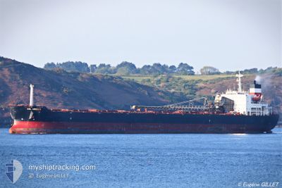
CSL ARGOSY
Self Discharging Bulk Carrier
Current Trip
| Trip Time | 3 days |
|---|---|
| Trip Distance | 57.86 nm |
| AVG Speed | 5.9 Knots |
| MAX Speed | 8.4 Knots |
| Draught | 8.3 m |
| AVG Wind | 8.5 knots |
| MAX Wind | 18 knots |
| MIN Temp | 25°C / 77°F |
| MAX Temp | 27.7°C / 81.86°F |
| Position Received | 3 d ago |
Current Position
| Longitude | -14.81675° |
|---|---|
| Latitude | 10.34107° |
| Status | Under way using engine |
| Speed | 0.4 Knots |
| Course | 317° |
| Area | North Atlantic Ocean |
| Station | T-AIS |
| Position Received | 3 d ago |
Info
Information
The current position of CSL ARGOSY is in North Atlantic Ocean with coordinates 10.34107° / -14.81675° as reported on 2024-04-21 11:03 by AIS to our vessel tracker app. The vessel's current speed is 0.4 Knots and is currently inside the port of KAMSAR.
The vessel CSL ARGOSY (IMO: 7915412, MMSI: 308299000) is a Self Discharging Bulk Carrier that was built in 1981 ( 43 years old ). It's sailing under the flag of [BS] Bahamas.
In this page you can find informations about the vessels current position, last detected port calls, and current voyage information. If the vessels is not in coverage by AIS you will find the latest position.
The current position of CSL ARGOSY is detected by our AIS receivers and we are not responsible for the reliability of the data. The last position was recorded while the vessel was in Coverage by the Ais receivers of our vessel tracking app.
The current draught of CSL ARGOSY as reported by AIS is 8.3 meters
Weather
| Temperature | 26.7°C / 80.06°F |
|---|---|
| Wind Speed | 11 knots |
| Direction | 277° W |
| Pressure | 1011.2 hPa |
| Humidity | 71 % |
| Cloud Coverage | 48 % |
Featured Company
Last Port Calls
| Port | Arrival | Departure | Time In Port |
|---|---|---|---|
| 2024-04-24 07:56 | |||
| 2024-04-19 04:52 | 2024-04-21 06:17 | 2 d | |
| 2024-04-13 09:07 | 2024-04-15 12:27 | 2 d | |
| 2024-04-08 19:30 | 2024-04-10 21:03 | 2 d | |
| 2024-03-30 10:19 | 2024-04-01 11:24 | 2 d | |
| 2024-03-19 19:14 | 2024-03-21 05:45 | 1 d | |
| 2024-03-13 10:09 | 2024-03-15 10:49 | 2 d | |
| 2024-03-08 14:43 | 2024-03-10 19:47 | 2 d | |
| 2024-03-01 07:58 | 2024-03-03 18:37 | 2 d | |
| 2024-02-27 08:54 | 2024-02-28 09:59 | 1 d |
Last Trips
| Origin | Departure | Destination | Arrival | Distance | |
|---|---|---|---|---|---|
| 2024-04-21 06:17 | 2024-04-24 07:56 | 57.86 nm | |||
| 2024-04-15 12:27 | 2024-04-19 04:52 | 54.41 nm | |||
| 2024-04-10 21:03 | 2024-04-13 09:07 | 61.54 nm | |||
| 2024-04-01 11:24 | 2024-04-08 19:30 | 62.30 nm | |||
| 2024-03-21 05:45 | 2024-03-30 10:19 | 64.15 nm | |||
| 2024-03-15 10:49 | 2024-03-19 19:14 | 56.00 nm | |||
| 2024-03-10 19:47 | 2024-03-13 10:09 | 53.85 nm | |||
| 2024-03-03 18:37 | 2024-03-08 14:43 | 29.03 nm | |||
| 2024-02-28 09:59 | 2024-03-01 07:58 | 56.74 nm | |||
| 2024-02-23 18:38 | 2024-02-27 08:54 | 51.95 nm |
Events
| Time | Event | Details | Position / Dest | Info |
|---|---|---|---|---|
| 2024-04-24 07:56 | PORT ARRIVAL |
|
10.63911 / -14.63019
[GN] KAMSAR
|
Speed: 0.7 kn Course: 193° |
| 2024-04-23 12:17 | STOP Moving | 0.58 nm, West of KAMSAR |
10.63479 / -14.63764
BS FPO>US PCV
|
Speed: 0.2 kn Course: 27° |
| 2024-04-23 10:09 | START Moving | 11.07 nm, South West of KAMSAR |
10.48226 / -14.73154
BS FPO>US PCV
|
Speed: 6.4 kn Course: 20° |
| 2024-04-23 04:10 | STOP Moving | 11.96 nm, South West of KAMSAR |
10.46812 / -14.73726
BS FPO>US PCV
|
Speed: 0.2 kn Course: 28° |
| 2024-04-23 02:08 | START Moving |
10.28208 / -14.80405
BS FPO>US PCV
|
Speed: 3.9 kn Course: 312° |
|
| 2024-04-21 13:05 | STOP Moving |
10.29029 / -14.80078
BS FPO>US PCV
|
Speed: 0.1 kn Course: 169° |
|
| 2024-04-21 11:54 | START Moving |
10.31838 / -14.80915
BS FPO>US PCV
|
Speed: 3.2 kn Course: 90° |
|
| 2024-04-21 11:09 | Status Changed | Default Under way using engine |
10.34053 / -14.81835
BS FPO>US PCV
|
Speed: 0.4 kn Course: 317° |
| 2024-04-21 11:03 | OUT of Coverage |
10.34107 / -14.81675
North Atlantic Ocean
|
Speed: 0.4 kn Course: 318.2° |
|
| 2024-04-21 10:54 | STOP Moving | 20.88 nm, South West of KAMSAR |
10.34128 / -14.81687
BS FPO>US PCV
|
Speed: 0.3 kn Course: 356° |