
TOCONAO
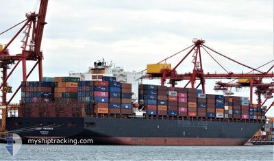
Container Ship
Current Trip
| Time Travelled | 2 days |
|---|---|
| Remaining Time | --- |
| Distance Travelled | 565.51 nm |
| Remaining Distance | 212.28 nm |
| AVG Speed | 10.4 Knots |
| MAX Speed | 15.5 Knots |
| AVG Wind | 8 knots |
| MAX Wind | 12.9 knots |
| MIN Temp | 19.2°C / 66.56°F |
| MAX Temp | 26.5°C / 79.7°F |
| Draught | 9.6 m |
| Position Received | 1 d ago |
Current Position
| Longitude | 119.18255° |
|---|---|
| Latitude | 24.46146° |
| Status | Under way using engine |
| Speed | 11 Knots |
| Course | 52.2° |
| Area | South China Sea |
| Station | T-AIS |
| Position Received | 1 d ago |
Info
Information
The current position of TOCONAO is in South China Sea with coordinates 24.46146° / 119.18255° as reported on 2024-04-15 05:37 by AIS to our vessel tracker app. The vessel's current speed is 11 Knots and is heading at the port of YANGSHAN. The estimated time of arrival as calculated by MyShipTracking vessel tracking app is 2024-04-17 02:00 LT
The vessel TOCONAO (IMO: 9627899, MMSI: 636015980) is a Container Ship that was built in 2013 ( 11 years old ). It's sailing under the flag of [LR] Liberia.
In this page you can find informations about the vessels current position, last detected port calls, and current voyage information. If the vessels is not in coverage by AIS you will find the latest position.
The current position of TOCONAO is detected by our AIS receivers and we are not responsible for the reliability of the data. The last position was recorded while the vessel was in Coverage by the Ais receivers of our vessel tracking app.
The current draught of TOCONAO as reported by AIS is 9.6 meters
Weather
| Temperature | 17.8°C / 64.04°F |
|---|---|
| Wind Speed | 12 knots |
| Direction | 117° ESE |
| Pressure | 1010 hPa |
| Humidity | 97.8 % |
| Cloud Coverage | 100 % |
Featured Company
Last Port Calls
| Port | Arrival | Departure | Time In Port |
|---|---|---|---|
| 2024-04-12 22:53 | 2024-04-13 23:10 | 1 d | |
| 2024-03-11 09:04 | 2024-03-13 14:39 | 2 d | |
| 2024-03-08 09:54 | 2024-03-09 12:18 | 1 d | |
| 2024-03-05 21:31 | 2024-03-06 21:06 | 23 h | |
| 2024-03-04 04:22 | 2024-03-05 07:40 | 1 d | |
| 2024-03-01 16:16 | 2024-03-03 06:57 | 1 d | |
| 2024-02-20 08:12 | 2024-02-21 18:21 | 1 d | |
| 2024-02-18 07:35 | 2024-02-19 11:52 | 1 d | |
| 2024-02-17 08:07 | 2024-02-17 22:48 | 14 h | |
| 2024-02-15 02:07 | 2024-02-17 02:35 | 2 d |
Most Visited Ports (Last year)
| Port | Arrivals | |
|---|---|---|
| 5 | ||
| 5 | ||
| 4 | ||
| 4 | ||
| 4 | ||
| 3 |
Last Trips
| Origin | Departure | Destination | Arrival | Distance | |
|---|---|---|---|---|---|
| 2024-03-13 14:39 | 2024-04-13 06:53 | 13596.49 nm | |||
| 2024-03-09 13:18 | 2024-03-11 09:04 | 241.85 nm | |||
| 2024-03-06 22:06 | 2024-03-08 10:54 | 378.40 nm | |||
| 2024-03-05 08:40 | 2024-03-05 22:31 | 139.81 nm | |||
| 2024-03-03 06:57 | 2024-03-04 05:22 | 396.06 nm | |||
| 2024-02-21 21:21 | 2024-03-01 16:16 | 3057.75 nm | |||
| 2024-02-19 14:52 | 2024-02-20 11:12 | 265.60 nm | |||
| 2024-02-18 01:48 | 2024-02-18 10:35 | 48.57 nm | |||
| 2024-02-17 05:35 | 2024-02-17 11:07 | 61.80 nm | |||
| 2024-02-14 04:02 | 2024-02-15 05:07 | 390.98 nm |
Events
| Time | Event | Details | Position / Dest | Info |
|---|---|---|---|---|
| 2024-04-15 05:42 | Status Changed | Default Under way using engine |
24.47038 / 119.19474
CNYSA
|
Speed: 11 kn Course: 52.2° |
| 2024-04-15 05:37 | OUT of Coverage |
24.46146 / 119.18255
South China Sea
CNYSA
|
Speed: 11 kn Course: 52.2° |
|
| 2024-04-15 05:37 | Status Changed | Under way using engine Default |
24.46118 / 119.18215
CNYSA
|
Speed: 11.1 kn Course: 50° |
| 2024-04-15 05:22 | IN Coverage |
24.46146 / 119.18255
South China Sea
CNYSA
|
Speed: 11 kn Course: 52.2° |
|
| 2024-04-15 01:14 | Status Changed | Default Under way using engine |
23.93319 / 118.51308
CNYSA
|
Speed: 10.8 kn Course: 49.1° |
| 2024-04-15 01:09 | OUT of Coverage |
23.92275 / 118.49977
South China Sea
CNYSA
|
Speed: 10.8 kn Course: 49.1° |
|
| 2024-04-14 23:38 | Status Changed | Under way using engine Default |
23.75699 / 118.28969
CNYSA
|
Speed: 9.8 kn Course: 46° |
| 2024-04-14 23:34 | Status Changed | Default Under way using engine |
23.74908 / 118.28089
CNYSA
|
Speed: 9.7 kn Course: 45.7° |
| 2024-04-14 23:20 | Status Changed | Under way using engine Default |
23.72204 / 118.24867
CNYSA
|
Speed: 9.8 kn Course: 49° |
| 2024-04-14 23:10 | Status Changed | Default Under way using engine |
23.70466 / 118.22709
CNYSA
|
Speed: 9.7 kn Course: 48.5° |