
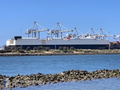
CSAV RIO NEVADO
Vehicles Carrier
Current Trip
| Time Travelled | 1 day |
|---|---|
| Remaining Time | --- |
| Distance Travelled | 533.44 nm |
| Remaining Distance | --- |
| AVG Speed | 13.5 Knots |
| MAX Speed | 16.4 Knots |
| AVG Wind | 6.9 knots |
| MAX Wind | 16 knots |
| MIN Temp | 13.8°C / 56.84°F |
| MAX Temp | 22.4°C / 72.32°F |
| Draught | 7.9 m |
| Position Received | 1 d ago |
Current Position
| Longitude | 174.58151° |
|---|---|
| Latitude | -34.91123° |
| Status | Under way using engine |
| Speed | 15.7 Knots |
| Course | 318° |
| Area | South Pacific Ocean |
| Station | T-AIS |
| Position Received | 1 d ago |
Info
Information
The current position of CSAV RIO NEVADO is in South Pacific Ocean with coordinates -34.91123° / 174.58151° as reported on 2024-04-17 21:08 by AIS to our vessel tracker app. The vessel's current speed is 15.7 Knots and is heading at the port of LAEM CHABANG. The estimated time of arrival as calculated by MyShipTracking vessel tracking app is 2024-05-02 06:00 LT
The vessel CSAV RIO NEVADO (IMO: 9325180, MMSI: 636015994) is a Vehicles Carrier that was built in 2007 ( 17 years old ). It's sailing under the flag of [LR] Liberia.
In this page you can find informations about the vessels current position, last detected port calls, and current voyage information. If the vessels is not in coverage by AIS you will find the latest position.
The current position of CSAV RIO NEVADO is detected by our AIS receivers and we are not responsible for the reliability of the data. The last position was recorded while the vessel was in Coverage by the Ais receivers of our vessel tracking app.
The current draught of CSAV RIO NEVADO as reported by AIS is 7.9 meters
Weather
| Temperature | 22.4°C / 72.32°F |
|---|---|
| Wind Speed | 16 knots |
| Direction | 5° N |
| Pressure | 1018.5 hPa |
| Humidity | 70.3 % |
| Cloud Coverage | 100 % |
Featured Company
Last Port Calls
| Port | Arrival | Departure | Time In Port |
|---|---|---|---|
| 2024-04-17 00:56 | 2024-04-17 11:21 | 10 h | |
| 2024-04-12 18:05 | 2024-04-13 09:31 | 15 h | |
| 2024-04-08 14:29 | 2024-04-10 04:17 | 1 d | |
| 2024-04-06 10:37 | 2024-04-06 22:43 | 12 h | |
| 2024-03-22 22:36 | 2024-03-23 15:31 | 16 h | |
| 2024-03-03 12:30 | 2024-03-05 07:21 | 1 d | |
| 2024-02-25 23:26 | 2024-02-26 22:26 | 23 h | |
| 2024-02-23 14:06 | 2024-02-24 08:58 | 18 h | |
| 2024-02-19 02:47 | 2024-02-19 14:35 | 11 h | |
| 2024-02-02 01:31 | 2024-02-03 15:39 | 1 d |
Last Trips
| Origin | Departure | Destination | Arrival | Distance | |
|---|---|---|---|---|---|
| 2024-04-13 19:31 | 2024-04-17 12:56 | 1324.62 nm | |||
| 2024-04-10 14:17 | 2024-04-13 04:05 | 626.13 nm | |||
| 2024-04-07 08:13 | 2024-04-09 00:29 | 532.56 nm | |||
| 2024-03-23 22:31 | 2024-04-06 21:07 | 4578.02 nm | |||
| 2024-03-05 18:21 | 2024-03-23 05:36 | 4873.01 nm | |||
| 2024-02-27 08:26 | 2024-03-03 23:30 | 1319.28 nm | |||
| 2024-02-24 19:58 | 2024-02-26 09:26 | 575.29 nm | |||
| 2024-02-20 01:05 | 2024-02-24 01:06 | 1065.12 nm | |||
| 2024-02-03 22:39 | 2024-02-19 13:17 | 4598.14 nm | |||
| 2024-01-16 01:58 | 2024-02-02 08:31 | 2513.96 nm |
Events
| Time | Event | Details | Position / Dest | Info |
|---|---|---|---|---|
| 2024-04-17 21:15 | Status Changed | Default Under way using engine |
-34.88788 / 174.55525
NZAKL>THLCH
|
Speed: 15.7 kn Course: 318° |
| 2024-04-17 21:08 | Status Changed | Under way using engine Default |
-34.91123 / 174.58151
NZAKL>THLCH
|
Speed: 15.5 kn Course: 318° |
| 2024-04-17 21:08 | OUT of Coverage |
-34.91123 / 174.58151
South Pacific Ocean
NZAKL>THLCH
|
Speed: 15.7 kn Course: 318° |
|
| 2024-04-17 20:48 | Status Changed | Default Under way using engine |
-34.97805 / 174.65173
NZAKL>THLCH
|
Speed: 15.5 kn Course: 319° |
| 2024-04-17 20:45 | Status Changed | Under way using engine Default |
-34.98837 / 174.66236
NZAKL>THLCH
|
Speed: 15.4 kn Course: 319° |
| 2024-04-17 20:18 | Status Changed | Default Under way using engine |
-35.07337 / 174.75325
NZAKL>THLCH
|
Speed: 15.4 kn Course: 318° |
| 2024-04-17 20:06 | Status Changed | Under way using engine Default |
-35.11175 / 174.79475
NZAKL>THLCH
|
Speed: 15.4 kn Course: 319° |
| 2024-04-17 19:55 | Status Changed | Default Under way using engine |
-35.14843 / 174.83363
NZAKL>THLCH
|
Speed: 15.5 kn Course: 319° |
| 2024-04-17 19:25 | Status Changed | Under way using engine Default |
-35.25088 / 174.93858
NZAKL>THLCH
|
Speed: 16.1 kn Course: 0° |
| 2024-04-17 19:23 | IN Coverage |
-35.24708 / 174.93633
South Pacific Ocean
NZAKL>THLCH
|
Speed: 15 kn Course: 330° |