
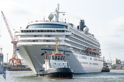
CRYSTAL SYMPHONY
Passengers Ship
Current Trip
| Time Travelled | 1 day |
|---|---|
| Remaining Time | 5 h, 23 mins |
| Distance Travelled | 267.20 nm |
| Remaining Distance | 76.13 nm |
| AVG Speed | 10.9 Knots |
| MAX Speed | 15.9 Knots |
| AVG Wind | 8.9 knots |
| MAX Wind | 18.2 knots |
| MIN Temp | 10.5°C / 50.9°F |
| MAX Temp | 18.9°C / 66.02°F |
| Draught | 8 m |
| Position Received | 5 h, 26 m ago |
Current Position
| Longitude | 24.79483° |
|---|---|
| Latitude | 39.71792° |
| Status | Under way using engine |
| Speed | 11.5 Knots |
| Course | 283° |
| Area | Aegean Sea |
| Station | T-AIS |
| Position Received | 5 h, 26 m ago |
Info
Information
The current position of CRYSTAL SYMPHONY is in Aegean Sea with coordinates 39.71792° / 24.79483° as reported on 2024-04-19 15:10 by AIS to our vessel tracker app. The vessel's current speed is 11.5 Knots and is heading at the port of THESSALONIKI. The estimated time of arrival as calculated by MyShipTracking vessel tracking app is 2024-04-20 02:00 LT
The vessel CRYSTAL SYMPHONY (IMO: 9066667, MMSI: 309168000) is a Passengers Ship that was built in 1995 ( 29 years old ). It's sailing under the flag of [BS] Bahamas.
In this page you can find informations about the vessels current position, last detected port calls, and current voyage information. If the vessels is not in coverage by AIS you will find the latest position.
The current position of CRYSTAL SYMPHONY is detected by our AIS receivers and we are not responsible for the reliability of the data. The last position was recorded while the vessel was in Coverage by the Ais receivers of our vessel tracking app.
The current draught of CRYSTAL SYMPHONY as reported by AIS is 8 meters
Weather
| Temperature | 15.8°C / 60.44°F |
|---|---|
| Wind Speed | 19 knots |
| Direction | 82° E |
| Pressure | 1005.4 hPa |
| Humidity | 66.6 % |
| Cloud Coverage | 100 % |
Featured Company
Last Port Calls
| Port | Arrival | Departure | Time In Port |
|---|---|---|---|
| 2024-04-17 04:50 | 2024-04-18 17:12 | 1 d | |
| 2024-04-15 00:20 | 2024-04-15 20:30 | 20 h | |
| 2024-04-12 03:14 | 2024-04-13 15:55 | 1 d | |
| 2024-04-10 04:50 | 2024-04-10 16:04 | 11 h | |
| 2024-04-09 03:52 | 2024-04-09 14:47 | 10 h | |
| 2024-04-08 04:02 | 2024-04-08 14:52 | 10 h | |
| 2024-04-05 04:04 | 2024-04-06 16:24 | 1 d | |
| 2024-04-04 03:02 | 2024-04-04 12:18 | 9 h | |
| 2024-03-26 04:09 | 2024-03-27 10:05 | 1 d | |
| 2024-03-25 02:13 | 2024-03-25 10:53 | 8 h |
Last Trips
| Origin | Departure | Destination | Arrival | Distance | |
|---|---|---|---|---|---|
| 2024-04-15 23:30 | 2024-04-17 07:50 | 362.23 nm | |||
| 2024-04-13 18:55 | 2024-04-15 03:20 | 339.13 nm | |||
| 2024-04-10 19:04 | 2024-04-12 06:14 | 274.68 nm | |||
| 2024-04-09 17:47 | 2024-04-10 07:50 | 226.58 nm | |||
| 2024-04-08 17:52 | 2024-04-09 06:52 | 214.58 nm | |||
| 2024-04-06 19:24 | 2024-04-08 07:02 | 382.52 nm | |||
| 2024-03-27 15:35 | 2024-04-05 07:04 | 2930.09 nm | |||
| 2024-03-27 15:35 | 2024-04-04 05:02 | 2622.01 nm | |||
| 2024-03-25 16:23 | 2024-03-26 09:39 | 254.21 nm | |||
| 2024-03-23 16:39 | 2024-03-25 07:43 | 695.52 nm |
Events
| Time | Event | Details | Position / Dest | Info |
|---|---|---|---|---|
| 2024-04-19 15:49 | Status Changed | Default Under way using engine |
39.72666 / 24.67333
GR SKG
|
Speed: 11.5 kn Course: 283° |
| 2024-04-19 15:10 | OUT of Coverage |
39.71792 / 24.79483
Aegean Sea
GR SKG
|
Speed: 11.5 kn Course: 283° |
|
| 2024-04-19 14:39 | IN Coverage |
39.69653 / 24.92096
Aegean Sea
GR SKG
|
Speed: 11.4 kn Course: 282.7° |
|
| 2024-04-19 13:14 | OUT of Coverage |
39.63613 / 25.27153
Aegean Sea
GR SKG
|
Speed: 11.9 kn Course: 282.5° |
|
| 2024-04-19 10:06 | Detected in Sea | Greek part of the Aegean Sea |
39.91436 / 25.81728
Aegean Sea
GR SKG
|
Speed: 11 kn Course: 229.1° |
| 2024-04-19 09:45 | IN Coverage |
39.95636 / 25.88413
Aegean Sea
GR SKG
|
Speed: 11.7 kn Course: 231.2° |
|
| 2024-04-19 08:43 | OUT of Coverage |
40.02382 / 26.12518
Aegean Sea
GR SKG
|
Speed: 11.7 kn Course: 264° |
|
| 2024-04-19 08:43 | Change Sea Area | Turkish part of the Aegean Sea Turkish part of the Sea of Marmara |
40.02382 / 26.12518
Aegean Sea
GR SKG
|
Speed: 11.7 kn Course: 264° |
| 2024-04-19 06:24 | IN Coverage |
40.33819 / 26.62692
Sea of Marmara
GR SKG
|
Speed: 15.2 kn Course: 227.2° |
|
| 2024-04-19 04:38 | OUT of Coverage |
40.51356 / 26.96218
Sea of Marmara
GR SKG
|
Speed: 10 kn Course: 244.1° |