
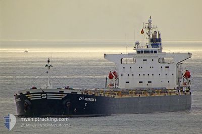
CPT GEORGIOS S
Bulk Carrier
Current Trip
| Trip Time | 4 days |
|---|---|
| Trip Distance | 826.47 nm |
| AVG Speed | 10.9 Knots |
| MAX Speed | 10.9 Knots |
| Draught | 13.1 m |
| AVG Wind | 9.2 knots |
| MAX Wind | 23.3 knots |
| MIN Temp | 13.2°C / 55.76°F |
| MAX Temp | 20.5°C / 68.9°F |
| Position Received | 5 h, 28 m ago |
Current Position
| Longitude | 32.33852° |
|---|---|
| Latitude | 31.20225° |
| Status | At anchor |
| Speed | 7.2 Knots |
| Course | 192° |
| Area | Mediterranean Sea - Eastern Basin |
| Station | T-AIS |
| Position Received | 5 h, 28 m ago |
Info
Information
The current position of CPT GEORGIOS S is in Mediterranean Sea - Eastern Basin with coordinates 31.20225° / 32.33852° as reported on 2024-04-19 05:58 by AIS to our vessel tracker app. The vessel's current speed is 7.2 Knots and is currently inside the port of SUEZ CANAL.
The vessel CPT GEORGIOS S (IMO: 9262936, MMSI: 636019585) is a Bulk Carrier that was built in 2002 ( 22 years old ). It's sailing under the flag of [LR] Liberia.
In this page you can find informations about the vessels current position, last detected port calls, and current voyage information. If the vessels is not in coverage by AIS you will find the latest position.
The current position of CPT GEORGIOS S is detected by our AIS receivers and we are not responsible for the reliability of the data. The last position was recorded while the vessel was in Coverage by the Ais receivers of our vessel tracking app.
The current draught of CPT GEORGIOS S as reported by AIS is 13.1 meters
Weather
| Temperature | 18.7°C / 65.66°F |
|---|---|
| Wind Speed | 5 knots |
| Direction | 311° NW |
| Pressure | 1014.4 hPa |
| Humidity | 77.5 % |
| Cloud Coverage | 4 % |
Featured Company
Last Port Calls
| Port | Arrival | Departure | Time In Port |
|---|---|---|---|
| 2024-04-19 05:44 | |||
| 2024-04-14 16:15 | 2024-04-14 17:36 | 1 h | |
| 2024-04-05 16:51 | 2024-04-11 02:54 | 5 d | |
| 2024-03-15 01:37 | 2024-03-28 15:54 | 13 d |
Last Trips
| Origin | Departure | Destination | Arrival | Distance | |
|---|---|---|---|---|---|
| 2024-04-14 20:36 | 2024-04-19 07:44 | 826.47 nm | |||
| 2024-04-11 05:54 | 2024-04-14 19:15 | 221.54 nm | |||
| 2024-03-28 16:54 | 2024-04-05 19:51 | 1753.98 nm | |||
| 2024-01-25 22:14 | 2024-03-15 02:37 | 8933.78 nm |
Events
| Time | Event | Details | Position / Dest | Info |
|---|---|---|---|---|
| 2024-04-19 05:58 | OUT of Coverage |
31.20225 / 32.33852
Mediterranean Sea - Eastern Basin
[EG] SUEZ CANAL
|
Speed: 7.2 kn Course: 190.1° |
|
| 2024-04-19 05:44 | PORT ARRIVAL |
|
31.22631 / 32.34531
[EG] SUEZ CANAL
|
Speed: 6.8 kn Course: 194.1° |
| 2024-04-19 05:15 | IN Coverage |
31.27200 / 32.35801
Mediterranean Sea - Eastern Basin
|
Speed: 6.2 kn Course: 194.9° |
|
| 2024-04-18 17:59 | OUT of Coverage |
31.39369 / 32.31109
Mediterranean Sea - Eastern Basin
|
Speed: Course: 64.8° |
|
| 2024-04-18 17:34 | IN Coverage |
31.39356 / 32.31099
Mediterranean Sea - Eastern Basin
|
Speed: Course: 174° |
|
| 2024-04-18 03:33 | Status Changed | Default Under way using engine |
32.21504 / 31.44463
PORT SAID
|
Speed: 13.5 kn Course: 135.9° |
| 2024-04-18 03:26 | OUT of Coverage |
32.23220 / 31.42545
Mediterranean Sea - Eastern Basin
PORT SAID
|
Speed: 13.5 kn Course: 135.9° |
|
| 2024-04-18 03:18 | Status Changed | Under way using engine Default |
32.25551 / 31.39905
PORT SAID
|
Speed: 13.4 kn Course: 137° |
| 2024-04-18 03:01 | Status Changed | Default Under way using engine |
32.30013 / 31.34883
PORT SAID
|
Speed: 13.2 kn Course: 136° |
| 2024-04-18 02:54 | Status Changed | Under way using engine Default |
32.31968 / 31.32686
PORT SAID
|
Speed: 13.2 kn Course: 138° |