
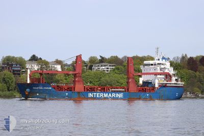
INDUSTRIAL COURAGE
Cargo
Current Trip
| Trip Time | 13 days |
|---|---|
| Trip Distance | 2538.90 nm |
| AVG Speed | 10.8 Knots |
| MAX Speed | 13.1 Knots |
| Draught | 8.5 m |
| AVG Wind | 9.5 knots |
| MAX Wind | 20 knots |
| MIN Temp | 20.4°C / 68.72°F |
| MAX Temp | 33.5°C / 92.3°F |
| Position Received | 2 d ago |
Current Position
| Longitude | -79.68078° |
|---|---|
| Latitude | 9.79539° |
| Status | Under way using engine |
| Speed | 11.2 Knots |
| Course | 18.6° |
| Area | Caribbean Sea |
| Station | T-AIS |
| Position Received | 2 d ago |
Info
Information
The current position of INDUSTRIAL COURAGE is in Caribbean Sea with coordinates 9.79539° / -79.68078° as reported on 2024-04-16 11:00 by AIS to our vessel tracker app. The vessel's current speed is 11.2 Knots and is currently inside the port of KINGSTON (JM).
The vessel INDUSTRIAL COURAGE (IMO: 9810329, MMSI: 255806166) is a Cargo It's sailing under the flag of [PT] Portugal.
In this page you can find informations about the vessels current position, last detected port calls, and current voyage information. If the vessels is not in coverage by AIS you will find the latest position.
The current position of INDUSTRIAL COURAGE is detected by our AIS receivers and we are not responsible for the reliability of the data. The last position was recorded while the vessel was in Coverage by the Ais receivers of our vessel tracking app.
The current draught of INDUSTRIAL COURAGE as reported by AIS is 8.5 meters
Weather
| Temperature | 26.8°C / 80.24°F |
|---|---|
| Wind Speed | 3 knots |
| Direction | 3° N |
| Pressure | 1011.6 hPa |
| Humidity | 71.8 % |
| Cloud Coverage | 51 % |
Featured Company
Last Port Calls
| Port | Arrival | Departure | Time In Port |
|---|---|---|---|
| 2024-04-18 12:57 | |||
| 2024-04-03 23:46 | 2024-04-04 14:18 | 14 h | |
| 2024-03-27 17:35 | 2024-03-29 08:48 | 1 d | |
| 2024-03-22 15:25 | 2024-03-23 12:15 | 20 h | |
| 2024-03-12 13:43 | 2024-03-13 11:29 | 21 h | |
| 2024-02-10 09:55 | 2024-02-13 13:32 | 3 d |
Last Trips
| Origin | Departure | Destination | Arrival | Distance | |
|---|---|---|---|---|---|
| 2024-04-04 11:18 | 2024-04-18 07:57 | 2538.90 nm | |||
| 2024-03-29 05:48 | 2024-04-03 20:46 | 291.30 nm | |||
| 2024-03-23 07:15 | 2024-03-27 14:35 | 464.90 nm | |||
| 2024-03-13 06:29 | 2024-03-22 10:25 | 1592.69 nm | |||
| 2024-02-13 10:32 | 2024-03-12 08:43 | 7065.48 nm | |||
| 2024-01-28 14:34 | 2024-02-10 06:55 | 3111.07 nm |
Events
| Time | Event | Details | Position / Dest | Info |
|---|---|---|---|---|
| 2024-04-18 13:21 | STOP Moving |
17.97940 / -76.82420
[JM] KINGSTON (JM)
|
Speed: 0.1 kn Course: 312° |
|
| 2024-04-18 12:57 | PORT ARRIVAL |
|
17.97046 / -76.82838
[JM] KINGSTON (JM)
|
Speed: 9.1 kn Course: 283° |
| 2024-04-16 11:07 | Status Changed | Default Under way using engine |
9.81626 / -79.67341
JMKIN
|
Speed: 11.2 kn Course: 18.6° |
| 2024-04-16 11:00 | Status Changed | Under way using engine Default |
9.79539 / -79.68078
JMKIN
|
Speed: 11.1 kn Course: 20° |
| 2024-04-16 11:00 | OUT of Coverage |
9.79539 / -79.68078
Caribbean Sea
JMKIN
|
Speed: 11.2 kn Course: 18.6° |
|
| 2024-04-16 10:53 | Status Changed | Default Under way using engine |
9.77389 / -79.68834
JMKIN
|
Speed: 10.8 kn Course: 18.3° |
| 2024-04-16 09:55 | Status Changed | Under way using engine Default |
9.62669 / -79.77168
JMKIN
|
Speed: 11.2 kn Course: 28° |
| 2024-04-16 09:52 | Status Changed | Default Under way using engine |
9.61699 / -79.77686
JMKIN
|
Speed: 11.3 kn Course: 27.2° |
| 2024-04-16 08:19 | Detected in Sea | Panamanian part of the Caribbean Sea |
9.37402 / -79.91876
Caribbean Sea
JMKIN
|
Speed: 8.6 kn Course: 359.5° |
| 2024-04-16 07:37 | START Moving | 3.89 nm, South of CRISTOBAL |
9.28221 / -79.92134
JMKIN
|
Speed: 3.8 kn Course: 0° |