
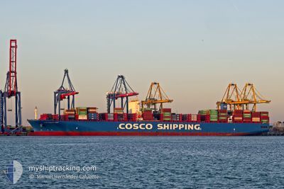
COSCO SHIPPING ANDES
Cargo A
Current Trip
| Time Travelled | 12 days |
|---|---|
| Remaining Time | --- |
| Distance Travelled | 4908.10 nm |
| Remaining Distance | --- |
| AVG Speed | 16.6 Knots |
| MAX Speed | 18.8 Knots |
| AVG Wind | 11.8 knots |
| MAX Wind | 21 knots |
| MIN Temp | 14.4°C / 57.92°F |
| MAX Temp | 29.4°C / 84.92°F |
| Draught | 12.4 m |
| Position Received | 5 d ago |
Current Position
| Longitude | -15.89900° |
|---|---|
| Latitude | 8.84430° |
| Status | Under way using engine |
| Speed | 17.1 Knots |
| Course | 149.1° |
| Area | North Atlantic Ocean |
| Station | T-AIS |
| Position Received | 5 d ago |
Info
Information
The current position of COSCO SHIPPING ANDES is in North Atlantic Ocean with coordinates 8.84430° / -15.89900° as reported on 2024-04-19 15:50 by AIS to our vessel tracker app. The vessel's current speed is 17.1 Knots and is heading at the port of PORT KLANG. The estimated time of arrival as calculated by MyShipTracking vessel tracking app is 2024-05-10 22:00 LT
The vessel COSCO SHIPPING ANDES (IMO: 9757888, MMSI: 477194600) is a Cargo A It's sailing under the flag of [HK] Hong Kong.
In this page you can find informations about the vessels current position, last detected port calls, and current voyage information. If the vessels is not in coverage by AIS you will find the latest position.
The current position of COSCO SHIPPING ANDES is detected by our AIS receivers and we are not responsible for the reliability of the data. The last position was recorded while the vessel was in Coverage by the Ais receivers of our vessel tracking app.
The current draught of COSCO SHIPPING ANDES as reported by AIS is 12.4 meters
Weather
| Temperature | 22.6°C / 72.68°F |
|---|---|
| Wind Speed | 18 knots |
| Direction | 148° SSE |
| Pressure | 1016.5 hPa |
| Humidity | 78.8 % |
| Cloud Coverage | 29 % |
Featured Company
Last Port Calls
| Port | Arrival | Departure | Time In Port |
|---|---|---|---|
| 2024-04-10 10:46 | 2024-04-12 16:44 | 2 d | |
| 2024-04-06 13:43 | 2024-04-08 17:40 | 2 d | |
| 2024-04-04 05:43 | 2024-04-05 17:31 | 1 d | |
| 2024-04-01 23:52 | 2024-04-03 03:25 | 1 d | |
| 2024-03-29 20:03 | 2024-03-31 06:02 | 1 d | |
| 2024-03-01 09:11 | 2024-03-02 05:23 | 20 h | |
| 2024-02-25 16:42 | 2024-02-26 03:27 | 10 h | |
| 2024-02-24 14:50 | 2024-02-25 04:56 | 14 h | |
| 2024-02-20 02:49 | 2024-02-20 17:59 | 15 h | |
| 2024-02-16 07:02 | 2024-02-17 10:39 | 1 d |
Most Visited Ports (Last year)
| Port | Arrivals | |
|---|---|---|
| 5 | ||
| 5 | ||
| 5 | ||
| 3 | ||
| 3 | ||
| 3 |
Last Trips
| Origin | Departure | Destination | Arrival | Distance | |
|---|---|---|---|---|---|
| 2024-04-08 19:40 | 2024-04-10 12:46 | 628.15 nm | |||
| 2024-04-05 19:31 | 2024-04-06 15:43 | 219.40 nm | |||
| 2024-04-03 05:25 | 2024-04-04 07:43 | 201.69 nm | |||
| 2024-03-31 08:02 | 2024-04-02 01:52 | 220.49 nm | |||
| 2024-03-02 13:23 | 2024-03-29 21:03 | 11144.18 nm | |||
| 2024-02-26 11:27 | 2024-03-01 17:11 | 1469.56 nm | |||
| 2024-02-25 12:56 | 2024-02-26 00:42 | 114.26 nm | |||
| 2024-02-21 01:59 | 2024-02-24 22:50 | 1018.81 nm | |||
| 2024-02-17 19:39 | 2024-02-20 10:49 | 493.32 nm | |||
| 2024-02-13 02:30 | 2024-02-16 16:02 | 530.64 nm |
Events
| Time | Event | Details | Position / Dest | Info |
|---|---|---|---|---|
| 2024-04-19 15:58 | Status Changed | Default Under way using engine |
8.81500 / -15.88167
MY PKG
|
Speed: 17.1 kn Course: 149.1° |
| 2024-04-19 15:50 | OUT of Coverage |
8.84430 / -15.89900
North Atlantic Ocean
MY PKG
|
Speed: 17.1 kn Course: 149.1° |
|
| 2024-04-19 15:26 | Status Changed | Under way using engine Default |
8.93973 / -15.96004
MY PKG
|
Speed: 17 kn Course: 145° |
| 2024-04-19 15:26 | IN Coverage |
8.93973 / -15.96004
North Atlantic Ocean
MY PKG
|
Speed: 17 kn Course: 146.5° |
|
| 2024-04-19 12:39 | OUT of Coverage |
9.56339 / -16.42778
North Atlantic Ocean
MY PKG
|
Speed: 17.3 kn Course: 141.3° |
|
| 2024-04-19 11:22 | Change Sea Area | Guinean part of the North Atlantic Ocean Guinea Bissau part of the North Atlantic Ocean |
9.84590 / -16.66457
North Atlantic Ocean
MY PKG
|
Speed: 16.9 kn Course: 141.9° |
| 2024-04-19 05:37 | Change Sea Area | Guinea Bissau part of the North Atlantic Ocean Senegalese part of the North Atlantic Ocean |
11.27303 / -17.39768
North Atlantic Ocean
MY PKG
|
Speed: 17.9 kn Course: 165° |
| 2024-04-19 05:37 | Status Changed | Under way using engine Default |
11.27303 / -17.39768
MY PKG
|
Speed: 18 kn Course: 172° |
| 2024-04-19 05:37 | IN Coverage |
11.27303 / -17.39768
North Atlantic Ocean
MY PKG
|
Speed: 17.9 kn Course: 165° |
|
| 2024-04-19 03:25 | OUT of Coverage |
11.92697 / -17.51308
North Atlantic Ocean
MY PKG
|
Speed: 17.7 kn Course: 170.4° |