
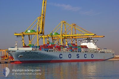
COSCO AFRICA
Container Ship
Current Trip
| Time Travelled | 2 days |
|---|---|
| Remaining Time | --- |
| Distance Travelled | 486.26 nm |
| Remaining Distance | --- |
| AVG Speed | 9.4 Knots |
| MAX Speed | 17.7 Knots |
| AVG Wind | 12.4 knots |
| MAX Wind | 26.4 knots |
| MIN Temp | 4.9°C / 40.82°F |
| MAX Temp | 7.9°C / 46.22°F |
| Draught | 12.9 m |
| Position Received | 1 d ago |
Current Position
| Longitude | -131.78972° |
|---|---|
| Latitude | 54.34289° |
| Status | Under way using engine |
| Speed | 8.8 Knots |
| Course | 268.7° |
| Area | The Coastal Waters of Southeast Alaska and British Columbia |
| Station | T-AIS |
| Position Received | 1 d ago |
Info
Information
The current position of COSCO AFRICA is in The Coastal Waters of Southeast Alaska and British Columbia with coordinates 54.34289° / -131.78972° as reported on 2024-04-22 05:23 by AIS to our vessel tracker app. The vessel's current speed is 8.8 Knots and is heading at the port of TIANJIN. The estimated time of arrival as calculated by MyShipTracking vessel tracking app is 2024-05-15 05:00 LT
The vessel COSCO AFRICA (IMO: 9345439, MMSI: 370188000) is a Container Ship that was built in 2008 ( 16 years old ). It's sailing under the flag of [PA] Panama.
In this page you can find informations about the vessels current position, last detected port calls, and current voyage information. If the vessels is not in coverage by AIS you will find the latest position.
The current position of COSCO AFRICA is detected by our AIS receivers and we are not responsible for the reliability of the data. The last position was recorded while the vessel was in Coverage by the Ais receivers of our vessel tracking app.
The current draught of COSCO AFRICA as reported by AIS is 12.9 meters
Weather
| Temperature | 5.4°C / 41.72°F |
|---|---|
| Wind Speed | 8 knots |
| Direction | 66° ENE |
| Pressure | 1010.3 hPa |
| Humidity | 90.7 % |
| Cloud Coverage | 28 % |
Featured Company
Last Port Calls
| Port | Arrival | Departure | Time In Port |
|---|---|---|---|
| 2024-04-20 12:18 | 2024-04-21 23:52 | 1 d | |
| 2024-04-20 11:56 | 2024-04-20 12:09 | 13 m | |
| 2024-04-12 18:18 | 2024-04-16 12:54 | 3 d | |
| 2024-03-28 16:00 | 2024-03-28 17:32 | 1 h | |
| 2024-03-28 12:48 | 2024-03-28 12:59 | 10 m | |
| 2024-03-28 11:30 | 2024-03-28 12:32 | 1 h | |
| 2024-03-28 09:42 | 2024-03-28 10:32 | 49 m | |
| 2024-03-23 19:01 | 2024-03-24 17:48 | 22 h | |
| 2024-03-20 07:04 | 2024-03-21 20:18 | 1 d | |
| 2024-03-04 07:05 | 2024-03-06 00:29 | 1 d |
Most Visited Ports (Last year)
| Port | Arrivals | |
|---|---|---|
| 11 | ||
| 9 | ||
| 7 | ||
| 6 | ||
| 6 |
Last Trips
| Origin | Departure | Destination | Arrival | Distance | |
|---|---|---|---|---|---|
| 2024-04-20 05:09 | 2024-04-20 05:18 | 0.21 nm | |||
| 2024-04-16 05:54 | 2024-04-20 04:56 | 1475.68 nm | |||
| 2024-03-29 01:32 | 2024-04-12 11:18 | 5854.24 nm | |||
| 2024-03-28 20:59 | 2024-03-29 00:00 | 0.58 nm | |||
| 2024-03-28 20:32 | 2024-03-28 20:48 | 0.12 nm | |||
| 2024-03-28 18:32 | 2024-03-28 19:30 | 0.12 nm | |||
| 2024-03-25 01:48 | 2024-03-28 17:42 | 479.33 nm | |||
| 2024-03-22 04:18 | 2024-03-24 03:01 | 411.71 nm | |||
| 2024-03-05 16:29 | 2024-03-20 15:04 | 4956.76 nm | |||
| 2024-03-03 22:33 | 2024-03-03 23:05 | 0.88 nm |
Events
| Time | Event | Details | Position / Dest | Info |
|---|---|---|---|---|
| 2024-04-22 05:30 | Status Changed | Default Under way using engine |
54.34265 / -131.82227
CNTSN
|
Speed: 8.8 kn Course: 268.7° |
| 2024-04-22 05:23 | OUT of Coverage |
54.34289 / -131.78972
The Coastal Waters of Southeast Alaska and British Columbia
CNTSN
|
Speed: 8.8 kn Course: 268.7° |
|
| 2024-04-22 00:58 | ETA Changed | 2024/05/15 05:00 2024/05/15 09:45 |
54.23558 / -130.62861
CNTSN
|
Speed: 17.1 kn Course: 287° |
| 2024-04-22 00:02 | ETA Changed | 2024/05/15 09:45 2024/04/20 09:45 |
54.25296 / -130.35230
CNTSN
|
Speed: 9.6 kn Course: 161.6° |
| 2024-04-21 23:52 | PORT DEPARTURE |
|
54.27614 / -130.36506
CNTSN
|
Speed: 8.5 kn Course: 168° |
| 2024-04-21 23:46 | START Moving |
54.28822 / -130.36375
[CA] PRINCE RUPERT
|
Speed: 3.5 kn Course: 192° |
|
| 2024-04-21 23:43 | Status Changed | Under way using engine Moored |
54.28949 / -130.36237
[CA] PRINCE RUPERT
|
Speed: 1 kn Course: 186° |
| 2024-04-21 23:38 | Draught Changed | 12.9 12.7 |
54.28893 / -130.36068
[CA] PRINCE RUPERT
|
Speed: Course: 185° |
| 2024-04-21 23:36 | Destination Changed | CNTSN CA PRR |
54.28893 / -130.36068
[CA] PRINCE RUPERT
|
Speed: Course: 185° |
| 2024-04-21 18:03 | Status Changed | Moored Default |
54.28889 / -130.36064
[CA] PRINCE RUPERT
|
Speed: Course: 185° |