
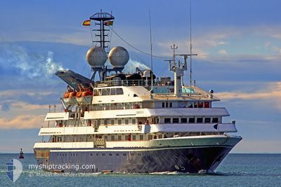
CORINTHIAN
Passengers Ship
Current Trip
| Trip Time | 12 h, 55 mins |
|---|---|
| Trip Distance | 92.24 nm |
| AVG Speed | 6.7 Knots |
| MAX Speed | 8.5 Knots |
| Draught | 4.1 m |
| AVG Wind | 6.3 knots |
| MAX Wind | 10 knots |
| MIN Temp | 13.9°C / 57.02°F |
| MAX Temp | 21.5°C / 70.7°F |
| Position Received | 1 d ago |
Current Position
| Longitude | -6.17972° |
|---|---|
| Latitude | 35.81652° |
| Status | Under way using engine |
| Speed | 7.9 Knots |
| Course | 89.3° |
| Area | North Atlantic Ocean |
| Station | T-AIS |
| Position Received | 1 d ago |
Info
Information
The current position of CORINTHIAN is in North Atlantic Ocean with coordinates 35.81652° / -6.17972° as reported on 2024-04-23 03:22 by AIS to our vessel tracker app. The vessel's current speed is 7.9 Knots and is currently inside the port of TANGIER.
The vessel CORINTHIAN (IMO: 8708672, MMSI: 249556000) is a Passengers Ship that was built in 1990 ( 34 years old ). It's sailing under the flag of [MT] Malta.
In this page you can find informations about the vessels current position, last detected port calls, and current voyage information. If the vessels is not in coverage by AIS you will find the latest position.
The current position of CORINTHIAN is detected by our AIS receivers and we are not responsible for the reliability of the data. The last position was recorded while the vessel was in Coverage by the Ais receivers of our vessel tracking app.
The current draught of CORINTHIAN as reported by AIS is 4.1 meters
Weather
| Temperature | 21°C / 69.8°F |
|---|---|
| Wind Speed | 13 knots |
| Direction | 68° ENE |
| Pressure | 1016.2 hPa |
| Humidity | 51.5 % |
| Cloud Coverage | 32 % |
Featured Company
Last Port Calls
| Port | Arrival | Departure | Time In Port |
|---|---|---|---|
| 2024-04-23 06:10 | |||
| 2024-04-22 04:58 | 2024-04-22 17:15 | 12 h | |
| 2024-04-21 05:21 | 2024-04-21 18:34 | 13 h | |
| 2024-04-19 05:59 | 2024-04-19 18:41 | 12 h | |
| 2024-04-16 04:32 | 2024-04-18 16:28 | 2 d | |
| 2024-04-15 04:36 | 2024-04-15 16:15 | 11 h | |
| 2024-04-14 06:39 | 2024-04-14 12:17 | 5 h | |
| 2024-04-13 05:37 | 2024-04-13 15:11 | 9 h | |
| 2024-04-12 05:38 | 2024-04-12 16:15 | 10 h | |
| 2024-04-11 07:10 | 2024-04-11 19:12 | 12 h |
Last Trips
| Origin | Departure | Destination | Arrival | Distance | |
|---|---|---|---|---|---|
| 2024-04-22 19:15 | 2024-04-23 07:10 | 92.24 nm | |||
| 2024-04-21 20:34 | 2024-04-22 06:58 | 66.42 nm | |||
| 2024-04-19 20:41 | 2024-04-21 07:21 | 352.30 nm | |||
| 2024-04-18 18:28 | 2024-04-19 07:59 | 169.06 nm | |||
| 2024-04-15 18:15 | 2024-04-16 06:32 | 169.10 nm | |||
| 2024-04-14 14:17 | 2024-04-15 06:36 | 165.79 nm | |||
| 2024-04-13 17:11 | 2024-04-14 08:39 | 204.57 nm | |||
| 2024-04-12 18:15 | 2024-04-13 07:37 | 67.75 nm | |||
| 2024-04-11 19:12 | 2024-04-12 07:38 | 66.42 nm | |||
| 2024-04-10 19:43 | 2024-04-11 07:10 | 139.43 nm |
Events
| Time | Event | Details | Position / Dest | Info |
|---|---|---|---|---|
| 2024-04-23 06:22 | STOP Moving |
35.79113 / -5.79954
[MA] TANGIER
|
Speed: Course: 275° |
|
| 2024-04-23 06:10 | PORT ARRIVAL |
|
35.79028 / -5.79415
[MA] TANGIER
|
Speed: 3.5 kn Course: 206° |
| 2024-04-23 03:29 | Status Changed | Default Under way using engine |
35.81704 / -6.15717
MA TNG
|
Speed: 7.9 kn Course: 89.3° |
| 2024-04-23 03:22 | OUT of Coverage |
35.81652 / -6.17972
North Atlantic Ocean
MA TNG
|
Speed: 7.9 kn Course: 89.3° |
|
| 2024-04-23 03:09 | Status Changed | Under way using engine Default |
35.81637 / -6.21130
MA TNG
|
Speed: 6.9 kn Course: 105° |
| 2024-04-23 02:54 | Status Changed | Default Under way using engine |
35.82337 / -6.24700
MA TNG
|
Speed: 7.6 kn Course: 104.1° |
| 2024-04-23 01:58 | Detected in Sea | Moroccan part of the North Atlantic Ocean |
35.88750 / -6.36625
North Atlantic Ocean
MA TNG
|
Speed: 7.9 kn Course: 178.5° |
| 2024-04-23 01:35 | Status Changed | Under way using engine Default |
35.95585 / -6.35961
MA TNG
|
Speed: 8.2 kn Course: 227° |
| 2024-04-23 01:18 | Status Changed | Default Under way using engine |
35.96054 / -6.35243
MA TNG
|
Speed: 7.9 kn Course: 264.5° |
| 2024-04-23 01:07 | Status Changed | Under way using engine Default |
35.96309 / -6.31919
MA TNG
|
Speed: 7.2 kn Course: 271° |