
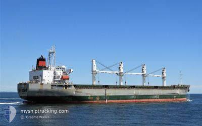
21 GLORY
General Cargo
Current Trip
| Time Travelled | 16 days |
|---|---|
| Remaining Time | --- |
| Distance Travelled | 3389.07 nm |
| Remaining Distance | --- |
| AVG Speed | 12.7 Knots |
| MAX Speed | 16.7 Knots |
| AVG Wind | 12.5 knots |
| MAX Wind | 32 knots |
| MIN Temp | 17.2°C / 62.96°F |
| MAX Temp | 31.7°C / 89.06°F |
| Draught | 6.9 m |
| Position Received | 1 h, 50 m ago |
Current Position
| Longitude | -51.90180° |
|---|---|
| Latitude | -32.27484° |
| Status | At anchor |
| Speed | 0.3 Knots |
| Course | 225° |
| Area | South Atlantic Ocean |
| Station | T-AIS |
| Position Received | 1 h, 50 m ago |
Info
Information
The current position of 21 GLORY is in South Atlantic Ocean with coordinates -32.27484° / -51.90180° as reported on 2024-04-18 08:24 by AIS to our vessel tracker app. The vessel's current speed is 0.3 Knots
The vessel 21 GLORY (IMO: 9468217, MMSI: 636015110) is a General Cargo that was built in 2011 ( 13 years old ). It's sailing under the flag of [LR] Liberia.
In this page you can find informations about the vessels current position, last detected port calls, and current voyage information. If the vessels is not in coverage by AIS you will find the latest position.
The current position of 21 GLORY is detected by our AIS receivers and we are not responsible for the reliability of the data. The last position was recorded while the vessel was in Coverage by the Ais receivers of our vessel tracking app.
The current draught of 21 GLORY as reported by AIS is 6.9 meters
Weather
| Temperature | 17.3°C / 63.14°F |
|---|---|
| Wind Speed | 19 knots |
| Direction | 260° W |
| Pressure | 1016.2 hPa |
| Humidity | 75.6 % |
| Cloud Coverage | --- |
Featured Company
Last Trips
| Origin | Departure | Destination | Arrival | Distance | |
|---|---|---|---|---|---|
| 2024-02-23 21:53 | 2024-03-24 00:30 | 5581.93 nm | |||
| 2024-02-16 21:21 | 2024-02-20 14:36 | 31.12 nm | |||
| 2024-02-11 16:06 | 2024-02-13 05:27 | 16.62 nm | |||
| 2024-01-12 06:14 | 2024-02-11 08:26 | 7825.26 nm | |||
| 2024-01-12 06:14 | 2024-02-09 08:55 | 7677.60 nm |
Events
| Time | Event | Details | Position / Dest | Info |
|---|---|---|---|---|
| 2024-04-18 08:36 | Status Changed | Default At anchor |
-32.27490 / -51.90170
BR RIG
|
Speed: 0.3 kn Course: 225° |
| 2024-04-18 08:24 | OUT of Coverage |
-32.27484 / -51.90180
South Atlantic Ocean
|
Speed: 0.3 kn Course: 161.8° |
|
| 2024-04-18 08:21 | Status Changed | At anchor Default |
-32.27483 / -51.90182
BR RIG
|
Speed: 0.5 kn Course: 230° |
| 2024-04-18 08:15 | IN Coverage |
-32.27483 / -51.90182
South Atlantic Ocean
|
Speed: 0.2 kn Course: 336.4° |
|
| 2024-04-17 18:48 | Status Changed | Default At anchor |
-32.27491 / -51.90174
BR RIG
|
Speed: 0.1 kn Course: 228° |
| 2024-04-17 18:39 | Status Changed | At anchor Default |
-32.27503 / -51.90168
BR RIG
|
Speed: 0.5 kn Course: 234° |
| 2024-04-17 18:39 | OUT of Coverage |
-32.27503 / -51.90168
South Atlantic Ocean
|
Speed: 0.1 kn Course: 142.7° |
|
| 2024-04-17 18:27 | Status Changed | Default At anchor |
-32.27497 / -51.90174
BR RIG
|
Speed: 0.2 kn Course: 233° |
| 2024-04-17 17:42 | Status Changed | At anchor Default |
-32.27503 / -51.90162
BR RIG
|
Speed: 0.3 kn Course: 232° |
| 2024-04-17 17:18 | Status Changed | Default At anchor |
-32.27525 / -51.90164
BR RIG
|
Speed: 0.4 kn Course: 225° |