
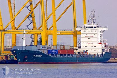
CONTSHIP VOW
General Cargo
Current Trip
GEPTI
| Time Travelled | 1 day |
|---|---|
| Remaining Time | --- |
| Distance Travelled | 325.57 nm |
| Remaining Distance | --- |
| AVG Speed | 12 Knots |
| MAX Speed | 12.9 Knots |
| AVG Wind | 15.6 knots |
| MAX Wind | 25.6 knots |
| MIN Temp | 11.7°C / 53.06°F |
| MAX Temp | 15°C / 59°F |
| Draught | 6.4 m |
| Position Received | 1 d ago |
Current Position
| Longitude | 28.68953° |
|---|---|
| Latitude | 44.10568° |
| Status | Under way using engine |
| Speed | 6.3 Knots |
| Course | 71° |
| Area | Black Sea |
| Station | T-AIS |
| Position Received | 1 d ago |
Info
Information
The current position of CONTSHIP VOW is in Black Sea with coordinates 44.10568° / 28.68953° as reported on 2024-04-23 03:31 by AIS to our vessel tracker app. The vessel's current speed is 6.3 Knots
The vessel CONTSHIP VOW (IMO: 9395599, MMSI: 636018185) is a General Cargo that was built in 2007 ( 17 years old ). It's sailing under the flag of [LR] Liberia.
In this page you can find informations about the vessels current position, last detected port calls, and current voyage information. If the vessels is not in coverage by AIS you will find the latest position.
The current position of CONTSHIP VOW is detected by our AIS receivers and we are not responsible for the reliability of the data. The last position was recorded while the vessel was in Coverage by the Ais receivers of our vessel tracking app.
The current draught of CONTSHIP VOW as reported by AIS is 6.4 meters
Weather
| Temperature | 14.9°C / 58.82°F |
|---|---|
| Wind Speed | 14 knots |
| Direction | 114° ESE |
| Pressure | 1009.7 hPa |
| Humidity | 83.7 % |
| Cloud Coverage | 100 % |
Featured Company
Last Port Calls
| Port | Arrival | Departure | Time In Port |
|---|---|---|---|
| 2024-04-22 14:56 | 2024-04-23 03:40 | 12 h | |
| 2024-04-12 21:13 | 2024-04-13 10:37 | 13 h | |
| 2024-04-11 03:26 | 2024-04-12 04:10 | 1 d | |
| 2024-04-07 22:53 | 2024-04-10 02:46 | 2 d | |
| 2024-04-02 09:42 | 2024-04-02 20:07 | 10 h | |
| 2024-04-02 08:22 | 2024-04-02 09:29 | 1 h | |
| 2024-04-01 22:20 | 2024-04-02 07:58 | 9 h | |
| 2024-04-01 00:40 | 2024-04-01 13:33 | 12 h | |
| 2024-03-25 02:27 | 2024-03-25 22:48 | 20 h | |
| 2024-03-25 02:05 | 2024-03-25 02:21 | 15 m |
Most Visited Ports (Last year)
| Port | Arrivals | |
|---|---|---|
| 19 | ||
| 15 | ||
| 13 | ||
| 12 | ||
| 10 | ||
| 7 |
Last Trips
| Origin | Departure | Destination | Arrival | Distance | |
|---|---|---|---|---|---|
| 2024-04-13 13:37 | 2024-04-22 17:56 | 3653.09 nm | |||
| 2024-04-12 07:10 | 2024-04-13 00:13 | 232.31 nm | |||
| 2024-04-10 05:46 | 2024-04-11 06:26 | 318.87 nm | |||
| 2024-04-02 23:07 | 2024-04-08 01:53 | 262.29 nm | |||
| 2024-04-02 12:29 | 2024-04-02 12:42 | 12.68 nm | |||
| 2024-04-02 10:58 | 2024-04-02 11:22 | 24.15 nm | |||
| 2024-04-01 16:33 | 2024-04-02 01:20 | 79.57 nm | |||
| 2024-03-26 00:48 | 2024-04-01 03:40 | 1575.74 nm | |||
| 2024-03-25 04:21 | 2024-03-25 04:27 | 2.31 nm | |||
| 2024-03-24 07:19 | 2024-03-25 04:05 | 266.50 nm |
Events
| Time | Event | Details | Position / Dest | Info |
|---|---|---|---|---|
| 2024-04-24 10:38 | Draught Changed | 6.4 7 |
42.32242 / 35.55140
GEPTI
|
Speed: 11.9 kn Course: 89° |
| 2024-04-24 10:38 | Destination Changed | GEPTI ROCND |
42.32242 / 35.55140
GEPTI
|
Speed: 11.9 kn Course: 89° |
| 2024-04-24 10:38 | ETA Changed | 2024/04/25 06:30 2024/04/21 12:30 |
42.32242 / 35.55140
GEPTI
|
Speed: 11.9 kn Course: 89° |
| 2024-04-24 02:36 | START Moving |
42.33135 / 34.43410
ROCND
|
Speed: 12 kn Course: 89° |
|
| 2024-04-24 02:32 | STOP Moving |
42.33082 / 34.41617
ROCND
|
Speed: Course: 89° |
|
| 2024-04-24 02:12 | START Moving |
42.32843 / 34.32382
ROCND
|
Speed: 12.5 kn Course: 88° |
|
| 2024-04-24 02:07 | STOP Moving |
42.32796 / 34.30358
ROCND
|
Speed: Course: 92° |
|
| 2024-04-23 19:28 | START Moving |
42.63016 / 32.54372
ROCND
|
Speed: 12.3 kn Course: 117° |
|
| 2024-04-23 19:10 | STOP Moving |
42.65742 / 32.46612
ROCND
|
Speed: Course: 115° |
|
| 2024-04-23 03:31 | OUT of Coverage |
44.10568 / 28.68953
Black Sea
|
Speed: 6.3 kn Course: 71.7° |