
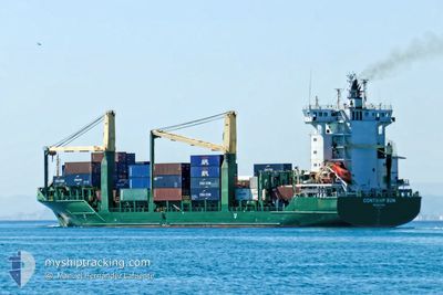
CONTSHIP SUN
Cargo A
Current Trip
DZALG
| Time Travelled | 1 day |
|---|---|
| Remaining Time | --- |
| Distance Travelled | 522.37 nm |
| Remaining Distance | --- |
| AVG Speed | 13.1 Knots |
| MAX Speed | 15.3 Knots |
| AVG Wind | 16 knots |
| MAX Wind | 29.4 knots |
| MIN Temp | 12.2°C / 53.96°F |
| MAX Temp | 15.1°C / 59.18°F |
| Draught | 8.8 m |
| Position Received | 15 d ago |
Current Position
| Longitude | 14.14063° |
|---|---|
| Latitude | 35.89760° |
| Status | Under way using engine |
| Speed | 11.6 Knots |
| Course | 302° |
| Area | Mediterranean Sea - Eastern Basin |
| Station | T-AIS |
| Position Received | 15 d ago |
Info
Information
The current position of CONTSHIP SUN is in Mediterranean Sea - Eastern Basin with coordinates 35.89760° / 14.14063° as reported on 2024-04-10 03:05 by AIS to our vessel tracker app. The vessel's current speed is 11.6 Knots
The vessel CONTSHIP SUN (IMO: 9347815, MMSI: 636017894) is a Cargo A It's sailing under the flag of [LR] Liberia.
In this page you can find informations about the vessels current position, last detected port calls, and current voyage information. If the vessels is not in coverage by AIS you will find the latest position.
The current position of CONTSHIP SUN is detected by our AIS receivers and we are not responsible for the reliability of the data. The last position was recorded while the vessel was in Coverage by the Ais receivers of our vessel tracking app.
The current draught of CONTSHIP SUN as reported by AIS is 8.8 meters
Weather
| Temperature | 15.1°C / 59.18°F |
|---|---|
| Wind Speed | 17 knots |
| Direction | 282° WNW |
| Pressure | 1014.4 hPa |
| Humidity | 71.3 % |
| Cloud Coverage | 13 % |
Featured Company
Last Port Calls
| Port | Arrival | Departure | Time In Port |
|---|---|---|---|
| 2024-04-17 18:01 | 2024-04-23 20:20 | 6 d | |
| 2024-04-08 22:00 | 2024-04-10 00:39 | 1 d | |
| 2024-04-01 12:09 | 2024-04-03 18:54 | 2 d | |
| 2024-03-28 21:37 | 2024-03-29 20:12 | 22 h | |
| 2024-03-19 08:01 | 2024-03-19 16:01 | 8 h | |
| 2024-03-17 09:12 | 2024-03-18 08:42 | 23 h | |
| 2024-03-11 20:58 | |||
| 2024-03-03 03:13 | 2024-03-04 19:31 | 1 d | |
| 2024-02-21 16:41 | |||
| 2024-02-19 03:33 | 2024-02-20 22:58 | 1 d |
Most Visited Ports (Last year)
| Port | Arrivals | |
|---|---|---|
| 15 | ||
| 10 | ||
| 10 | ||
| 10 | ||
| 9 | ||
| 9 |
Last Trips
| Origin | Departure | Destination | Arrival | Distance | |
|---|---|---|---|---|---|
| 2024-04-10 02:39 | 2024-04-17 19:01 | 947.06 nm | |||
| 2024-04-03 20:54 | 2024-04-09 00:00 | 278.59 nm | |||
| 2024-03-29 22:12 | 2024-04-01 14:09 | 787.89 nm | |||
| 2024-03-19 19:01 | 2024-03-28 23:37 | 784.20 nm | |||
| 2024-03-18 11:42 | 2024-03-19 11:01 | 273.30 nm | |||
| 2024-03-11 21:58 | 2024-03-17 12:12 | 1278.56 nm | |||
| 2024-02-20 23:58 | 2024-02-21 18:41 | 173.53 nm | |||
| 2024-02-13 07:14 | 2024-02-19 04:33 | 397.28 nm | |||
| 2024-02-05 19:53 | 2024-02-09 04:35 | 227.13 nm | |||
| 2024-01-31 21:08 | 2024-02-02 11:33 | 284.05 nm |
Events
| Time | Event | Details | Position / Dest | Info |
|---|---|---|---|---|
| 2024-04-23 20:25 | START Moving |
36.76136 / 3.08033
[DZ] ALGER
|
Speed: 7.3 kn Course: -1° |
|
| 2024-04-23 20:20 | PORT DEPARTURE |
|
36.83114 / 3.12146
DZALG
|
Speed: 7.3 kn Course: -1° |
| 2024-04-17 18:18 | STOP Moving |
36.76500 / 3.06667
[DZ] ALGER
|
Speed: Course: -1° |
|
| 2024-04-17 18:01 | PORT ARRIVAL |
|
36.76071 / 3.08280
[DZ] ALGER
|
Speed: 5 kn Course: 186° |
| 2024-04-17 17:15 | START Moving | 5.3 nm, North of ALGER |
36.85500 / 3.10333
DZALG
|
Speed: 4 kn Course: -1° |
| 2024-04-17 12:15 | STOP Moving | 5.29 nm, North of ALGER |
36.85833 / 3.06167
DZALG
|
Speed: Course: -1° |