
PARIS II
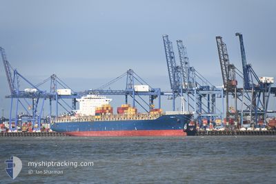
Container Ship
Current Trip
| Time Travelled | 15 h, 40 mins |
|---|---|
| Remaining Time | 8 days |
| Distance Travelled | 274.38 nm |
| Remaining Distance | 3893.81 nm |
| AVG Speed | 18 Knots |
| MAX Speed | 18.5 Knots |
| AVG Wind | 7.6 knots |
| MAX Wind | 13 knots |
| MIN Temp | 21.2°C / 70.16°F |
| MAX Temp | 27.8°C / 82.04°F |
| Draught | 10.1 m |
| Position Received | 14 h, 53 m ago |
Current Position
| Longitude | -69.46099° |
|---|---|
| Latitude | 18.28903° |
| Status | Under way using engine |
| Speed | 17.8 Knots |
| Course | 132.3° |
| Area | Caribbean Sea |
| Station | T-AIS |
| Position Received | 14 h, 53 m ago |
Info
Information
The current position of PARIS II is in Caribbean Sea with coordinates 18.28903° / -69.46099° as reported on 2024-04-19 10:18 by AIS to our vessel tracker app. The vessel's current speed is 17.8 Knots and is heading at the port of PARANAGUA. The estimated time of arrival as calculated by MyShipTracking vessel tracking app is 2024-04-29 00:28 LT
The vessel PARIS II (IMO: 9222273, MMSI: 636092887) is a Container Ship that was built in 2001 ( 23 years old ). It's sailing under the flag of [LR] Liberia.
In this page you can find informations about the vessels current position, last detected port calls, and current voyage information. If the vessels is not in coverage by AIS you will find the latest position.
The current position of PARIS II is detected by our AIS receivers and we are not responsible for the reliability of the data. The last position was recorded while the vessel was in Coverage by the Ais receivers of our vessel tracking app.
The current draught of PARIS II as reported by AIS is 10.1 meters
Weather
| Temperature | 27.8°C / 82.04°F |
|---|---|
| Wind Speed | 7 knots |
| Direction | 49° NE |
| Pressure | 1013.1 hPa |
| Humidity | 73.9 % |
| Cloud Coverage | 64 % |
Featured Company
Last Port Calls
| Port | Arrival | Departure | Time In Port |
|---|---|---|---|
| 2024-04-17 14:50 | 2024-04-19 09:32 | 1 d | |
| 2024-04-13 00:52 | 2024-04-14 05:17 | 1 d | |
| 2024-04-09 08:13 | 2024-04-10 17:48 | 1 d | |
| 2024-04-04 15:14 | 2024-04-08 08:26 | 3 d | |
| 2024-03-23 08:03 | 2024-03-27 07:43 | 3 d | |
| 2024-03-04 01:36 | |||
| 2024-02-29 11:24 | 2024-02-29 11:29 | 5 m | |
| 2024-02-26 14:32 | 2024-02-26 14:46 | 14 m | |
| 2024-02-21 11:08 | 2024-02-22 06:08 | 19 h | |
| 2024-02-17 10:08 | 2024-02-18 01:28 | 15 h |
Most Visited Ports (Last year)
| Port | Arrivals | |
|---|---|---|
| 3 | ||
| 3 | ||
| 2 | ||
| 2 | ||
| 2 | ||
| 2 |
Last Trips
| Origin | Departure | Destination | Arrival | Distance | |
|---|---|---|---|---|---|
| 2024-04-14 01:17 | 2024-04-17 10:50 | 1223.25 nm | |||
| 2024-04-10 13:48 | 2024-04-12 20:52 | 559.74 nm | |||
| 2024-04-08 04:26 | 2024-04-09 04:13 | 286.69 nm | |||
| 2024-03-27 03:43 | 2024-04-04 11:14 | 1092.31 nm | |||
| 2024-02-29 08:29 | 2024-03-03 22:36 | 846.30 nm | |||
| 2024-02-26 11:46 | 2024-02-29 08:24 | 270.18 nm | |||
| 2024-02-22 03:08 | 2024-02-26 11:32 | 187.16 nm | |||
| 2024-02-17 22:28 | 2024-02-21 08:08 | 840.90 nm | |||
| 2024-02-16 19:34 | 2024-02-17 07:08 | 146.41 nm | |||
| 2024-02-11 11:42 | 2024-02-15 13:44 | 1014.16 nm |
Events
| Time | Event | Details | Position / Dest | Info |
|---|---|---|---|---|
| 2024-04-19 10:37 | Status Changed | Default Under way using engine |
18.22647 / -69.38504
DOCAU=>BRPNG
|
Speed: 17.8 kn Course: 132.3° |
| 2024-04-19 10:18 | OUT of Coverage |
18.28903 / -69.46099
Caribbean Sea
DOCAU=>BRPNG
|
Speed: 17.8 kn Course: 132.3° |
|
| 2024-04-19 09:32 | PORT DEPARTURE |
|
18.42961 / -69.61603
DOCAU=>BRPNG
|
Speed: 6.8 kn Course: 102° |
| 2024-04-19 09:25 | START Moving |
18.42879 / -69.62817
[DO] BOCA CHIKA
|
Speed: 3.4 kn Course: 67° |
|
| 2024-04-19 09:22 | Status Changed | Under way using engine Moored |
18.42769 / -69.62917
[DO] BOCA CHIKA
|
Speed: Course: 7° |
| 2024-04-19 06:49 | Status Changed | Moored Default |
18.42792 / -69.63093
[DO] BOCA CHIKA
|
Speed: Course: 349° |
| 2024-04-19 06:49 | IN Coverage |
18.42792 / -69.63093
Caribbean Sea
[DO] BOCA CHIKA
|
Speed: 0.1 kn Course: 169° |
|
| 2024-04-19 01:37 | OUT of Coverage |
18.42791 / -69.63094
Caribbean Sea
[DO] BOCA CHIKA
|
Speed: 0.1 kn Course: 349° |
|
| 2024-04-18 23:56 | Status Changed | Moored Default |
18.42792 / -69.63093
[DO] BOCA CHIKA
|
Speed: Course: 349° |
| 2024-04-18 23:56 | IN Coverage |
18.42792 / -69.63093
Caribbean Sea
[DO] BOCA CHIKA
|
Speed: Course: 29° |