
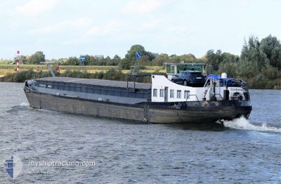
CONTESSA
Cargo
Current Trip
NVT
| Time Travelled | 16 days |
|---|---|
| Remaining Time | --- |
| Distance Travelled | 222.09 nm |
| Remaining Distance | --- |
| AVG Speed | 5.8 Knots |
| MAX Speed | 9.6 Knots |
| AVG Wind | 10.6 knots |
| MAX Wind | 21.8 knots |
| MIN Temp | 4.1°C / 39.38°F |
| MAX Temp | 18.7°C / 65.66°F |
| Draught | 0.1 m |
| Position Received | 3 d ago |
Current Position
| Longitude | 5.69000° |
|---|---|
| Latitude | 50.78858° |
| Status | Default |
| Speed | 8.6 Knots |
| Course | 189.7° |
| Area | North Sea |
| Station | T-AIS |
| Position Received | 3 d ago |
Info
Information
The current position of CONTESSA is in North Sea with coordinates 50.78858° / 5.69000° as reported on 2024-04-20 08:28 by AIS to our vessel tracker app. The vessel's current speed is 8.6 Knots
The vessel CONTESSA (MMSI: 205370390) is a Cargo It's sailing under the flag of [BE] Belgium.
In this page you can find informations about the vessels current position, last detected port calls, and current voyage information. If the vessels is not in coverage by AIS you will find the latest position.
The current position of CONTESSA is detected by our AIS receivers and we are not responsible for the reliability of the data. The last position was recorded while the vessel was in Coverage by the Ais receivers of our vessel tracking app.
The current draught of CONTESSA as reported by AIS is 0.1 meters
Weather
| Temperature | 6°C / 42.8°F |
|---|---|
| Wind Speed | 7 knots |
| Direction | 329° NNW |
| Pressure | 1021.2 hPa |
| Humidity | 82.7 % |
| Cloud Coverage | 100 % |
Featured Company
Most Visited Ports (Last year)
| Port | Arrivals | |
|---|---|---|
| 7 | ||
| 5 | ||
| 2 | ||
| 2 | ||
| 2 | ||
| 2 |
Events
| Time | Event | Details | Position / Dest | Info |
|---|---|---|---|---|
| 2024-04-20 08:28 | OUT of Coverage |
50.78858 / 5.69000
North Sea
|
Speed: 8.6 kn Course: 189.7° |
|
| 2024-04-20 08:27 | START Moving | 0.56 nm, South West of WAOLENWIERT |
50.79131 / 5.69067
NVT
|
Speed: 8.6 kn Course: 187.3° |
| 2024-04-20 08:16 | STOP Moving | 0.46 nm, West of WAOLENWIERT |
50.79433 / 5.69085
NVT
|
Speed: Course: 511° |
| 2024-04-20 07:51 | START Moving | 0.41 nm, West of WAOLENWIERT |
50.79722 / 5.69120
NVT
|
Speed: 5.2 kn Course: 184.5° |
| 2024-04-20 07:38 | STOP Moving | 0.41 nm, West of WAOLENWIERT |
50.79930 / 5.69164
NVT
|
Speed: 0.1 kn Course: 511° |
| 2024-04-20 05:19 | START Moving | 1.94 nm, South of BARGE TERMINAL BORN |
51.03003 / 5.79566
NVT
|
Speed: 5.1 kn Course: 204.9° |
| 2024-04-19 20:00 | STOP Moving | 1.83 nm, South of BARGE TERMINAL BORN |
51.03189 / 5.79654
NVT
|
Speed: Course: 511° |
| 2024-04-19 19:56 | START Moving | 1.71 nm, South of BARGE TERMINAL BORN |
51.03367 / 5.79771
NVT
|
Speed: 4.8 kn Course: 201.7° |
| 2024-04-19 19:34 | STOP Moving | 1.6 nm, South of BARGE TERMINAL BORN |
51.03542 / 5.79866
NVT
|
Speed: 0.1 kn Course: 511° |
| 2024-04-19 18:57 | START Moving | 0.86 nm, East of OHE EN LAAK |
51.10576 / 5.84828
NVT
|
Speed: 8.5 kn Course: 209.4° |