
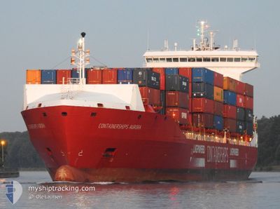
CONTAINERSHIPSAURORA
Cargo
Current Trip
| Time Travelled | 1 day |
|---|---|
| Remaining Time | 2 days |
| Distance Travelled | 396.68 nm |
| Remaining Distance | 388.62 nm |
| AVG Speed | 11.1 Knots |
| MAX Speed | 17.6 Knots |
| AVG Wind | 7.2 knots |
| MAX Wind | 18.9 knots |
| MIN Temp | -1.3°C / 29.66°F |
| MAX Temp | 4.8°C / 40.64°F |
| Draught | 8.4 m |
| Position Received | 1 m ago |
Current Position
| Longitude | 9.36440° |
|---|---|
| Latitude | 54.15049° |
| Status | Under way using engine |
| Speed | |
| Course | 241° |
| Area | Baltic Sea |
| Station | T-AIS |
| Position Received | 1 m ago |
Info
Information
The current position of CONTAINERSHIPSAURORA is in Baltic Sea with coordinates 54.15049° / 9.36440° as reported on 2024-04-23 06:30 by AIS to our vessel tracker app. The vessel's current speed is 0 Knots and is heading at the port of TEES. The estimated time of arrival as calculated by MyShipTracking vessel tracking app is 2024-04-25 16:27 LT
The vessel CONTAINERSHIPSAURORA (IMO: 9814014, MMSI: 209659000) is a Cargo It's sailing under the flag of [CY] Cyprus.
In this page you can find informations about the vessels current position, last detected port calls, and current voyage information. If the vessels is not in coverage by AIS you will find the latest position.
The current position of CONTAINERSHIPSAURORA is detected by our AIS receivers and we are not responsible for the reliability of the data. The last position was recorded while the vessel was in Coverage by the Ais receivers of our vessel tracking app.
The current draught of CONTAINERSHIPSAURORA as reported by AIS is 8.4 meters
Weather
| Temperature | 3.9°C / 39.02°F |
|---|---|
| Wind Speed | 2 knots |
| Direction | 262° W |
| Pressure | 1020.1 hPa |
| Humidity | 69.5 % |
| Cloud Coverage | 21 % |
Featured Company
Last Port Calls
| Port | Arrival | Departure | Time In Port |
|---|---|---|---|
| 2024-04-20 23:52 | 2024-04-21 22:16 | 22 h | |
| 2024-04-20 03:16 | 2024-04-20 15:58 | 12 h | |
| 2024-04-18 22:28 | 2024-04-18 22:32 | 4 m | |
| 2024-04-16 22:30 | 2024-04-17 15:46 | 17 h | |
| 2024-04-14 11:21 | 2024-04-16 01:46 | 1 d | |
| 2024-04-10 09:06 | 2024-04-11 17:37 | 1 d | |
| 2024-04-09 01:07 | 2024-04-09 20:06 | 18 h | |
| 2024-04-06 09:48 | 2024-04-06 09:52 | 4 m | |
| 2024-04-03 04:36 | 2024-04-04 19:29 | 1 d | |
| 2024-03-31 14:57 | 2024-04-01 00:11 | 9 h |
Last Trips
| Origin | Departure | Destination | Arrival | Distance | |
|---|---|---|---|---|---|
| 2024-04-20 18:58 | 2024-04-21 01:52 | 119.53 nm | |||
| 2024-04-19 00:32 | 2024-04-20 06:16 | 409.49 nm | |||
| 2024-04-17 17:46 | 2024-04-19 00:28 | 331.55 nm | |||
| 2024-04-16 02:46 | 2024-04-17 00:30 | 290.43 nm | |||
| 2024-04-11 19:37 | 2024-04-14 12:21 | 1006.52 nm | |||
| 2024-04-09 23:06 | 2024-04-10 11:06 | 158.03 nm | |||
| 2024-04-06 11:52 | 2024-04-09 04:07 | 451.00 nm | |||
| 2024-04-04 20:29 | 2024-04-06 11:48 | 432.05 nm | |||
| 2024-04-01 01:11 | 2024-04-03 05:36 | 291.69 nm | |||
| 2024-03-28 19:07 | 2024-03-31 15:57 | 999.94 nm |
Events
| Time | Event | Details | Position / Dest | Info |
|---|---|---|---|---|
| 2024-04-23 06:19 | STOP Moving | 0.32 nm, South West of FISCHERHUTTE |
54.15067 / 9.36594
GBTEE
|
Speed: Course: 247° |
| 2024-04-23 05:10 | START Moving | 6.85 nm, North East of FISCHERHUTTE |
54.19928 / 9.55182
GBTEE
|
Speed: 3.3 kn Course: 235° |
| 2024-04-23 04:44 | STOP Moving | 6.96 nm, North East of FISCHERHUTTE |
54.20045 / 9.55443
GBTEE
|
Speed: 0.3 kn Course: 237° |
| 2024-04-23 00:55 | START Moving | 3.83 nm, North West of KIEL |
54.36066 / 10.05943
GBTEE
|
Speed: 3.1 kn Course: 254° |
| 2024-04-23 00:41 | STOP Moving | 3.71 nm, North West of KIEL |
54.36225 / 10.06437
GBTEE
|
Speed: 0.3 kn Course: 242° |
| 2024-04-23 00:00 | START Moving | 1.43 nm, South West of STICKENHΟRN SPORT |
54.36669 / 10.13808
GBTEE
|
Speed: 3.1 kn Course: 284° |
| 2024-04-22 23:33 | STOP Moving | 1.35 nm, South West of STICKENHΟRN SPORT |
54.36596 / 10.14260
GBTEE
|
Speed: 0.3 kn Course: 284° |
| 2024-04-22 23:04 | START Moving | 0.64 nm, West of MOELTENORT |
54.37271 / 10.17756
GBTEE
|
Speed: 3.1 kn Course: 216° |
| 2024-04-22 22:41 | STOP Moving | 0.52 nm, West of MOELTENORT |
54.37600 / 10.18045
GBTEE
|
Speed: 0.3 kn Course: 218° |
| 2024-04-22 20:11 | Change Sea Area | German part of the Baltic Sea Danish part of the Baltic Sea |
54.56462 / 10.56564
Baltic Sea
GBTEE
|
Speed: 7 kn Course: 247° |