
COME TOGETHER
Pleasure Craft
Current Trip
| Trip Time | --- |
|---|---|
| Trip Distance | --- |
| AVG Speed | --- |
| MAX Speed | --- |
| Draught | --- |
| AVG Wind | --- |
| MAX Wind | --- |
| MIN Temp | --- |
| MAX Temp | --- |
| Position Received | 11 h, 51 m ago |
Current Position
| Longitude | -77.31883° |
|---|---|
| Latitude | 25.07860° |
| Status | Moored |
| Speed | |
| Course | 279° |
| Area | North Atlantic Ocean |
| Station | T-AIS |
| Position Received | 11 h, 51 m ago |
Info
Information
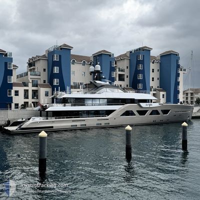
The current position of COME TOGETHER is in North Atlantic Ocean with coordinates 25.07860° / -77.31883° as reported on 2024-04-24 23:23 by AIS to our vessel tracker app. The vessel's current speed is 0 Knots and is currently inside the port of NASSAU.
The vessel COME TOGETHER (IMO: 9880312, MMSI: 319226800) is a Pleasure Craft It's sailing under the flag of [KY] Cayman Is.
In this page you can find informations about the vessels current position, last detected port calls, and current voyage information. If the vessels is not in coverage by AIS you will find the latest position.
The current position of COME TOGETHER is detected by our AIS receivers and we are not responsible for the reliability of the data. The last position was recorded while the vessel was in Coverage by the Ais receivers of our vessel tracking app.
The current draught of COME TOGETHER as reported by AIS is 3.4 meters
Weather
| Temperature | 23°C / 73.4°F |
|---|---|
| Wind Speed | 9 knots |
| Direction | 61° ENE |
| Pressure | 1018.8 hPa |
| Humidity | 64.3 % |
| Cloud Coverage | 96 % |
Featured Company
Most Visited Ports (Last year)
| Port | Arrivals | |
|---|---|---|
| 13 | ||
| 8 | ||
| 4 | ||
| 3 | ||
| 3 | ||
| 2 |
Last Trips
| Origin | Departure | Destination | Arrival | Distance | |
|---|---|---|---|---|---|
| 2024-01-08 08:34 | 2024-02-29 14:06 | 1461.33 nm |
Events
| Time | Event | Details | Position / Dest | Info |
|---|---|---|---|---|
| 2024-04-24 23:23 | OUT of Coverage |
25.07860 / -77.31883
North Atlantic Ocean
[BS] NASSAU
|
Speed: Course: 279.6° |
|
| 2024-04-24 17:29 | IN Coverage |
25.07860 / -77.31880
North Atlantic Ocean
[BS] NASSAU
|
Speed: Course: 279.4° |
|
| 2024-04-24 16:02 | OUT of Coverage |
25.07860 / -77.31882
North Atlantic Ocean
[BS] NASSAU
|
Speed: Course: 279.6° |
|
| 2024-04-23 18:12 | Destination Changed | BS NAS WPB UQ PLT |
25.07862 / -77.31882
[BS] NASSAU
|
Speed: Course: 279° |
| 2024-04-23 18:12 | ETA Changed | 2025/03/22 12:00 2025/03/24 21:00 |
25.07862 / -77.31882
[BS] NASSAU
|
Speed: Course: 279° |
| 2024-04-23 15:42 | IN Coverage |
25.07860 / -77.31880
North Atlantic Ocean
[BS] NASSAU
|
Speed: Course: 279.7° |
|
| 2024-04-22 07:22 | OUT of Coverage |
26.20674 / -78.63198
North Atlantic Ocean
|
Speed: 12.7 kn Course: 113.7° |
|
| 2024-04-22 05:49 | Detected in Sea | Bahamas part of the North Atlantic Ocean |
26.34352 / -78.96500
North Atlantic Ocean
|
Speed: 13 kn Course: 114.1° |
| 2024-04-22 05:49 | IN Coverage |
26.34352 / -78.96500
North Atlantic Ocean
|
Speed: 13 kn Course: 114.1° |
|
| 2024-04-21 21:56 | OUT of Coverage |
26.74848 / -80.05094
North Atlantic Ocean
|
Speed: Course: 91.9° |