
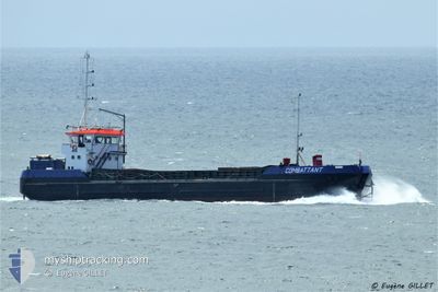
COMBATTANT
Motor Hopper
Current Trip
| Trip Time | 1 day |
|---|---|
| Trip Distance | 182.71 nm |
| AVG Speed | 7.7 Knots |
| MAX Speed | 9.9 Knots |
| Draught | 1.7 m |
| AVG Wind | 9.9 knots |
| MAX Wind | 13 knots |
| MIN Temp | 6.1°C / 42.98°F |
| MAX Temp | 15.6°C / 60.08°F |
| Position Received | 1 m ago |
Current Position
| Longitude | -3.35313° |
|---|---|
| Latitude | 47.73897° |
| Status | Under way using engine |
| Speed | |
| Course | --- |
| Area | Bay of Biscay |
| Station | T-AIS |
| Position Received | 1 m ago |
Info
Information
The current position of COMBATTANT is in Bay of Biscay with coordinates 47.73897° / -3.35313° as reported on 2024-04-19 23:32 by AIS to our vessel tracker app. The vessel's current speed is 0 Knots and is currently inside the port of LORIENT.
The vessel COMBATTANT (IMO: 9028342, MMSI: 227007320) is a Motor Hopper that was built in 1977 ( 47 years old ). It's sailing under the flag of [FR] France.
In this page you can find informations about the vessels current position, last detected port calls, and current voyage information. If the vessels is not in coverage by AIS you will find the latest position.
The current position of COMBATTANT is detected by our AIS receivers and we are not responsible for the reliability of the data. The last position was recorded while the vessel was in Coverage by the Ais receivers of our vessel tracking app.
The current draught of COMBATTANT as reported by AIS is 1.7 meters
Weather
| Temperature | 11.2°C / 52.16°F |
|---|---|
| Wind Speed | 5 knots |
| Direction | 350° N |
| Pressure | 1023.1 hPa |
| Humidity | 77.4 % |
| Cloud Coverage | 66 % |
Featured Company
Last Port Calls
| Port | Arrival | Departure | Time In Port |
|---|---|---|---|
| 2024-04-19 16:31 | |||
| 2024-04-14 09:06 | 2024-04-18 14:25 | 4 d | |
| 2024-04-12 08:59 | 2024-04-13 22:21 | 1 d | |
| 2024-04-11 20:28 | 2024-04-12 08:45 | 12 h | |
| 2024-04-10 07:41 | 2024-04-11 20:23 | 1 d | |
| 2024-03-31 21:59 | 2024-04-10 07:37 | 9 d | |
| 2024-03-31 09:25 | 2024-03-31 21:55 | 12 h | |
| 2024-03-30 21:14 | 2024-03-31 08:53 | 11 h | |
| 2024-03-26 19:37 | 2024-03-30 20:59 | 4 d | |
| 2024-03-25 18:55 | 2024-03-26 19:33 | 1 d |
Most Visited Ports (Last year)
| Port | Arrivals | |
|---|---|---|
| 82 | ||
| 12 | ||
| 2 | ||
| 2 |
Last Trips
| Origin | Departure | Destination | Arrival | Distance | |
|---|---|---|---|---|---|
| 2024-04-18 16:25 | 2024-04-19 18:31 | 182.71 nm | |||
| 2024-04-14 00:21 | 2024-04-14 11:06 | 71.82 nm | |||
| 2024-04-12 10:45 | 2024-04-12 10:59 | 1.04 nm | |||
| 2024-04-11 22:23 | 2024-04-11 22:28 | 0.30 nm | |||
| 2024-04-10 09:37 | 2024-04-10 09:41 | 0.32 nm | |||
| 2024-03-31 23:55 | 2024-03-31 23:59 | 0.37 nm | |||
| 2024-03-31 10:53 | 2024-03-31 11:25 | 1.61 nm | |||
| 2024-03-30 21:59 | 2024-03-30 22:14 | 0.89 nm | |||
| 2024-03-26 20:33 | 2024-03-26 20:37 | 0.27 nm | |||
| 2024-03-25 19:24 | 2024-03-25 19:55 | 1.37 nm |
Events
| Time | Event | Details | Position / Dest | Info |
|---|---|---|---|---|
| 2024-04-19 16:41 | STOP Moving |
47.73899 / -3.35315
[FR] LORIENT
|
Speed: 0.3 kn Course: 511° |
|
| 2024-04-19 16:31 | PORT ARRIVAL |
|
47.73006 / -3.35715
[FR] LORIENT
|
Speed: 7.3 kn Course: 41° |
| 2024-04-19 14:38 | Change Sea Area | French part of the Bay of Biscay French part of the Celtic Sea |
47.65344 / -3.70387
Bay of Biscay
LORIENT
|
Speed: 8.8 kn Course: 83° |
| 2024-04-19 14:38 | IN Coverage |
47.65344 / -3.70387
Bay of Biscay
LORIENT
|
Speed: 8.8 kn Course: 83° |
|
| 2024-04-19 10:21 | OUT of Coverage |
47.87550 / -4.54401
Celtic Sea
LORIENT
|
Speed: 8.5 kn Course: 140° |
|
| 2024-04-19 03:15 | Change Sea Area | French part of the Celtic Sea French part of the English Channel |
48.69037 / -4.62214
Celtic Sea
LORIENT
|
Speed: 7.6 kn Course: 238° |
| 2024-04-18 19:31 | Destination Changed | LORIENT SAINT-MALO |
48.93155 / -3.13501
LORIENT
|
Speed: 9.7 kn Course: 252° |
| 2024-04-18 19:31 | ETA Changed | 2024/04/19 19:00 2025/03/14 12:00 |
48.93155 / -3.13501
LORIENT
|
Speed: 9.7 kn Course: 252° |
| 2024-04-18 18:19 | IN Coverage |
48.91314 / -2.87616
English Channel
|
Speed: 9.6 kn Course: 302° |
|
| 2024-04-18 14:25 | PORT DEPARTURE |
|
48.91314 / -2.87616
SAINT-MALO
|
Speed: Course: 511° |