
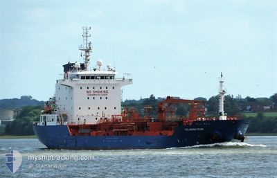
COLORADO STAR
Oil/Chemical Tanker
Current Trip
| Time Travelled | 2 days |
|---|---|
| Remaining Time | --- |
| Distance Travelled | 174.99 nm |
| Remaining Distance | --- |
| AVG Speed | 10 Knots |
| MAX Speed | 12.7 Knots |
| AVG Wind | 15.4 knots |
| MAX Wind | 25 knots |
| MIN Temp | 4.8°C / 40.64°F |
| MAX Temp | 8°C / 46.4°F |
| Draught | 6.3 m |
| Position Received | 9 h, 5 m ago |
Current Position
| Longitude | 0.47465° |
|---|---|
| Latitude | 53.60531° |
| Status | At anchor |
| Speed | 0.3 Knots |
| Course | 298° |
| Area | North Sea |
| Station | T-AIS |
| Position Received | 9 h, 5 m ago |
Info
Information
The current position of COLORADO STAR is in North Sea with coordinates 53.60531° / 0.47465° as reported on 2024-04-25 01:58 by AIS to our vessel tracker app. The vessel's current speed is 0.3 Knots
The vessel COLORADO STAR (IMO: 9527609, MMSI: 248127000) is a Oil/Chemical Tanker that was built in 2010 ( 14 years old ). It's sailing under the flag of [MT] Malta.
In this page you can find informations about the vessels current position, last detected port calls, and current voyage information. If the vessels is not in coverage by AIS you will find the latest position.
The current position of COLORADO STAR is detected by our AIS receivers and we are not responsible for the reliability of the data. The last position was recorded while the vessel was in Coverage by the Ais receivers of our vessel tracking app.
The current draught of COLORADO STAR as reported by AIS is 6.3 meters
Weather
| Temperature | 5.5°C / 41.9°F |
|---|---|
| Wind Speed | 14 knots |
| Direction | 311° NW |
| Pressure | 1002.4 hPa |
| Humidity | 88.4 % |
| Cloud Coverage | 100 % |
Featured Company
Last Port Calls
| Port | Arrival | Departure | Time In Port |
|---|---|---|---|
| 2024-04-22 00:07 | 2024-04-23 00:19 | 1 d | |
| 2024-04-18 14:53 | 2024-04-21 04:34 | 2 d | |
| 2024-04-07 13:30 | 2024-04-08 11:45 | 22 h | |
| 2024-04-05 18:25 | 2024-04-06 12:22 | 17 h | |
| 2024-03-31 11:15 | 2024-04-03 02:03 | 2 d | |
| 2024-03-29 02:11 | 2024-03-31 10:25 | 2 d | |
| 2024-03-25 05:30 | 2024-03-26 15:16 | 1 d | |
| 2024-03-19 20:18 | 2024-03-20 14:15 | 17 h | |
| 2024-03-16 13:16 | 2024-03-17 14:12 | 1 d | |
| 2024-03-12 12:49 | 2024-03-13 11:45 | 22 h |
Last Trips
| Origin | Departure | Destination | Arrival | Distance | |
|---|---|---|---|---|---|
| 2024-04-21 05:34 | 2024-04-22 02:07 | 191.01 nm | |||
| 2024-04-08 13:45 | 2024-04-18 15:53 | 969.56 nm | |||
| 2024-04-06 14:22 | 2024-04-07 15:30 | 251.64 nm | |||
| 2024-04-03 04:03 | 2024-04-05 20:25 | 565.46 nm | |||
| 2024-03-31 12:25 | 2024-03-31 13:15 | 5.01 nm | |||
| 2024-03-26 16:16 | 2024-03-29 03:11 | 493.15 nm | |||
| 2024-03-20 15:15 | 2024-03-25 06:30 | 317.18 nm | |||
| 2024-03-17 15:12 | 2024-03-19 21:18 | 559.43 nm | |||
| 2024-03-13 12:45 | 2024-03-16 14:16 | 582.37 nm | |||
| 2024-03-10 07:48 | 2024-03-12 13:49 | 459.58 nm |
Events
| Time | Event | Details | Position / Dest | Info |
|---|---|---|---|---|
| 2024-04-25 02:05 | Status Changed | Default At anchor |
53.60512 / .47451
NLRTM > GBIMM
|
Speed: 0.3 kn Course: 298° |
| 2024-04-25 01:58 | OUT of Coverage |
53.60531 / .47465
North Sea
|
Speed: 0.3 kn Course: 255.6° |
|
| 2024-04-25 01:46 | Status Changed | At anchor Default |
53.60573 / .47506
NLRTM > GBIMM
|
Speed: 0.4 kn Course: 191° |
| 2024-04-25 01:44 | Status Changed | Default At anchor |
53.60586 / .47498
NLRTM > GBIMM
|
Speed: 0.4 kn Course: 259° |
| 2024-04-25 01:36 | Status Changed | At anchor Default |
53.60636 / .47393
NLRTM > GBIMM
|
Speed: 0.5 kn Course: 243° |
| 2024-04-25 01:32 | Status Changed | Default At anchor |
53.60667 / .47347
NLRTM > GBIMM
|
Speed: 0.6 kn Course: 241° |
| 2024-04-25 01:32 | Status Changed | At anchor Default |
53.60670 / .47346
NLRTM > GBIMM
|
Speed: 0.4 kn Course: 214° |
| 2024-04-25 01:16 | IN Coverage |
53.60670 / .47346
North Sea
|
Speed: 0.6 kn Course: 138.2° |
|
| 2024-04-23 16:48 | STOP Moving | 19.48 nm, East of GRIMSBY |
53.60303 / .47498
NLRTM > GBIMM
|
Speed: 0.2 kn Course: 357° |
| 2024-04-23 12:41 | OUT of Coverage |
53.17269 / 1.25759
North Sea
NLRTM > GBIMM
|
Speed: 12.2 kn Course: 323.8° |