
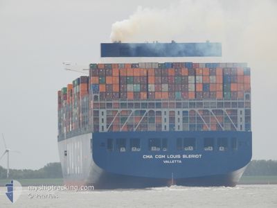
CMACGM LOUIS BLERIOT
Cargo A
Current Trip
| Time Travelled | 5 days |
|---|---|
| Remaining Time | 22 days |
| Distance Travelled | 2278.06 nm |
| Remaining Distance | 9388.99 nm |
| AVG Speed | 16.2 Knots |
| MAX Speed | 19 Knots |
| AVG Wind | 14.2 knots |
| MAX Wind | 32 knots |
| MIN Temp | 10°C / 50°F |
| MAX Temp | 21.7°C / 71.06°F |
| Draught | 13.5 m |
| Position Received | 11 h, 56 m ago |
Current Position
| Longitude | -17.67829° |
|---|---|
| Latitude | 20.62474° |
| Status | Under way using engine |
| Speed | 17.1 Knots |
| Course | 182.6° |
| Area | North Atlantic Ocean |
| Station | T-AIS |
| Position Received | 11 h, 56 m ago |
Info
Information
The current position of CMACGM LOUIS BLERIOT is in North Atlantic Ocean with coordinates 20.62474° / -17.67829° as reported on 2024-04-24 21:50 by AIS to our vessel tracker app. The vessel's current speed is 17.1 Knots and is heading at the port of SINGAPORE. The estimated time of arrival as calculated by MyShipTracking vessel tracking app is 2024-05-18 01:45 LT
The vessel CMACGM LOUIS BLERIOT (IMO: 9776432, MMSI: 248794000) is a Cargo A It's sailing under the flag of [MT] Malta.
In this page you can find informations about the vessels current position, last detected port calls, and current voyage information. If the vessels is not in coverage by AIS you will find the latest position.
The current position of CMACGM LOUIS BLERIOT is detected by our AIS receivers and we are not responsible for the reliability of the data. The last position was recorded while the vessel was in Coverage by the Ais receivers of our vessel tracking app.
The current draught of CMACGM LOUIS BLERIOT as reported by AIS is 13.5 meters
Weather
| Temperature | 21.7°C / 71.06°F |
|---|---|
| Wind Speed | 12 knots |
| Direction | 354° N |
| Pressure | 1012.5 hPa |
| Humidity | 83.1 % |
| Cloud Coverage | 61 % |
Featured Company
Last Port Calls
| Port | Arrival | Departure | Time In Port |
|---|---|---|---|
| 2024-04-18 02:45 | 2024-04-19 18:57 | 1 d | |
| 2024-04-14 20:03 | 2024-04-17 07:53 | 2 d | |
| 2024-04-11 04:23 | 2024-04-14 01:59 | 2 d | |
| 2024-04-07 22:53 | 2024-04-10 03:08 | 2 d | |
| 2024-03-29 21:19 | 2024-03-30 18:09 | 20 h | |
| 2024-02-29 03:16 | 2024-03-01 18:37 | 1 d | |
| 2024-02-24 12:42 | 2024-02-25 04:29 | 15 h | |
| 2024-02-19 00:31 | 2024-02-20 05:20 | 1 d |
Most Visited Ports (Last year)
| Port | Arrivals | |
|---|---|---|
| 6 | ||
| 5 | ||
| 4 | ||
| 4 | ||
| 4 | ||
| 4 |
Last Trips
| Origin | Departure | Destination | Arrival | Distance | |
|---|---|---|---|---|---|
| 2024-04-17 09:53 | 2024-04-18 04:45 | 274.12 nm | |||
| 2024-04-14 02:59 | 2024-04-14 22:03 | 260.43 nm | |||
| 2024-04-10 05:08 | 2024-04-11 05:23 | 261.09 nm | |||
| 2024-03-30 19:09 | 2024-04-08 00:53 | 1638.18 nm | |||
| 2024-03-02 02:37 | 2024-03-29 22:19 | 10904.61 nm | |||
| 2024-02-25 12:29 | 2024-02-29 11:16 | 1461.84 nm | |||
| 2024-02-20 13:20 | 2024-02-24 20:42 | 903.84 nm | |||
| 2024-01-14 02:46 | 2024-02-19 08:31 | 552.08 nm |
Events
| Time | Event | Details | Position / Dest | Info |
|---|---|---|---|---|
| 2024-04-24 21:55 | Status Changed | Default Under way using engine |
20.60069 / -17.67928
SGSIN PWBGA
|
Speed: 17.1 kn Course: 182.6° |
| 2024-04-24 21:50 | Change Sea Area | Western Saharan part of the North Atlantic Ocean Spanish (Canary Islands) part of the North Atlantic Ocean |
20.62474 / -17.67829
North Atlantic Ocean
SGSIN PWBGA
|
Speed: 17.1 kn Course: 182.6° |
| 2024-04-24 21:50 | Status Changed | Under way using engine Default |
20.62474 / -17.67829
SGSIN PWBGA
|
Speed: 17.1 kn Course: 183° |
| 2024-04-24 21:50 | IN Coverage |
20.62474 / -17.67829
North Atlantic Ocean
SGSIN PWBGA
|
Speed: 17.1 kn Course: 182.6° |
|
| 2024-04-24 21:50 | OUT of Coverage |
20.62474 / -17.67829
North Atlantic Ocean
SGSIN PWBGA
|
Speed: 17.1 kn Course: 182.6° |
|
| 2024-04-23 17:38 | Status Changed | Default Under way using engine |
27.81396 / -13.81475
SGSIN PWBGA
|
Speed: 17.3 kn Course: 214.9° |
| 2024-04-23 17:22 | OUT of Coverage |
27.87556 / -13.76614
North Atlantic Ocean
SGSIN PWBGA
|
Speed: 17.3 kn Course: 214.9° |
|
| 2024-04-23 16:48 | Status Changed | Under way using engine Default |
28.01031 / -13.66330
SGSIN PWBGA
|
Speed: 17 kn Course: 216° |
| 2024-04-23 16:42 | Status Changed | Default Under way using engine |
28.03333 / -13.64500
SGSIN PWBGA
|
Speed: 17.5 kn Course: 215.3° |
| 2024-04-23 16:21 | Status Changed | Under way using engine Default |
28.11735 / -13.57764
SGSIN PWBGA
|
Speed: 17.7 kn Course: 215° |