
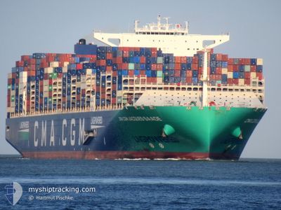
CMACGM JACQUES SAADE
Cargo D
Current Trip
| Time Travelled | 15 days |
|---|---|
| Remaining Time | --- |
| Distance Travelled | 7148.00 nm |
| Remaining Distance | --- |
| AVG Speed | 17.9 Knots |
| MAX Speed | 24 Knots |
| AVG Wind | 10.5 knots |
| MAX Wind | 26 knots |
| MIN Temp | 16.5°C / 61.7°F |
| MAX Temp | 30.3°C / 86.54°F |
| Draught | 16.4 m |
| Position Received | 2 d ago |
Current Position
| Longitude | 17.37908° |
|---|---|
| Latitude | -33.72122° |
| Status | Under way using engine |
| Speed | 19.6 Knots |
| Course | 321.4° |
| Area | South Atlantic Ocean |
| Station | T-AIS |
| Position Received | 2 d ago |
Info
Information
The current position of CMACGM JACQUES SAADE is in South Atlantic Ocean with coordinates -33.72122° / 17.37908° as reported on 2024-04-17 07:46 by AIS to our vessel tracker app. The vessel's current speed is 19.6 Knots and is heading at the port of TANGER MED. The estimated time of arrival as calculated by MyShipTracking vessel tracking app is 2024-04-28 15:00 LT
The vessel CMACGM JACQUES SAADE (IMO: 9839179, MMSI: 228386700) is a Cargo D It's sailing under the flag of [FR] France.
In this page you can find informations about the vessels current position, last detected port calls, and current voyage information. If the vessels is not in coverage by AIS you will find the latest position.
The current position of CMACGM JACQUES SAADE is detected by our AIS receivers and we are not responsible for the reliability of the data. The last position was recorded while the vessel was in Coverage by the Ais receivers of our vessel tracking app.
The current draught of CMACGM JACQUES SAADE as reported by AIS is 16.4 meters
Weather
| Temperature | 23.7°C / 74.66°F |
|---|---|
| Wind Speed | 13 knots |
| Direction | 144° SE |
| Pressure | 1012.8 hPa |
| Humidity | 85 % |
| Cloud Coverage | 13 % |
Featured Company
Last Port Calls
| Port | Arrival | Departure | Time In Port |
|---|---|---|---|
| 2024-04-03 00:19 | 2024-04-04 06:18 | 1 d | |
| 2024-03-28 20:34 | 2024-03-30 03:45 | 1 d | |
| 2024-03-21 22:16 | 2024-03-24 02:47 | 2 d | |
| 2024-03-19 11:32 | |||
| 2024-03-08 17:41 | 2024-03-10 23:58 | 2 d | |
| 2024-02-08 05:02 | 2024-02-08 14:30 | 9 h |
Most Visited Ports (Last year)
| Port | Arrivals | |
|---|---|---|
| 7 | ||
| 6 | ||
| 4 | ||
| 4 | ||
| 3 | ||
| 3 |
Last Trips
| Origin | Departure | Destination | Arrival | Distance | |
|---|---|---|---|---|---|
| 2024-03-30 11:45 | 2024-04-03 08:19 | 1464.13 nm | |||
| 2024-03-24 10:47 | 2024-03-29 04:34 | 871.00 nm | |||
| 2024-03-19 19:32 | 2024-03-22 06:16 | 457.21 nm | |||
| 2024-01-19 07:35 | 2024-03-09 01:41 | 13362.32 nm | |||
| 2024-01-19 07:35 | 2024-02-08 07:02 | 4700.83 nm |
Events
| Time | Event | Details | Position / Dest | Info |
|---|---|---|---|---|
| 2024-04-17 07:49 | Status Changed | Default Under way using engine |
-33.70546 / 17.36422
MAPTM
|
Speed: 19.6 kn Course: 321.4° |
| 2024-04-17 07:46 | OUT of Coverage |
-33.72122 / 17.37908
South Atlantic Ocean
MAPTM
|
Speed: 19.6 kn Course: 321.4° |
|
| 2024-04-17 07:40 | Status Changed | Under way using engine Default |
-33.74538 / 17.40285
MAPTM
|
Speed: 19.8 kn Course: 320° |
| 2024-04-17 07:33 | Status Changed | Default Under way using engine |
-33.77433 / 17.43154
MAPTM
|
Speed: 19.9 kn Course: 320.6° |
| 2024-04-17 07:25 | Status Changed | Under way using engine Default |
-33.80796 / 17.46437
MAPTM
|
Speed: 19.8 kn Course: 321° |
| 2024-04-17 07:22 | Status Changed | Default Under way using engine |
-33.82433 / 17.48017
MAPTM
|
Speed: 19.7 kn Course: 321.6° |
| 2024-04-17 07:13 | Status Changed | Under way using engine Default |
-33.86263 / 17.51664
MAPTM
|
Speed: 20 kn Course: 322° |
| 2024-04-17 07:10 | IN Coverage |
-33.86263 / 17.51664
South Atlantic Ocean
MAPTM
|
Speed: 19.6 kn Course: 322.4° |
|
| 2024-04-17 06:01 | Status Changed | Default Under way using engine |
-34.16672 / 17.79144
MAPTM
|
Speed: 18.7 kn Course: 329.8° |
| 2024-04-17 05:56 | OUT of Coverage |
-34.18847 / 17.80631
South Atlantic Ocean
MAPTM
|
Speed: 18.7 kn Course: 329.8° |