
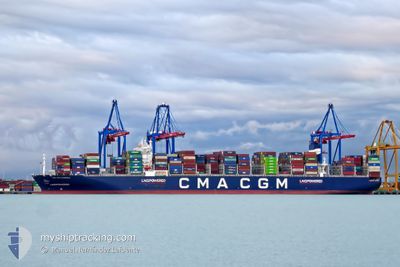
CMA CGM SCANDOLA
Cargo
Current Trip
| Trip Time | 3 days |
|---|---|
| Trip Distance | 1249.66 nm |
| AVG Speed | 15.8 Knots |
| MAX Speed | 20.3 Knots |
| Draught | 12.3 m |
| AVG Wind | 11 knots |
| MAX Wind | 27.2 knots |
| MIN Temp | 4.7°C / 40.46°F |
| MAX Temp | 19.7°C / 67.46°F |
| Position Received | 3 m ago |
Current Position
| Longitude | 29.83968° |
|---|---|
| Latitude | 40.74744° |
| Status | Moored |
| Speed | |
| Course | 263° |
| Area | Sea of Marmara |
| Station | T-AIS |
| Position Received | 3 m ago |
Info
Information
The current position of CMA CGM SCANDOLA is in Sea of Marmara with coordinates 40.74744° / 29.83968° as reported on 2024-04-25 16:33 by AIS to our vessel tracker app. The vessel's current speed is 0 Knots and is currently inside the port of DERINCE.
The vessel CMA CGM SCANDOLA (IMO: 9859129, MMSI: 215839000) is a Cargo It's sailing under the flag of [MT] Malta.
In this page you can find informations about the vessels current position, last detected port calls, and current voyage information. If the vessels is not in coverage by AIS you will find the latest position.
The current position of CMA CGM SCANDOLA is detected by our AIS receivers and we are not responsible for the reliability of the data. The last position was recorded while the vessel was in Coverage by the Ais receivers of our vessel tracking app.
The current draught of CMA CGM SCANDOLA as reported by AIS is 12.3 meters
Weather
| Temperature | 17.5°C / 63.5°F |
|---|---|
| Wind Speed | 2 knots |
| Direction | 231° SW |
| Pressure | 1004.2 hPa |
| Humidity | 83.6 % |
| Cloud Coverage | 100 % |
Featured Company
Last Port Calls
| Port | Arrival | Departure | Time In Port |
|---|---|---|---|
| 2024-04-25 04:45 | |||
| 2024-04-19 18:35 | 2024-04-22 01:15 | 2 d | |
| 2024-04-15 22:08 | 2024-04-17 19:10 | 1 d | |
| 2024-04-12 11:09 | 2024-04-13 13:35 | 1 d | |
| 2024-03-16 18:45 | 2024-03-18 05:02 | 1 d | |
| 2024-03-11 04:26 | 2024-03-12 15:18 | 1 d | |
| 2024-03-06 14:54 | 2024-03-07 12:06 | 21 h | |
| 2024-03-05 04:09 | 2024-03-06 02:16 | 22 h | |
| 2024-02-27 16:31 | 2024-02-28 09:23 | 16 h | |
| 2024-02-09 07:02 | 2024-02-13 06:49 | 3 d |
Last Trips
| Origin | Departure | Destination | Arrival | Distance | |
|---|---|---|---|---|---|
| 2024-04-22 03:15 | 2024-04-25 07:45 | 1249.66 nm | |||
| 2024-04-17 21:10 | 2024-04-19 20:35 | 778.66 nm | |||
| 2024-04-13 15:35 | 2024-04-16 00:08 | 754.43 nm | |||
| 2024-03-18 13:02 | 2024-04-12 13:09 | 11087.95 nm | |||
| 2024-03-12 23:18 | 2024-03-17 02:45 | 1444.12 nm | |||
| 2024-03-07 20:06 | 2024-03-11 12:26 | 1449.41 nm | |||
| 2024-03-06 10:16 | 2024-03-06 22:54 | 5.95 nm | |||
| 2024-02-28 14:53 | 2024-03-05 12:09 | 1656.21 nm | |||
| 2024-02-13 07:49 | 2024-02-27 22:01 | 6287.81 nm | |||
| 2024-02-03 12:40 | 2024-02-09 08:02 | 1206.00 nm |
Events
| Time | Event | Details | Position / Dest | Info |
|---|---|---|---|---|
| 2024-04-25 05:21 | Status Changed | Moored Under way using engine |
40.74771 / 29.83971
[TR] DERINCE
|
Speed: Course: 263° |
| 2024-04-25 05:06 | STOP Moving |
40.74738 / 29.84025
[TR] DERINCE
|
Speed: 0.3 kn Course: 267° |
|
| 2024-04-25 04:45 | PORT ARRIVAL |
|
40.74527 / 29.84568
[TR] DERINCE
|
Speed: 0.8 kn Course: 298° |
| 2024-04-24 17:55 | Status Changed | Under way using engine Default |
40.52959 / 27.06369
SIKOP > TRIZT
|
Speed: 12.5 kn Course: 67° |
| 2024-04-24 17:55 | IN Coverage |
40.52959 / 27.06369
Sea of Marmara
SIKOP > TRIZT
|
Speed: 14.3 kn Course: 66.2° |
|
| 2024-04-24 17:04 | Status Changed | Default Under way using engine |
40.46096 / 26.85086
SIKOP > TRIZT
|
Speed: 14.3 kn Course: 68.6° |
| 2024-04-24 16:52 | OUT of Coverage |
40.44190 / 26.79525
Sea of Marmara
SIKOP > TRIZT
|
Speed: 14.3 kn Course: 68.6° |
|
| 2024-04-24 13:48 | Change Sea Area | Turkish part of the Sea of Marmara Turkish part of the Aegean Sea |
40.01724 / 26.19149
Sea of Marmara
SIKOP > TRIZT
|
Speed: 6.2 kn Course: 76.9° |
| 2024-04-24 12:53 | Status Changed | Under way using engine Default |
39.97385 / 26.03274
SIKOP > TRIZT
|
Speed: 8.3 kn Course: 58° |
| 2024-04-24 12:46 | Status Changed | Default Under way using engine |
39.96572 / 26.01637
SIKOP > TRIZT
|
Speed: 10.1 kn Course: 51.3° |