
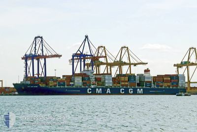
CMA CGM RHONE
Cargo A
Current Trip
| Time Travelled | 3 days |
|---|---|
| Remaining Time | --- |
| Distance Travelled | 1088.89 nm |
| Remaining Distance | --- |
| AVG Speed | 15 Knots |
| MAX Speed | 17 Knots |
| AVG Wind | 10.7 knots |
| MAX Wind | 16 knots |
| MIN Temp | 23.9°C / 75.02°F |
| MAX Temp | 26.8°C / 80.24°F |
| Draught | 10.6 m |
| Position Received | 2 m ago |
Current Position
| Longitude | -62.67135° |
|---|---|
| Latitude | 18.44512° |
| Status | Under way using engine |
| Speed | 15.3 Knots |
| Course | 114.8° |
| Area | Caribbean Sea |
| Station | T-AIS |
| Position Received | 2 m ago |
Info
Information
The current position of CMA CGM RHONE is in Caribbean Sea with coordinates 18.44512° / -62.67135° as reported on 2024-04-25 12:34 by AIS to our vessel tracker app. The vessel's current speed is 15.3 Knots and is heading at the port of PORT KLANG. The estimated time of arrival as calculated by MyShipTracking vessel tracking app is 2024-05-25 04:00 LT
The vessel CMA CGM RHONE (IMO: 9674543, MMSI: 229989000) is a Cargo A It's sailing under the flag of [MT] Malta.
In this page you can find informations about the vessels current position, last detected port calls, and current voyage information. If the vessels is not in coverage by AIS you will find the latest position.
The current position of CMA CGM RHONE is detected by our AIS receivers and we are not responsible for the reliability of the data. The last position was recorded while the vessel was in Coverage by the Ais receivers of our vessel tracking app.
The current draught of CMA CGM RHONE as reported by AIS is 10.6 meters
Weather
| Temperature | 26.6°C / 79.88°F |
|---|---|
| Wind Speed | 15 knots |
| Direction | 89° E |
| Pressure | 1016.8 hPa |
| Humidity | 73.1 % |
| Cloud Coverage | 33 % |
Featured Company
Last Port Calls
| Port | Arrival | Departure | Time In Port |
|---|---|---|---|
| 2024-04-21 12:57 | 2024-04-22 12:06 | 23 h | |
| 2024-04-18 13:18 | 2024-04-19 18:14 | 1 d | |
| 2024-04-16 05:26 | 2024-04-18 01:24 | 1 d | |
| 2024-04-12 09:34 | 2024-04-13 07:20 | 21 h | |
| 2024-03-17 08:06 | 2024-03-18 18:29 | 1 d | |
| 2024-03-13 23:31 | 2024-03-15 05:36 | 1 d | |
| 2024-03-11 06:32 | 2024-03-11 22:01 | 15 h | |
| 2024-03-08 04:42 | |||
| 2024-02-26 04:15 | 2024-02-27 05:50 | 1 d |
Last Trips
| Origin | Departure | Destination | Arrival | Distance | |
|---|---|---|---|---|---|
| 2024-04-19 14:14 | 2024-04-21 08:57 | 452.81 nm | |||
| 2024-04-17 21:24 | 2024-04-18 09:18 | 118.08 nm | |||
| 2024-04-13 03:20 | 2024-04-16 01:26 | 539.42 nm | |||
| 2024-03-19 03:29 | 2024-04-12 05:34 | 10027.32 nm | |||
| 2024-03-15 14:36 | 2024-03-17 17:06 | 806.72 nm | |||
| 2024-03-12 06:01 | 2024-03-14 08:31 | 482.08 nm | |||
| 2024-03-08 12:42 | 2024-03-11 14:32 | 927.06 nm | |||
| 2024-01-28 11:20 | 2024-02-26 11:15 | 11662.92 nm |
Events
| Time | Event | Details | Position / Dest | Info |
|---|---|---|---|---|
| 2024-04-25 12:20 | Status Changed | Under way using engine Default |
18.47090 / -62.72923
MYPKG
|
Speed: 15.1 kn Course: 115° |
| 2024-04-25 11:40 | Status Changed | Default Under way using engine |
18.54219 / -62.88934
MYPKG
|
Speed: 15.2 kn Course: 114.9° |
| 2024-04-25 11:34 | Change Sea Area | Anguilla part of the Caribbean Sea Bahamas part of the North Atlantic Ocean |
18.55296 / -62.91305
Caribbean Sea
MYPKG
|
Speed: 15.2 kn Course: 114.9° |
| 2024-04-25 11:34 | Status Changed | Under way using engine Default |
18.55296 / -62.91305
MYPKG
|
Speed: 15.1 kn Course: 116° |
| 2024-04-25 11:21 | IN Coverage |
18.55296 / -62.91305
Caribbean Sea
MYPKG
|
Speed: 15.2 kn Course: 114.9° |
|
| 2024-04-23 03:34 | Status Changed | Default Under way using engine |
25.49100 / -76.12527
MYPKG
|
Speed: 16.1 kn Course: 120° |
| 2024-04-23 03:29 | OUT of Coverage |
25.50244 / -76.14712
North Atlantic Ocean
|
Speed: 16.1 kn Course: 120° |
|
| 2024-04-23 00:42 | Status Changed | Under way using engine Default |
25.71623 / -76.91290
MYPKG
|
Speed: 15.2 kn Course: 136° |
| 2024-04-23 00:36 | IN Coverage |
25.71559 / -76.90843
North Atlantic Ocean
|
Speed: 13.4 kn Course: 97.4° |
|
| 2024-04-22 22:35 | OUT of Coverage |
25.85682 / -77.45393
North Atlantic Ocean
|
Speed: 15 kn Course: 119.2° |