
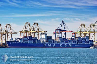
CMA CGM LITANI
Cargo D
Current Trip
| Time Travelled | 3 days |
|---|---|
| Remaining Time | 11 h, 9 mins |
| Distance Travelled | 831.35 nm |
| Remaining Distance | 410.78 nm |
| AVG Speed | 17 Knots |
| MAX Speed | 22 Knots |
| AVG Wind | 14.5 knots |
| MAX Wind | 20.7 knots |
| MIN Temp | 17.4°C / 63.32°F |
| MAX Temp | 22.2°C / 71.96°F |
| Draught | 10.1 m |
| Position Received | 1 d ago |
Current Position
| Longitude | -51.89845° |
|---|---|
| Latitude | -32.34605° |
| Status | At anchor |
| Speed | 0.1 Knots |
| Course | 204° |
| Area | South Atlantic Ocean |
| Station | T-AIS |
| Position Received | 1 d ago |
Info
Information
The current position of CMA CGM LITANI is in South Atlantic Ocean with coordinates -32.34605° / -51.89845° as reported on 2024-04-24 09:53 by AIS to our vessel tracker app. The vessel's current speed is 0.1 Knots and is heading at the port of RIO GRANDE. The estimated time of arrival as calculated by MyShipTracking vessel tracking app is 2024-04-26 07:23 LT
The vessel CMA CGM LITANI (IMO: 9705055, MMSI: 256033000) is a Cargo D It's sailing under the flag of [MT] Malta.
In this page you can find informations about the vessels current position, last detected port calls, and current voyage information. If the vessels is not in coverage by AIS you will find the latest position.
The current position of CMA CGM LITANI is detected by our AIS receivers and we are not responsible for the reliability of the data. The last position was recorded while the vessel was in Coverage by the Ais receivers of our vessel tracking app.
The current draught of CMA CGM LITANI as reported by AIS is 10.1 meters
Weather
| Temperature | 20.9°C / 69.62°F |
|---|---|
| Wind Speed | 9 knots |
| Direction | 133° SE |
| Pressure | 1017.5 hPa |
| Humidity | 87.2 % |
| Cloud Coverage | 100 % |
Featured Company
Last Port Calls
| Port | Arrival | Departure | Time In Port |
|---|---|---|---|
| 2024-04-21 02:12 | 2024-04-22 19:05 | 1 d | |
| 2024-04-18 01:54 | 2024-04-19 19:09 | 1 d | |
| 2024-04-15 10:47 | 2024-04-16 06:28 | 19 h | |
| 2024-04-09 17:04 | 2024-04-12 09:16 | 2 d | |
| 2024-04-07 13:33 | 2024-04-07 13:41 | 7 m | |
| 2024-03-17 08:17 | 2024-03-19 04:47 | 1 d | |
| 2024-03-10 10:27 | 2024-03-11 02:27 | 15 h | |
| 2024-03-08 23:01 | 2024-03-10 06:07 | 1 d | |
| 2024-02-25 00:49 | 2024-02-26 02:47 | 1 d | |
| 2024-02-03 06:03 | 2024-02-05 14:11 | 2 d |
Last Trips
| Origin | Departure | Destination | Arrival | Distance | |
|---|---|---|---|---|---|
| 2024-04-19 16:09 | 2024-04-20 23:12 | 148.62 nm | |||
| 2024-04-16 03:28 | 2024-04-17 22:54 | 798.22 nm | |||
| 2024-04-12 06:16 | 2024-04-15 07:47 | 171.50 nm | |||
| 2024-04-07 10:41 | 2024-04-09 14:04 | 247.57 nm | |||
| 2024-03-19 12:47 | 2024-04-07 10:33 | 8867.88 nm | |||
| 2024-03-11 10:27 | 2024-03-17 16:17 | 1462.01 nm | |||
| 2024-03-10 14:07 | 2024-03-10 18:27 | 60.33 nm | |||
| 2024-02-26 10:47 | 2024-03-09 07:01 | 3123.02 nm | |||
| 2024-02-05 11:11 | 2024-02-25 08:49 | 8851.65 nm | |||
| 2024-01-31 09:07 | 2024-02-03 03:03 | 183.06 nm |
Events
| Time | Event | Details | Position / Dest | Info |
|---|---|---|---|---|
| 2024-04-25 09:33 | STOP Moving | 9.91 nm, East of NAVEGANTES |
-26.87678 / -48.47758
BRRIG
|
Speed: 0.3 kn Course: 132° |
| 2024-04-24 11:14 | START Moving | 21.55 nm, South East of RIO GRANDE |
-32.34851 / -51.89270
BRRIG
|
Speed: 9 kn Course: 81° |
| 2024-04-24 10:05 | Status Changed | Default At anchor |
-32.34604 / -51.89840
BRRIG
|
Speed: 0.1 kn Course: 204° |
| 2024-04-24 09:53 | OUT of Coverage |
-32.34605 / -51.89845
South Atlantic Ocean
|
Speed: 0.1 kn Course: 121.1° |
|
| 2024-04-24 09:05 | Status Changed | At anchor Default |
-32.34603 / -51.89841
BRRIG
|
Speed: 0.4 kn Course: 204° |
| 2024-04-24 08:17 | Status Changed | Default At anchor |
-32.34606 / -51.89834
BRRIG
|
Speed: 0.3 kn Course: 209° |
| 2024-04-24 08:05 | Status Changed | At anchor Default |
-32.34604 / -51.89847
BRRIG
|
Speed: 1.3 kn Course: 212° |
| 2024-04-24 07:29 | Status Changed | Default At anchor |
-32.34602 / -51.89858
BRRIG
|
Speed: 0.3 kn Course: 202° |
| 2024-04-24 06:53 | Status Changed | At anchor Default |
-32.34594 / -51.89874
BRRIG
|
Speed: 0.1 kn Course: 201° |
| 2024-04-24 06:41 | Status Changed | Default At anchor |
-32.34589 / -51.89894
BRRIG
|
Speed: 0.4 kn Course: 211° |