
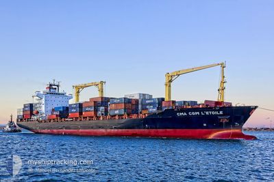
ETOILE
Container Ship
Current Trip
| Time Travelled | 7 days |
|---|---|
| Remaining Time | --- |
| Distance Travelled | 1407.30 nm |
| Remaining Distance | 4.26 nm |
| AVG Speed | 11.1 Knots |
| MAX Speed | 18.5 Knots |
| AVG Wind | 8.6 knots |
| MAX Wind | 17.9 knots |
| MIN Temp | 28.1°C / 82.58°F |
| MAX Temp | 32.6°C / 90.68°F |
| Draught | 9.8 m |
| Position Received | 6 m ago |
Current Position
| Longitude | 120.86006° |
|---|---|
| Latitude | 14.61160° |
| Status | At anchor |
| Speed | 0.1 Knots |
| Course | 185° |
| Area | South China Sea |
| Station | T-AIS |
| Position Received | 6 m ago |
Info
Information
The current position of ETOILE is in South China Sea with coordinates 14.61160° / 120.86006° as reported on 2024-04-25 14:56 by AIS to our vessel tracker app. The vessel's current speed is 0.1 Knots and is heading at the port of MANILA. The estimated time of arrival as calculated by MyShipTracking vessel tracking app is 2024-04-25 06:00 LT
The vessel ETOILE (IMO: 9301469, MMSI: 229263000) is a Container Ship that was built in 2005 ( 19 years old ). It's sailing under the flag of [MT] Malta.
In this page you can find informations about the vessels current position, last detected port calls, and current voyage information. If the vessels is not in coverage by AIS you will find the latest position.
The current position of ETOILE is detected by our AIS receivers and we are not responsible for the reliability of the data. The last position was recorded while the vessel was in Coverage by the Ais receivers of our vessel tracking app.
The current draught of ETOILE as reported by AIS is 9.8 meters
Weather
| Temperature | 29.7°C / 85.46°F |
|---|---|
| Wind Speed | 5 knots |
| Direction | 214° SW |
| Pressure | 1010.1 hPa |
| Humidity | 75.2 % |
| Cloud Coverage | 22 % |
Featured Company
Last Port Calls
| Port | Arrival | Departure | Time In Port |
|---|---|---|---|
| 2024-04-18 09:20 | 2024-04-18 09:36 | 16 m | |
| 2024-04-17 22:33 | 2024-04-18 08:46 | 10 h | |
| 2024-04-03 15:28 | 2024-04-04 03:13 | 11 h | |
| 2024-03-29 18:45 | 2024-03-30 20:18 | 1 d | |
| 2024-03-28 18:46 | 2024-03-29 05:37 | 10 h | |
| 2024-03-26 22:37 | 2024-03-27 10:27 | 11 h | |
| 2024-03-25 23:08 | 2024-03-26 21:27 | 22 h | |
| 2024-03-23 11:34 | 2024-03-23 14:24 | 2 h | |
| 2024-03-18 22:25 | 2024-03-19 11:45 | 13 h | |
| 2024-03-13 01:06 | 2024-03-13 10:01 | 8 h |
Most Visited Ports (Last year)
| Port | Arrivals | |
|---|---|---|
| 17 | ||
| 8 | ||
| 8 | ||
| 8 | ||
| 8 | ||
| 7 |
Last Trips
| Origin | Departure | Destination | Arrival | Distance | |
|---|---|---|---|---|---|
| 2024-04-18 15:46 | 2024-04-18 16:20 | 4.21 nm | |||
| 2024-04-04 11:13 | 2024-04-18 05:33 | 3097.78 nm | |||
| 2024-03-31 05:18 | 2024-04-03 23:28 | 571.03 nm | |||
| 2024-03-29 14:37 | 2024-03-30 03:45 | 125.36 nm | |||
| 2024-03-27 19:27 | 2024-03-29 03:46 | 383.96 nm | |||
| 2024-03-27 06:27 | 2024-03-27 07:37 | 8.33 nm | |||
| 2024-03-23 23:24 | 2024-03-26 08:08 | 436.47 nm | |||
| 2024-03-19 20:45 | 2024-03-23 20:34 | 776.61 nm | |||
| 2024-03-13 18:01 | 2024-03-19 07:25 | 1405.01 nm | |||
| 2024-03-12 08:12 | 2024-03-13 09:06 | 20.51 nm |
Events
| Time | Event | Details | Position / Dest | Info |
|---|---|---|---|---|
| 2024-04-25 14:56 | Status Changed | At anchor Default |
14.61160 / 120.86006
PHMNN
|
Speed: 0.2 kn Course: 202° |
| 2024-04-25 14:56 | IN Coverage |
14.61160 / 120.86006
South China Sea
|
Speed: 0.1 kn Course: 275° |
|
| 2024-04-25 07:20 | Status Changed | Default At anchor |
14.61001 / 120.86153
PHMNN
|
Speed: 0.1 kn Course: 272° |
| 2024-04-25 07:11 | Status Changed | At anchor Default |
14.60968 / 120.86148
PHMNN
|
Speed: 0.1 kn Course: 274° |
| 2024-04-25 07:11 | OUT of Coverage |
14.60968 / 120.86148
South China Sea
PHMNN
|
Speed: 0.1 kn Course: 2° |
|
| 2024-04-25 06:56 | IN Coverage |
14.60968 / 120.86148
South China Sea
PHMNN
|
Speed: 0.1 kn Course: 2° |
|
| 2024-04-25 06:10 | Status Changed | Default At anchor |
14.61108 / 120.86032
PHMNN
|
Speed: 0.3 kn Course: 199° |
| 2024-04-25 06:07 | OUT of Coverage |
14.61113 / 120.86008
South China Sea
PHMNN
|
Speed: 0.3 kn Course: 90.5° |
|
| 2024-04-25 06:01 | Status Changed | At anchor Default |
14.61104 / 120.85966
PHMNN
|
Speed: 0.2 kn Course: 176° |
| 2024-04-25 05:58 | Status Changed | Default At anchor |
14.61098 / 120.85945
PHMNN
|
Speed: 0.2 kn Course: 170° |