
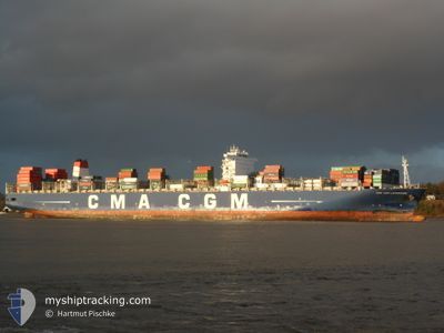
CMA CGM LAPEROUSE
Container Ship
Current Trip
| Time Travelled | 14 days |
|---|---|
| Remaining Time | --- |
| Distance Travelled | 6260.30 nm |
| Remaining Distance | --- |
| AVG Speed | 17.9 Knots |
| MAX Speed | 21.8 Knots |
| AVG Wind | 15.5 knots |
| MAX Wind | 34 knots |
| MIN Temp | 3.2°C / 37.76°F |
| MAX Temp | 26.2°C / 79.16°F |
| Draught | 13.6 m |
| Position Received | 20 m ago |
Current Position
| Longitude | -121.60183° |
|---|---|
| Latitude | 34.73659° |
| Status | Under way using engine |
| Speed | 13.8 Knots |
| Course | 128.7° |
| Area | North Pacific Ocean |
| Station | T-AIS |
| Position Received | 20 m ago |
Info
Information
The current position of CMA CGM LAPEROUSE is in North Pacific Ocean with coordinates 34.73659° / -121.60183° as reported on 2024-04-19 05:52 by AIS to our vessel tracker app. The vessel's current speed is 13.8 Knots
The vessel CMA CGM LAPEROUSE (IMO: 9454412, MMSI: 215930000) is a Container Ship that was built in 2010 ( 14 years old ). It's sailing under the flag of [MT] Malta.
In this page you can find informations about the vessels current position, last detected port calls, and current voyage information. If the vessels is not in coverage by AIS you will find the latest position.
The current position of CMA CGM LAPEROUSE is detected by our AIS receivers and we are not responsible for the reliability of the data. The last position was recorded while the vessel was in Coverage by the Ais receivers of our vessel tracking app.
The current draught of CMA CGM LAPEROUSE as reported by AIS is 13.6 meters
Weather
| Temperature | 13°C / 55.4°F |
|---|---|
| Wind Speed | 10 knots |
| Direction | 317° NW |
| Pressure | 1015.6 hPa |
| Humidity | 89.3 % |
| Cloud Coverage | 27 % |
Featured Company
Last Port Calls
| Port | Arrival | Departure | Time In Port |
|---|---|---|---|
| 2024-04-03 18:25 | 2024-04-04 22:49 | 1 d | |
| 2024-03-27 06:16 | 2024-03-29 01:32 | 1 d | |
| 2024-03-23 17:12 | 2024-03-24 20:13 | 1 d | |
| 2024-03-20 05:28 | 2024-03-21 05:09 | 23 h | |
| 2024-02-20 14:43 | 2024-02-21 19:05 | 1 d | |
| 2024-02-18 04:53 | 2024-02-20 02:21 | 1 d | |
| 2024-02-12 21:36 | 2024-02-14 18:41 | 1 d | |
| 2024-02-10 17:58 | 2024-02-11 04:15 | 10 h | |
| 2024-02-07 22:59 | 2024-02-09 13:52 | 1 d | |
| 2024-02-05 19:47 | 2024-02-06 14:05 | 18 h |
Most Visited Ports (Last year)
| Port | Arrivals | |
|---|---|---|
| 5 | ||
| 5 | ||
| 4 | ||
| 3 | ||
| 3 | ||
| 3 |
Last Trips
| Origin | Departure | Destination | Arrival | Distance | |
|---|---|---|---|---|---|
| 2024-03-29 08:32 | 2024-04-04 02:25 | 1682.34 nm | |||
| 2024-03-25 04:13 | 2024-03-27 13:16 | 818.82 nm | |||
| 2024-03-21 13:09 | 2024-03-24 01:12 | 331.63 nm | |||
| 2024-02-21 14:05 | 2024-03-20 13:28 | 12260.17 nm | |||
| 2024-02-19 21:21 | 2024-02-20 09:43 | 126.01 nm | |||
| 2024-02-14 13:41 | 2024-02-17 23:53 | 532.29 nm | |||
| 2024-02-10 23:15 | 2024-02-12 16:36 | 264.98 nm | |||
| 2024-02-09 08:52 | 2024-02-10 12:58 | 256.15 nm | |||
| 2024-02-06 10:05 | 2024-02-07 17:59 | 589.66 nm | |||
| 2024-01-29 14:08 | 2024-02-05 15:47 | 2840.55 nm |
Events
| Time | Event | Details | Position / Dest | Info |
|---|---|---|---|---|
| 2024-04-19 06:07 | Status Changed | Default Under way using engine |
34.70074 / -121.54530
USLAX
|
Speed: 13.8 kn Course: 128.7° |
| 2024-04-18 19:06 | Status Changed | Under way using engine Default |
36.43194 / -124.30058
USLAX
|
Speed: 18.9 kn Course: 127° |
| 2024-04-18 18:55 | Status Changed | Default Under way using engine |
36.46611 / -124.35563
USLAX
|
Speed: 19.4 kn Course: 128.2° |
| 2024-04-18 16:03 | Status Changed | Under way using engine Default |
37.02787 / -125.26314
USLAX
|
Speed: 19.3 kn Course: 128° |
| 2024-04-18 15:59 | Status Changed | Default Under way using engine |
37.04204 / -125.28596
USLAX
|
Speed: 19.3 kn Course: 127.2° |
| 2024-04-18 15:18 | ETA Changed | 2024/04/19 21:00 2024/04/19 17:00 |
37.17545 / -125.50271
USLAX
|
Speed: 19.1 kn Course: 128.5° |
| 2024-04-18 14:33 | Status Changed | Under way using engine Default |
37.32002 / -125.73778
USLAX
|
Speed: 19.1 kn Course: 127° |
| 2024-04-18 14:18 | Status Changed | Default Under way using engine |
37.37029 / -125.81965
USLAX
|
Speed: 18.9 kn Course: 126.9° |
| 2024-04-18 14:17 | Status Changed | Under way using engine Default |
37.37131 / -125.82130
USLAX
|
Speed: 19.1 kn Course: 129° |
| 2024-04-18 13:47 | Status Changed | Default Under way using engine |
37.47081 / -125.98357
USLAX
|
Speed: 19.3 kn Course: 128.3° |