
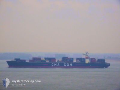
CMA CGM FLORIDA
Container Ship
Current Trip
| Time Travelled | 1 day |
|---|---|
| Remaining Time | --- |
| Distance Travelled | 412.57 nm |
| Remaining Distance | 7.98 nm |
| AVG Speed | 12.2 Knots |
| MAX Speed | 17.3 Knots |
| AVG Wind | 6.8 knots |
| MAX Wind | 21.9 knots |
| MIN Temp | 10.7°C / 51.26°F |
| MAX Temp | 16.6°C / 61.88°F |
| Draught | 9.4 m |
| Position Received | 3 m ago |
Current Position
| Longitude | 126.63280° |
|---|---|
| Latitude | 37.34161° |
| Status | Moored |
| Speed | |
| Course | 90° |
| Area | Yellow Sea |
| Station | T-AIS |
| Position Received | 3 m ago |
Info
Information
The current position of CMA CGM FLORIDA is in Yellow Sea with coordinates 37.34161° / 126.63280° as reported on 2024-04-25 16:44 by AIS to our vessel tracker app. The vessel's current speed is 0 Knots and is heading at the port of INCHEON. The estimated time of arrival as calculated by MyShipTracking vessel tracking app is 2024-04-25 15:00 LT
The vessel CMA CGM FLORIDA (IMO: 9348704, MMSI: 215189000) is a Container Ship that was built in 2008 ( 16 years old ). It's sailing under the flag of [MT] Malta.
In this page you can find informations about the vessels current position, last detected port calls, and current voyage information. If the vessels is not in coverage by AIS you will find the latest position.
The current position of CMA CGM FLORIDA is detected by our AIS receivers and we are not responsible for the reliability of the data. The last position was recorded while the vessel was in Coverage by the Ais receivers of our vessel tracking app.
The current draught of CMA CGM FLORIDA as reported by AIS is 9.4 meters
Weather
| Temperature | 12.1°C / 53.78°F |
|---|---|
| Wind Speed | 1 knots |
| Direction | 308° NW |
| Pressure | 1011.6 hPa |
| Humidity | 74.4 % |
| Cloud Coverage | 11 % |
Featured Company
Last Port Calls
| Port | Arrival | Departure | Time In Port |
|---|---|---|---|
| 2024-04-23 16:19 | 2024-04-24 01:39 | 9 h | |
| 2024-04-07 01:41 | 2024-04-08 00:32 | 22 h | |
| 2024-04-01 11:21 | 2024-04-01 23:13 | 11 h | |
| 2024-03-29 00:33 | 2024-03-31 03:55 | 2 d | |
| 2024-03-14 01:05 | 2024-03-14 23:05 | 22 h | |
| 2024-03-11 21:57 | 2024-03-12 19:43 | 21 h | |
| 2024-03-03 03:09 | 2024-03-05 12:55 | 2 d | |
| 2024-02-25 23:09 | 2024-02-26 11:43 | 12 h | |
| 2024-02-14 12:04 | 2024-02-16 02:44 | 1 d | |
| 2024-02-01 19:29 | 2024-02-02 08:22 | 12 h |
Most Visited Ports (Last year)
| Port | Arrivals | |
|---|---|---|
| 8 | ||
| 8 | ||
| 8 | ||
| 7 | ||
| 4 | ||
| 3 |
Last Trips
| Origin | Departure | Destination | Arrival | Distance | |
|---|---|---|---|---|---|
| 2024-04-07 14:32 | 2024-04-24 01:19 | 4442.58 nm | |||
| 2024-04-01 16:13 | 2024-04-06 15:41 | 2109.05 nm | |||
| 2024-03-30 20:55 | 2024-04-01 04:21 | 385.27 nm | |||
| 2024-03-15 07:05 | 2024-03-28 17:33 | 6274.90 nm | |||
| 2024-03-13 04:43 | 2024-03-14 09:05 | 517.30 nm | |||
| 2024-03-05 03:55 | 2024-03-12 06:57 | 2958.93 nm | |||
| 2024-02-26 03:43 | 2024-03-02 18:09 | 2462.24 nm | |||
| 2024-02-15 18:44 | 2024-02-25 15:09 | 1154.94 nm | |||
| 2024-02-02 16:22 | 2024-02-14 04:04 | 5759.66 nm | |||
| 2024-01-31 10:30 | 2024-02-02 03:29 | 247.19 nm |
Events
| Time | Event | Details | Position / Dest | Info |
|---|---|---|---|---|
| 2024-04-25 16:23 | Status Changed | Moored Under way using engine |
37.34160 / 126.63279
KRICH
|
Speed: Course: 90° |
| 2024-04-25 16:06 | STOP Moving | 6.46 nm, South of INCHEON |
37.34144 / 126.63265
KRICH
|
Speed: 0.3 kn Course: 90° |
| 2024-04-25 10:33 | Status Changed | Under way using engine Default |
36.52680 / 125.91302
KRICH
|
Speed: 13.1 kn Course: 16° |
| 2024-04-25 10:20 | Status Changed | Default Under way using engine |
36.48134 / 125.89770
KRICH
|
Speed: 12.6 kn Course: 15.4° |
| 2024-04-25 09:49 | Draught Changed | 9.4 10.4 |
36.36578 / 125.88156
KRICH
|
Speed: 12.9 kn Course: 3.6° |
| 2024-04-25 09:49 | Destination Changed | KRICH KRKAN |
36.36578 / 125.88156
KRICH
|
Speed: 12.9 kn Course: 3.6° |
| 2024-04-25 09:49 | ETA Changed | 2024/04/25 15:00 2024/04/23 12:00 |
36.36578 / 125.88156
KRICH
|
Speed: 12.9 kn Course: 3.6° |
| 2024-04-25 09:01 | Change Sea Area | South Korean part of the Yellow Sea United States (Hawaii) part of the North Pacific Ocean |
36.20314 / 125.85236
Yellow Sea
|
Speed: 12.7 kn Course: 16.9° |
| 2024-04-25 09:00 | Status Changed | Under way using engine Default |
36.20144 / 125.85173
KRKAN
|
Speed: 13 kn Course: 10° |
| 2024-04-25 09:00 | IN Coverage |
36.20314 / 125.85236
Yellow Sea
|
Speed: 12.7 kn Course: 16.9° |