
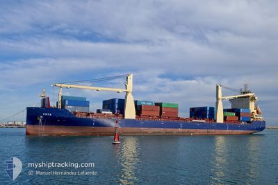
CIRTA
Cargo
Current Trip
| Time Travelled | 4 days |
|---|---|
| Remaining Time | --- |
| Distance Travelled | 657.87 nm |
| Remaining Distance | --- |
| AVG Speed | 11.1 Knots |
| MAX Speed | 12.9 Knots |
| AVG Wind | 7.4 knots |
| MAX Wind | 32.2 knots |
| MIN Temp | 11.7°C / 53.06°F |
| MAX Temp | 21.6°C / 70.88°F |
| Draught | 7.2 m |
| Position Received | 1 m ago |
Current Position
| Longitude | 10.02093° |
|---|---|
| Latitude | 44.01613° |
| Status | At anchor |
| Speed | |
| Course | 38° |
| Area | Tyrrhenian Sea |
| Station | T-AIS |
| Position Received | 1 m ago |
Info
Information
The current position of CIRTA is in Tyrrhenian Sea with coordinates 44.01613° / 10.02093° as reported on 2024-04-19 21:13 by AIS to our vessel tracker app. The vessel's current speed is 0 Knots
The vessel CIRTA (IMO: 9845051, MMSI: 605086060) is a Cargo It's sailing under the flag of [DZ] Algeria.
In this page you can find informations about the vessels current position, last detected port calls, and current voyage information. If the vessels is not in coverage by AIS you will find the latest position.
The current position of CIRTA is detected by our AIS receivers and we are not responsible for the reliability of the data. The last position was recorded while the vessel was in Coverage by the Ais receivers of our vessel tracking app.
The current draught of CIRTA as reported by AIS is 7.2 meters
Weather
| Temperature | 13°C / 55.4°F |
|---|---|
| Wind Speed | 8 knots |
| Direction | 221° SW |
| Pressure | 1012.5 hPa |
| Humidity | 56.9 % |
| Cloud Coverage | 17 % |
Featured Company
Last Port Calls
| Port | Arrival | Departure | Time In Port |
|---|---|---|---|
| 2024-04-04 20:40 | 2024-04-14 23:42 | 10 d | |
| 2024-03-30 03:53 | 2024-03-30 13:56 | 10 h | |
| 2024-03-27 04:20 | 2024-03-27 13:34 | 9 h | |
| 2024-03-25 14:23 | 2024-03-26 05:57 | 15 h | |
| 2024-03-22 20:35 | 2024-03-25 04:19 | 2 d | |
| 2024-03-21 12:17 | 2024-03-22 14:20 | 1 d | |
| 2024-03-16 12:13 | |||
| 2024-03-01 13:58 | 2024-03-01 22:46 | 8 h | |
| 2024-02-27 15:07 | 2024-02-28 10:29 | 19 h | |
| 2024-02-24 09:23 | 2024-02-26 15:40 | 2 d |
Last Trips
| Origin | Departure | Destination | Arrival | Distance | |
|---|---|---|---|---|---|
| 2024-03-30 14:56 | 2024-04-04 21:40 | 238.31 nm | |||
| 2024-03-27 14:34 | 2024-03-30 04:53 | 370.60 nm | |||
| 2024-03-26 06:57 | 2024-03-27 05:20 | 244.08 nm | |||
| 2024-03-25 05:19 | 2024-03-25 15:23 | 15.01 nm | |||
| 2024-03-22 15:20 | 2024-03-22 21:35 | 64.83 nm | |||
| 2024-03-16 13:13 | 2024-03-21 13:17 | 535.53 nm | |||
| 2024-02-28 11:29 | 2024-03-01 14:58 | 557.74 nm | |||
| 2024-02-26 16:40 | 2024-02-27 16:07 | 19.89 nm | |||
| 2024-02-23 19:06 | 2024-02-24 10:23 | 65.52 nm | |||
| 2024-02-13 22:12 | 2024-02-22 08:01 | 545.88 nm |
Events
| Time | Event | Details | Position / Dest | Info |
|---|---|---|---|---|
| 2024-04-19 14:10 | Status Changed | At anchor Under way using engine |
44.01666 / 10.02064
IT MDC
|
Speed: 0.7 kn Course: 68° |
| 2024-04-19 14:09 | STOP Moving | 1.25 nm, South West of MARINA DI CARRARA |
44.01672 / 10.02097
IT MDC
|
Speed: 0.2 kn Course: 62° |
| 2024-04-19 13:02 | Detected in Sea | Italian part of the Tyrrhenian Sea |
43.94358 / 9.81976
Tyrrhenian Sea
IT MDC
|
Speed: 12.8 kn Course: 70.8° |
| 2024-04-19 08:22 | Change Sea Area | Italian part of the Ligurian Sea Italian part of the Mediterranean Sea - Western Basin |
43.52069 / 8.61298
Ligurian Sea
IT MDC
|
Speed: 12.5 kn Course: 58.6° |
| 2024-04-19 08:20 | IN Coverage |
43.52069 / 8.61298
Ligurian Sea
IT MDC
|
Speed: 12.5 kn Course: 58.6° |
|
| 2024-04-19 07:14 | OUT of Coverage |
43.42510 / 8.33709
Mediterranean Sea - Western Basin
IT MDC
|
Speed: 11.5 kn Course: 63.9° |
|
| 2024-04-19 04:55 | Change Sea Area | Italian part of the Mediterranean Sea - Western Basin French part of the Mediterranean Sea - Western Basin |
43.23331 / 7.79162
Mediterranean Sea - Western Basin
IT MDC
|
Speed: 11.3 kn Course: 64.2° |
| 2024-04-19 04:25 | Detected in Sea | French part of the Mediterranean Sea - Western Basin |
43.19303 / 7.67548
Mediterranean Sea - Western Basin
IT MDC
|
Speed: 11.3 kn Course: 62.7° |
| 2024-04-19 04:16 | Detected in Sea | Mon�gasque part of the Mediterranean Sea - Western Basin |
43.18054 / 7.64100
Mediterranean Sea - Western Basin
IT MDC
|
Speed: 11.2 kn Course: 64.1° |
| 2024-04-19 00:36 | IN Coverage |
42.87674 / 6.79019
Mediterranean Sea - Western Basin
IT MDC
|
Speed: 11.2 kn Course: 67.4° |