
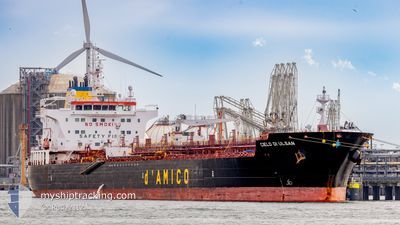
CIELO DI ULSAN
Tanker C
Current Trip
SARROCH
| Time Travelled | 20 days |
|---|---|
| Remaining Time | --- |
| Distance Travelled | 2191.01 nm |
| Remaining Distance | --- |
| AVG Speed | 11 Knots |
| MAX Speed | 15.5 Knots |
| AVG Wind | 12.3 knots |
| MAX Wind | 40.3 knots |
| MIN Temp | 8.4°C / 47.12°F |
| MAX Temp | 22.6°C / 72.68°F |
| Draught | 11.2 m |
| Position Received | 23 m ago |
Current Position
| Longitude | 9.08818° |
|---|---|
| Latitude | 39.04989° |
| Status | At anchor |
| Speed | |
| Course | 348° |
| Area | Tyrrhenian Sea |
| Station | T-AIS |
| Position Received | 23 m ago |
Info
Information
The current position of CIELO DI ULSAN is in Tyrrhenian Sea with coordinates 39.04989° / 9.08818° as reported on 2024-04-19 17:53 by AIS to our vessel tracker app. The vessel's current speed is 0 Knots
The vessel CIELO DI ULSAN (IMO: 9717266, MMSI: 256902000) is a Tanker C It's sailing under the flag of [MT] Malta.
In this page you can find informations about the vessels current position, last detected port calls, and current voyage information. If the vessels is not in coverage by AIS you will find the latest position.
The current position of CIELO DI ULSAN is detected by our AIS receivers and we are not responsible for the reliability of the data. The last position was recorded while the vessel was in Coverage by the Ais receivers of our vessel tracking app.
The current draught of CIELO DI ULSAN as reported by AIS is 11.2 meters
Weather
| Temperature | 15.5°C / 59.9°F |
|---|---|
| Wind Speed | 6 knots |
| Direction | 285° WNW |
| Pressure | 1017.2 hPa |
| Humidity | 49.7 % |
| Cloud Coverage | --- |
Featured Company
Last Port Calls
| Port | Arrival | Departure | Time In Port |
|---|---|---|---|
| 2024-03-28 06:10 | 2024-03-30 11:03 | 2 d | |
| 2024-03-18 10:46 | 2024-03-19 19:37 | 1 d | |
| 2024-03-12 13:44 | 2024-03-17 00:45 | 4 d | |
| 2024-03-05 17:59 | 2024-03-06 16:21 | 22 h | |
| 2024-03-03 15:54 | 2024-03-05 17:23 | 2 d | |
| 2024-02-19 05:07 | 2024-02-22 08:42 | 3 d | |
| 2024-02-13 23:22 | 2024-02-15 16:55 | 1 d |
Most Visited Ports (Last year)
| Port | Arrivals | |
|---|---|---|
| 5 | ||
| 5 | ||
| 4 | ||
| 3 | ||
| 3 | ||
| 3 |
Last Trips
| Origin | Departure | Destination | Arrival | Distance | |
|---|---|---|---|---|---|
| 2024-03-19 20:37 | 2024-03-28 07:10 | 1425.63 nm | |||
| 2024-03-17 01:45 | 2024-03-18 11:46 | 224.56 nm | |||
| 2024-03-06 17:21 | 2024-03-12 14:44 | 142.24 nm | |||
| 2024-03-05 18:23 | 2024-03-05 18:59 | 2.25 nm | |||
| 2024-02-22 09:42 | 2024-03-03 16:54 | 672.97 nm | |||
| 2024-02-15 17:55 | 2024-02-19 06:07 | 1042.23 nm | |||
| 2023-12-31 06:34 | 2024-02-14 00:22 | 2381.46 nm |
Events
| Time | Event | Details | Position / Dest | Info |
|---|---|---|---|---|
| 2024-04-19 17:47 | Status Changed | At anchor Default |
39.04989 / 9.08819
SARROCH
|
Speed: Course: 356° |
| 2024-04-19 17:34 | Status Changed | Default At anchor |
39.04985 / 9.08797
SARROCH
|
Speed: Course: 358° |
| 2024-04-19 16:31 | Status Changed | At anchor Default |
39.04986 / 9.08761
SARROCH
|
Speed: Course: 5° |
| 2024-04-19 16:10 | Status Changed | Default At anchor |
39.04987 / 9.08755
SARROCH
|
Speed: 0.1 kn Course: 10° |
| 2024-04-18 20:22 | IN Coverage |
39.05156 / 9.09003
Tyrrhenian Sea
|
Speed: 0.1 kn Course: 240.5° |
|
| 2024-04-18 19:19 | OUT of Coverage |
39.05139 / 9.09020
Tyrrhenian Sea
|
Speed: 0.1 kn Course: 344° |
|
| 2024-04-18 11:13 | Status Changed | At anchor Default |
39.05014 / 9.08915
SARROCH
|
Speed: Course: 321° |
| 2024-04-18 10:43 | Status Changed | Default At anchor |
39.05016 / 9.08909
SARROCH
|
Speed: Course: 323° |
| 2024-04-18 03:43 | Status Changed | At anchor Default |
39.05158 / 9.09022
SARROCH
|
Speed: Course: 278° |
| 2024-04-18 03:13 | Status Changed | Default At anchor |
39.05189 / 9.09029
SARROCH
|
Speed: 0.1 kn Course: 268° |