
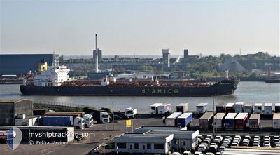
CIELO DI GAETA
Oil/Chemical Tanker
Current Trip
| Time Travelled | 17 h, 53 mins |
|---|---|
| Remaining Time | --- |
| Distance Travelled | 227.62 nm |
| Remaining Distance | --- |
| AVG Speed | 12.7 Knots |
| MAX Speed | 13.9 Knots |
| AVG Wind | 15.8 knots |
| MAX Wind | 18.9 knots |
| MIN Temp | 15.3°C / 59.54°F |
| MAX Temp | 20°C / 68°F |
| Draught | 7 m |
| Position Received | 12 m ago |
Current Position
| Longitude | -13.95556° |
|---|---|
| Latitude | 31.63281° |
| Status | Under way using engine |
| Speed | 13.1 Knots |
| Course | 16.7° |
| Area | North Atlantic Ocean |
| Station | T-AIS |
| Position Received | 12 m ago |
Info
Information
The current position of CIELO DI GAETA is in North Atlantic Ocean with coordinates 31.63281° / -13.95556° as reported on 2024-04-25 17:24 by AIS to our vessel tracker app. The vessel's current speed is 13.1 Knots and is heading at the port of DONGES. The estimated time of arrival as calculated by MyShipTracking vessel tracking app is 2024-04-29 08:00 LT
The vessel CIELO DI GAETA (IMO: 9669653, MMSI: 229632000) is a Oil/Chemical Tanker that was built in 2014 ( 10 years old ). It's sailing under the flag of [MT] Malta.
In this page you can find informations about the vessels current position, last detected port calls, and current voyage information. If the vessels is not in coverage by AIS you will find the latest position.
The current position of CIELO DI GAETA is detected by our AIS receivers and we are not responsible for the reliability of the data. The last position was recorded while the vessel was in Coverage by the Ais receivers of our vessel tracking app.
The current draught of CIELO DI GAETA as reported by AIS is 7 meters
Weather
| Temperature | 18.1°C / 64.58°F |
|---|---|
| Wind Speed | 17 knots |
| Direction | 26° NNE |
| Pressure | 1016.4 hPa |
| Humidity | 71.4 % |
| Cloud Coverage | 76 % |
Featured Company
Last Port Calls
| Port | Arrival | Departure | Time In Port |
|---|---|---|---|
| 2024-04-23 20:22 | 2024-04-24 23:44 | 1 d | |
| 2024-04-19 19:38 | 2024-04-22 00:02 | 2 d | |
| 2024-04-09 03:24 | 2024-04-11 13:36 | 2 d | |
| 2024-03-27 23:29 | 2024-03-29 22:28 | 1 d | |
| 2024-03-21 20:52 | 2024-03-24 11:39 | 2 d | |
| 2024-03-12 04:33 | 2024-03-13 14:54 | 1 d | |
| 2024-03-06 04:00 | 2024-03-07 22:44 | 1 d | |
| 2024-02-14 01:43 | 2024-02-15 19:32 | 1 d | |
| 2024-02-05 14:09 | 2024-02-07 18:08 | 2 d | |
| 2024-02-05 13:41 |
Most Visited Ports (Last year)
| Port | Arrivals | |
|---|---|---|
| 5 | ||
| 2 | ||
| 2 | ||
| 2 | ||
| 2 | ||
| 2 |
Last Trips
| Origin | Departure | Destination | Arrival | Distance | |
|---|---|---|---|---|---|
| 2024-04-22 01:02 | 2024-04-23 21:22 | 13.90 nm | |||
| 2024-04-11 15:36 | 2024-04-19 20:38 | 1391.64 nm | |||
| 2024-03-29 23:28 | 2024-04-09 05:24 | 1037.75 nm | |||
| 2024-03-24 12:39 | 2024-03-28 00:29 | 1046.72 nm | |||
| 2024-03-13 15:54 | 2024-03-21 21:52 | 1254.43 nm | |||
| 2024-03-07 23:44 | 2024-03-12 05:33 | 1092.35 nm | |||
| 2024-02-15 20:32 | 2024-03-06 05:00 | 1744.83 nm | |||
| 2024-02-07 21:08 | 2024-02-14 02:43 | 913.70 nm | |||
| 2024-02-05 16:41 | 2024-02-05 17:09 | 0.72 nm |
Events
| Time | Event | Details | Position / Dest | Info |
|---|---|---|---|---|
| 2024-04-25 17:33 | Status Changed | Default Under way using engine |
31.66500 / -13.94333
FRDON
|
Speed: 13.1 kn Course: 16.7° |
| 2024-04-25 17:18 | Status Changed | Under way using engine Default |
31.61041 / -13.96372
FRDON
|
Speed: 13.3 kn Course: 18° |
| 2024-04-25 17:06 | Status Changed | Default Under way using engine |
31.56700 / -13.98039
FRDON
|
Speed: 13.7 kn Course: 18.2° |
| 2024-04-25 16:51 | Change Sea Area | Portuguese (Madeira) part of the North Atlantic Ocean Spanish (Canary Islands) part of the North Atlantic Ocean |
31.51294 / -14.00108
North Atlantic Ocean
FRDON
|
Speed: 13.9 kn Course: 17.8° |
| 2024-04-25 16:51 | Status Changed | Under way using engine Default |
31.51294 / -14.00108
FRDON
|
Speed: 13.7 kn Course: 18° |
| 2024-04-25 16:46 | IN Coverage |
31.51294 / -14.00108
North Atlantic Ocean
FRDON
|
Speed: 13.9 kn Course: 17.8° |
|
| 2024-04-25 12:45 | Status Changed | Default Under way using engine |
30.72333 / -14.28833
FRDON
|
Speed: 12.6 kn Course: 18.1° |
| 2024-04-25 12:40 | OUT of Coverage |
30.70598 / -14.29576
North Atlantic Ocean
FRDON
|
Speed: 12.6 kn Course: 18.1° |
|
| 2024-04-25 12:30 | Status Changed | Under way using engine Default |
30.67247 / -14.30744
FRDON
|
Speed: 12 kn Course: 19° |
| 2024-04-25 12:15 | Status Changed | Default Under way using engine |
30.62333 / -14.32333
FRDON
|
Speed: 13.1 kn Course: 17.4° |