
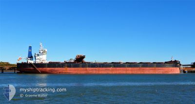
CIC OSLO
Cargo
Current Trip
| Time Travelled | 7 days |
|---|---|
| Remaining Time | 14 days |
| Distance Travelled | 1962.53 nm |
| Remaining Distance | 3742.04 nm |
| AVG Speed | 9.9 Knots |
| MAX Speed | 12.7 Knots |
| AVG Wind | 17.3 knots |
| MAX Wind | 34.9 knots |
| MIN Temp | 14.4°C / 57.92°F |
| MAX Temp | 24.7°C / 76.46°F |
| Draught | 18.4 m |
| Position Received | 7 d ago |
Current Position
| Longitude | 19.31684° |
|---|---|
| Latitude | -34.91947° |
| Status | Under way using engine |
| Speed | 10.3 Knots |
| Course | 112° |
| Area | South Atlantic Ocean |
| Station | T-AIS |
| Position Received | 7 d ago |
Info
Information
The current position of CIC OSLO is in South Atlantic Ocean with coordinates -34.91947° / 19.31684° as reported on 2024-04-12 03:10 by AIS to our vessel tracker app. The vessel's current speed is 10.3 Knots and is heading at the port of SINGAPORE. The estimated time of arrival as calculated by MyShipTracking vessel tracking app is 2024-05-04 02:39 LT
The vessel CIC OSLO (IMO: 9692818, MMSI: 371655000) is a Cargo It's sailing under the flag of [PA] Panama.
In this page you can find informations about the vessels current position, last detected port calls, and current voyage information. If the vessels is not in coverage by AIS you will find the latest position.
The current position of CIC OSLO is detected by our AIS receivers and we are not responsible for the reliability of the data. The last position was recorded while the vessel was in Coverage by the Ais receivers of our vessel tracking app.
The current draught of CIC OSLO as reported by AIS is 18.4 meters
Weather
| Temperature | 24.7°C / 76.46°F |
|---|---|
| Wind Speed | 15 knots |
| Direction | 72° ENE |
| Pressure | 1019.3 hPa |
| Humidity | 68.5 % |
| Cloud Coverage | 100 % |
Featured Company
Events
| Time | Event | Details | Position / Dest | Info |
|---|---|---|---|---|
| 2024-04-12 03:13 | Status Changed | Default Under way using engine |
-34.92216 / 19.32567
SGSIN PEBGB
|
Speed: 10.3 kn Course: 112° |
| 2024-04-12 03:10 | Status Changed | Under way using engine Default |
-34.91947 / 19.31684
SGSIN PEBGB
|
Speed: 10.3 kn Course: 111° |
| 2024-04-12 03:10 | OUT of Coverage |
-34.91947 / 19.31684
South Atlantic Ocean
SGSIN PEBGB
|
Speed: 10.3 kn Course: 112° |
|
| 2024-04-12 03:07 | Status Changed | Default Under way using engine |
-34.91556 / 19.30470
SGSIN PEBGB
|
Speed: 10.3 kn Course: 110.5° |
| 2024-04-12 02:51 | Status Changed | Under way using engine Default |
-34.89874 / 19.25206
SGSIN PEBGB
|
Speed: 10 kn Course: 110° |
| 2024-04-12 02:47 | Status Changed | Default Under way using engine |
-34.89507 / 19.23998
SGSIN PEBGB
|
Speed: 9.9 kn Course: 111.4° |
| 2024-04-12 01:04 | Status Changed | Under way using engine Default |
-34.78909 / 18.90228
SGSIN PEBGB
|
Speed: 9.9 kn Course: 111° |
| 2024-04-12 00:56 | Status Changed | Default Under way using engine |
-34.78041 / 18.87527
SGSIN PEBGB
|
Speed: 9.8 kn Course: 111.1° |
| 2024-04-12 00:52 | Status Changed | Under way using engine Default |
-34.77681 / 18.86424
SGSIN PEBGB
|
Speed: 9.7 kn Course: 112° |
| 2024-04-12 00:47 | Status Changed | Default Under way using engine |
-34.77233 / 18.84962
SGSIN PEBGB
|
Speed: 9.6 kn Course: 109.8° |