
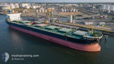
CHRYSANTHI S
Bulk Carrier
Current Trip
| Time Travelled | 6 days |
|---|---|
| Remaining Time | --- |
| Distance Travelled | 1047.91 nm |
| Remaining Distance | --- |
| AVG Speed | 11.2 Knots |
| MAX Speed | 11.2 Knots |
| AVG Wind | 9.6 knots |
| MAX Wind | 21 knots |
| MIN Temp | 12.1°C / 53.78°F |
| MAX Temp | 36.2°C / 97.16°F |
| Draught | 12.9 m |
| Position Received | 1 d ago |
Current Position
| Longitude | 32.55115° |
|---|---|
| Latitude | 29.86894° |
| Status | Under way using engine |
| Speed | 9.5 Knots |
| Course | 172.7° |
| Area | Gulf of Suez |
| Station | T-AIS |
| Position Received | 1 d ago |
Info
Information
The current position of CHRYSANTHI S is in Gulf of Suez with coordinates 29.86894° / 32.55115° as reported on 2024-04-17 15:38 by AIS to our vessel tracker app. The vessel's current speed is 9.5 Knots
The vessel CHRYSANTHI S (IMO: 9527441, MMSI: 636015701) is a Bulk Carrier that was built in 2012 ( 12 years old ). It's sailing under the flag of [LR] Liberia.
In this page you can find informations about the vessels current position, last detected port calls, and current voyage information. If the vessels is not in coverage by AIS you will find the latest position.
The current position of CHRYSANTHI S is detected by our AIS receivers and we are not responsible for the reliability of the data. The last position was recorded while the vessel was in Coverage by the Ais receivers of our vessel tracking app.
The current draught of CHRYSANTHI S as reported by AIS is 12.9 meters
Weather
| Temperature | 26.9°C / 80.42°F |
|---|---|
| Wind Speed | 7 knots |
| Direction | 22° NNE |
| Pressure | 1008.2 hPa |
| Humidity | 54 % |
| Cloud Coverage | 83 % |
Featured Company
Last Port Calls
| Port | Arrival | Departure | Time In Port |
|---|---|---|---|
| 2024-04-17 05:27 | 2024-04-17 14:53 | 9 h | |
| 2024-04-12 15:12 | 2024-04-12 16:30 | 1 h | |
| 2024-04-06 21:09 | 2024-04-08 13:21 | 1 d | |
| 2024-04-05 07:57 | 2024-04-06 20:29 | 1 d | |
| 2024-03-27 09:43 | 2024-03-27 11:16 | 1 h | |
| 2024-03-05 03:12 | 2024-03-18 11:11 | 13 d | |
| 2024-02-26 20:11 | 2024-02-26 21:36 | 1 h | |
| 2024-02-18 13:23 | 2024-02-22 06:27 | 3 d |
Last Trips
| Origin | Departure | Destination | Arrival | Distance | |
|---|---|---|---|---|---|
| 2024-04-12 19:30 | 2024-04-17 07:27 | 825.96 nm | |||
| 2024-04-08 16:21 | 2024-04-12 18:12 | 403.59 nm | |||
| 2024-04-06 23:29 | 2024-04-07 00:09 | 3.69 nm | |||
| 2024-03-27 14:16 | 2024-04-05 10:57 | 438.54 nm | |||
| 2024-03-18 12:11 | 2024-03-27 12:43 | 1619.70 nm | |||
| 2024-02-27 00:36 | 2024-03-05 04:12 | 1554.31 nm | |||
| 2024-02-22 08:27 | 2024-02-26 23:11 | 423.41 nm | |||
| 2024-01-26 20:45 | 2024-02-18 15:23 | 1573.99 nm |
Events
| Time | Event | Details | Position / Dest | Info |
|---|---|---|---|---|
| 2024-04-17 15:41 | Status Changed | Default Under way using engine |
29.86009 / 32.55246
EGPSD
|
Speed: 9.5 kn Course: 172.7° |
| 2024-04-17 15:38 | OUT of Coverage |
29.86894 / 32.55115
Gulf of Suez
|
Speed: 9.5 kn Course: 172.7° |
|
| 2024-04-17 14:56 | Change Sea Area | Egyptian part of the Gulf of Suez Egyptian part of the Mediterranean Sea - Eastern Basin |
29.94122 / 32.57361
Gulf of Suez
|
Speed: 6.8 kn Course: 223.9° |
| 2024-04-17 14:53 | PORT DEPARTURE |
|
29.94525 / 32.57735
EGPSD
|
Speed: 8.1 kn Course: 215° |
| 2024-04-17 12:41 | Status Changed | Under way using engine Default |
30.26725 / 32.48143
[EG] SUEZ CANAL
|
Speed: 10.1 kn Course: 108° |
| 2024-04-17 12:35 | Status Changed | Default Under way using engine |
30.27255 / 32.46297
[EG] SUEZ CANAL
|
Speed: 9.9 kn Course: 118° |
| 2024-04-17 12:11 | Status Changed | Under way using engine Default |
30.31704 / 32.40611
[EG] SUEZ CANAL
|
Speed: 10.4 kn Course: 141° |
| 2024-04-17 12:11 | IN Coverage |
30.31398 / 32.40883
Mediterranean Sea - Eastern Basin
[EG] SUEZ CANAL
|
Speed: 10.4 kn Course: 142.5° |
|
| 2024-04-17 06:55 | Status Changed | Default Under way using engine |
31.05229 / 32.30983
[EG] SUEZ CANAL
|
Speed: 6.8 kn Course: 177° |
| 2024-04-17 06:50 | OUT of Coverage |
31.06267 / 32.30947
Mediterranean Sea - Eastern Basin
[EG] SUEZ CANAL
|
Speed: 6.8 kn Course: 177.3° |