
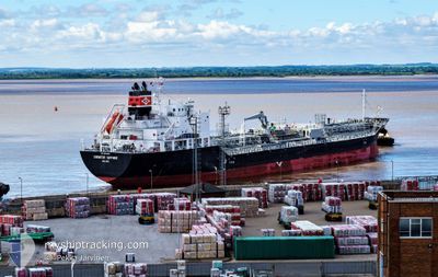
CHEMSTAR SAPPHIRE
Tanker
Current Trip
| Time Travelled | 1 day |
|---|---|
| Remaining Time | --- |
| Distance Travelled | 303.88 nm |
| Remaining Distance | --- |
| AVG Speed | 11.2 Knots |
| MAX Speed | 12.6 Knots |
| AVG Wind | 11.6 knots |
| MAX Wind | 15.2 knots |
| MIN Temp | 15.2°C / 59.36°F |
| MAX Temp | 17.9°C / 64.22°F |
| Draught | 6.7 m |
| Position Received | 1 h, 15 m ago |
Current Position
| Longitude | 128.27014° |
|---|---|
| Latitude | 34.12123° |
| Status | Under way using engine |
| Speed | 11.8 Knots |
| Course | 318.9° |
| Area | Japan Sea |
| Station | T-AIS |
| Position Received | 1 h, 15 m ago |
Info
Information
The current position of CHEMSTAR SAPPHIRE is in Japan Sea with coordinates 34.12123° / 128.27014° as reported on 2024-04-19 14:50 by AIS to our vessel tracker app. The vessel's current speed is 11.8 Knots and is heading at the port of YEOSU. The estimated time of arrival as calculated by MyShipTracking vessel tracking app is 2024-04-20 04:00 LT
The vessel CHEMSTAR SAPPHIRE (IMO: 9804904, MMSI: 538008644) is a Tanker It's sailing under the flag of [MH] Marshall Is.
In this page you can find informations about the vessels current position, last detected port calls, and current voyage information. If the vessels is not in coverage by AIS you will find the latest position.
The current position of CHEMSTAR SAPPHIRE is detected by our AIS receivers and we are not responsible for the reliability of the data. The last position was recorded while the vessel was in Coverage by the Ais receivers of our vessel tracking app.
The current draught of CHEMSTAR SAPPHIRE as reported by AIS is 6.7 meters
Weather
| Temperature | 17.1°C / 62.78°F |
|---|---|
| Wind Speed | 8 knots |
| Direction | 205° SSW |
| Pressure | 1013.2 hPa |
| Humidity | 74.5 % |
| Cloud Coverage | 100 % |
Featured Company
Last Port Calls
| Port | Arrival | Departure | Time In Port |
|---|---|---|---|
| 2024-04-18 07:28 | 2024-04-18 12:18 | 4 h | |
| 2024-04-16 22:27 | 2024-04-18 07:28 | 1 d | |
| 2024-04-13 13:25 | 2024-04-13 22:24 | 8 h | |
| 2024-04-10 01:41 | 2024-04-11 03:24 | 1 d | |
| 2024-04-04 13:53 | 2024-04-05 11:25 | 21 h | |
| 2024-03-13 13:34 | 2024-03-15 05:59 | 1 d | |
| 2024-03-06 06:36 | 2024-03-08 09:17 | 2 d | |
| 2024-02-29 18:19 | 2024-03-02 03:50 | 1 d | |
| 2024-02-07 16:40 | 2024-02-09 10:30 | 1 d | |
| 2024-02-01 14:38 | 2024-02-02 22:11 | 1 d |
Most Visited Ports (Last year)
| Port | Arrivals | |
|---|---|---|
| 3 | ||
| 2 | ||
| 2 | ||
| 2 | ||
| 1 | ||
| 1 |
Last Trips
| Origin | Departure | Destination | Arrival | Distance | |
|---|---|---|---|---|---|
| 2024-04-14 06:24 | 2024-04-18 16:28 | 958.59 nm | |||
| 2024-04-14 06:24 | 2024-04-17 07:27 | 952.75 nm | |||
| 2024-04-11 11:24 | 2024-04-13 21:25 | 530.56 nm | |||
| 2024-04-05 18:25 | 2024-04-10 09:41 | 1490.59 nm | |||
| 2024-03-15 07:59 | 2024-04-04 20:53 | 5718.27 nm | |||
| 2024-03-08 11:17 | 2024-03-13 15:34 | 543.63 nm | |||
| 2024-03-02 05:50 | 2024-03-06 08:36 | 782.62 nm | |||
| 2024-02-09 18:30 | 2024-02-29 20:19 | 5285.03 nm | |||
| 2024-02-03 06:11 | 2024-02-08 00:40 | 604.46 nm | |||
| 2024-01-17 15:08 | 2024-02-01 22:38 | 3468.90 nm |
Events
| Time | Event | Details | Position / Dest | Info |
|---|---|---|---|---|
| 2024-04-19 14:50 | OUT of Coverage |
34.12123 / 128.27014
Japan Sea
KR YOS
|
Speed: 11.8 kn Course: 318.9° |
|
| 2024-04-19 13:25 | Change Sea Area | South Korean part of the Japan Sea Japanese part of the Japan Sea |
34.04648 / 128.55988
Japan Sea
KR YOS
|
Speed: 11 kn Course: 275.9° |
| 2024-04-19 13:23 | IN Coverage |
34.04648 / 128.55988
Japan Sea
KR YOS
|
Speed: 11 kn Course: 275.9° |
|
| 2024-04-19 09:04 | OUT of Coverage |
34.68292 / 129.17880
Japan Sea
KR YOS
|
Speed: 11.6 kn Course: 198.7° |
|
| 2024-04-19 04:25 | Draught Changed | 6.7 7.5 |
34.85850 / 130.05671
KR YOS
|
Speed: 12.3 kn Course: 281.4° |
| 2024-04-19 04:25 | Destination Changed | KR YOS TW KHH |
34.85850 / 130.05671
KR YOS
|
Speed: 12.3 kn Course: 281.4° |
| 2024-04-19 04:25 | ETA Changed | 2024/04/20 04:00 2024/04/13 13:00 |
34.85850 / 130.05671
KR YOS
|
Speed: 12.3 kn Course: 281.4° |
| 2024-04-19 03:51 | IN Coverage |
34.83947 / 130.18909
Japan Sea
|
Speed: 12.5 kn Course: 277.7° |
|
| 2024-04-18 22:15 | OUT of Coverage |
35.20690 / 131.44352
Japan Sea
|
Speed: 10.2 kn Course: 248.3° |
|
| 2024-04-18 22:15 | IN Coverage |
35.20690 / 131.44352
Japan Sea
|
Speed: 10.2 kn Course: 248.3° |