
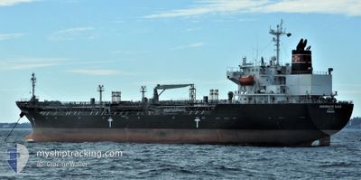
CHEMROUTE OASIS
Oil/Chemical Tanker
Current Trip
| Time Travelled | 47 days |
|---|---|
| Remaining Time | 16 h, 11 mins |
| Distance Travelled | 13777.32 nm |
| Remaining Distance | 228.99 nm |
| AVG Speed | 13.5 Knots |
| MAX Speed | 18 Knots |
| AVG Wind | 14.2 knots |
| MAX Wind | 40 knots |
| MIN Temp | 0.9°C / 33.62°F |
| MAX Temp | 29.2°C / 84.56°F |
| Draught | 10.2 m |
| Position Received | 5 d ago |
Current Position
| Longitude | -92.30010° |
|---|---|
| Latitude | -2.19481° |
| Status | Under way using engine |
| Speed | 13.2 Knots |
| Course | 139.4° |
| Area | South Pacific Ocean |
| Station | T-AIS |
| Position Received | 5 d ago |
Info
Information
The current position of CHEMROUTE OASIS is in South Pacific Ocean with coordinates -2.19481° / -92.30010° as reported on 2024-04-14 02:54 by AIS to our vessel tracker app. The vessel's current speed is 13.2 Knots and is heading at the port of MEJILLONES. The estimated time of arrival as calculated by MyShipTracking vessel tracking app is 2024-04-20 13:34 LT
The vessel CHEMROUTE OASIS (IMO: 9512173, MMSI: 372975000) is a Oil/Chemical Tanker that was built in 2011 ( 13 years old ). It's sailing under the flag of [PA] Panama.
In this page you can find informations about the vessels current position, last detected port calls, and current voyage information. If the vessels is not in coverage by AIS you will find the latest position.
The current position of CHEMROUTE OASIS is detected by our AIS receivers and we are not responsible for the reliability of the data. The last position was recorded while the vessel was in Coverage by the Ais receivers of our vessel tracking app.
The current draught of CHEMROUTE OASIS as reported by AIS is 10.2 meters
Weather
| Temperature | 20°C / 68°F |
|---|---|
| Wind Speed | 6 knots |
| Direction | 197° SSW |
| Pressure | 1012.9 hPa |
| Humidity | 69.2 % |
| Cloud Coverage | 33 % |
Featured Company
Most Visited Ports (Last year)
| Port | Arrivals | |
|---|---|---|
| 6 | ||
| 2 | ||
| 2 | ||
| 2 | ||
| 2 | ||
| 2 |
Events
| Time | Event | Details | Position / Dest | Info |
|---|---|---|---|---|
| 2024-04-18 03:46 | START Moving | 3.91 nm, North West of CALLAO |
-12.02254 / -77.21267
CL MJS
|
Speed: 3.1 kn Course: 270° |
| 2024-04-17 13:26 | STOP Moving | 4.05 nm, North West of CALLAO |
-12.01877 / -77.21306
CL MJS
|
Speed: 0.3 kn Course: 119° |
| 2024-04-14 02:58 | Status Changed | Default Under way using engine |
-2.20541 / -92.29112
CL MJS
|
Speed: 13.2 kn Course: 139.4° |
| 2024-04-14 02:54 | OUT of Coverage |
-2.19481 / -92.30010
South Pacific Ocean
CL MJS
|
Speed: 13.2 kn Course: 139.4° |
|
| 2024-04-14 01:49 | Status Changed | Under way using engine Default |
-2.00893 / -92.45743
CL MJS
|
Speed: 13.7 kn Course: 141° |
| 2024-04-14 01:45 | Status Changed | Default Under way using engine |
-1.99657 / -92.46809
CL MJS
|
Speed: 13.8 kn Course: 139.2° |
| 2024-04-13 22:59 | Status Changed | Under way using engine Default |
-1.50896 / -92.86137
CL MJS
|
Speed: 13.5 kn Course: 140° |
| 2024-04-13 22:49 | Status Changed | Default Under way using engine |
-1.47928 / -92.88638
CL MJS
|
Speed: 13.5 kn Course: 140.3° |
| 2024-04-13 22:46 | Status Changed | Under way using engine Default |
-1.46947 / -92.89441
CL MJS
|
Speed: 13.5 kn Course: 140° |
| 2024-04-13 22:18 | Status Changed | Default Under way using engine |
-1.39030 / -92.96042
CL MJS
|
Speed: 13.2 kn Course: 138.7° |