
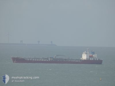
CHEM NEW YORK
Tanker C
Current Trip
| Time Travelled | 1 day |
|---|---|
| Remaining Time | --- |
| Distance Travelled | 450.99 nm |
| Remaining Distance | --- |
| AVG Speed | 12 Knots |
| MAX Speed | 13.3 Knots |
| AVG Wind | 5.4 knots |
| MAX Wind | 7.9 knots |
| MIN Temp | 17.6°C / 63.68°F |
| MAX Temp | 21.3°C / 70.34°F |
| Draught | 10 m |
| Position Received | 8 m ago |
Current Position
| Longitude | -10.29651° |
|---|---|
| Latitude | 33.91672° |
| Status | Under way using engine |
| Speed | 12 Knots |
| Course | 42° |
| Area | North Atlantic Ocean |
| Station | T-AIS |
| Position Received | 8 m ago |
Info
Information
The current position of CHEM NEW YORK is in North Atlantic Ocean with coordinates 33.91672° / -10.29651° as reported on 2024-04-18 23:03 by AIS to our vessel tracker app. The vessel's current speed is 12 Knots and is heading at the port of CASTELLON. The estimated time of arrival as calculated by MyShipTracking vessel tracking app is 2024-04-21 07:00 LT
The vessel CHEM NEW YORK (IMO: 9705732, MMSI: 636016361) is a Tanker C It's sailing under the flag of [LR] Liberia.
In this page you can find informations about the vessels current position, last detected port calls, and current voyage information. If the vessels is not in coverage by AIS you will find the latest position.
The current position of CHEM NEW YORK is detected by our AIS receivers and we are not responsible for the reliability of the data. The last position was recorded while the vessel was in Coverage by the Ais receivers of our vessel tracking app.
The current draught of CHEM NEW YORK as reported by AIS is 10 meters
Weather
| Temperature | 17.5°C / 63.5°F |
|---|---|
| Wind Speed | 4 knots |
| Direction | 335° NNW |
| Pressure | 1015.9 hPa |
| Humidity | 84.1 % |
| Cloud Coverage | 47 % |
Featured Company
Last Port Calls
| Port | Arrival | Departure | Time In Port |
|---|---|---|---|
| 2024-04-17 04:45 | 2024-04-17 10:21 | 5 h | |
| 2024-03-07 10:01 | 2024-03-08 02:52 | 16 h | |
| 2024-02-29 02:19 | 2024-03-01 05:57 | 1 d | |
| 2024-02-23 06:00 | 2024-02-23 23:16 | 17 h | |
| 2024-02-17 08:19 | 2024-02-18 01:54 | 17 h | |
| 2024-02-08 10:42 | 2024-02-09 02:24 | 15 h | |
| 2024-02-07 14:22 | 2024-02-08 03:50 | 13 h |
Most Visited Ports (Last year)
| Port | Arrivals | |
|---|---|---|
| 2 | ||
| 2 | ||
| 1 | ||
| 1 | ||
| 1 | ||
| 1 |
Last Trips
| Origin | Departure | Destination | Arrival | Distance | |
|---|---|---|---|---|---|
| 2024-03-08 10:52 | 2024-04-17 05:45 | 13354.31 nm | |||
| 2024-03-01 14:57 | 2024-03-07 18:01 | 998.86 nm | |||
| 2024-02-24 08:16 | 2024-02-29 11:19 | 487.31 nm | |||
| 2024-02-18 10:54 | 2024-02-23 15:00 | 67.84 nm | |||
| 2024-02-09 10:24 | 2024-02-17 17:19 | 1038.21 nm | |||
| 2024-02-08 11:50 | 2024-02-08 18:42 | 67.91 nm | |||
| 2023-12-30 12:43 | 2024-02-07 22:22 | 15806.97 nm |
Events
| Time | Event | Details | Position / Dest | Info |
|---|---|---|---|---|
| 2024-04-18 23:02 | Status Changed | Under way using engine Default |
33.91416 / -10.29924
ES CAS
|
Speed: 12.1 kn Course: 39° |
| 2024-04-18 22:29 | Status Changed | Default Under way using engine |
33.82917 / -10.38267
ES CAS
|
Speed: 12.1 kn Course: 38.7° |
| 2024-04-18 21:58 | Status Changed | Under way using engine Default |
33.74876 / -10.46096
ES CAS
|
Speed: 11.7 kn Course: 40° |
| 2024-04-18 21:58 | IN Coverage |
33.75182 / -10.45799
North Atlantic Ocean
ES CAS
|
Speed: 12.2 kn Course: 39.5° |
|
| 2024-04-18 20:32 | Status Changed | Default Under way using engine |
33.53285 / -10.68477
ES CAS
|
Speed: 11.8 kn Course: 41.5° |
| 2024-04-18 19:49 | OUT of Coverage |
33.42323 / -10.80030
North Atlantic Ocean
ES CAS
|
Speed: 11.8 kn Course: 41.5° |
|
| 2024-04-18 19:21 | IN Coverage |
33.35777 / -10.86956
North Atlantic Ocean
ES CAS
|
Speed: 11.9 kn Course: 41.7° |
|
| 2024-04-18 19:20 | Status Changed | Under way using engine Default |
33.35292 / -10.87476
ES CAS
|
Speed: 11.8 kn Course: 43° |
| 2024-04-18 16:42 | Status Changed | Default Under way using engine |
32.95385 / -11.28423
ES CAS
|
Speed: 11.3 kn Course: 39.9° |
| 2024-04-18 16:36 | OUT of Coverage |
32.93989 / -11.29839
North Atlantic Ocean
ES CAS
|
Speed: 11.3 kn Course: 39.9° |