
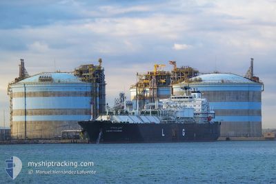
CHEIKH BOUAMAMA
Lng Tanker
Current Trip
| Trip Time | 3 days |
|---|---|
| Trip Distance | 612.33 nm |
| AVG Speed | 8.1 Knots |
| MAX Speed | 13.8 Knots |
| Draught | 9.8 m |
| AVG Wind | 21.1 knots |
| MAX Wind | 36 knots |
| MIN Temp | 7.2°C / 44.96°F |
| MAX Temp | 17.9°C / 64.22°F |
| Position Received | 20 h, 51 m ago |
Current Position
| Longitude | 4.98184° |
|---|---|
| Latitude | 43.34886° |
| Status | Under way using engine |
| Speed | 7.5 Knots |
| Course | 21.1° |
| Area | Mediterranean Sea - Western Basin |
| Station | T-AIS |
| Position Received | 20 h, 51 m ago |
Info
Information
The current position of CHEIKH BOUAMAMA is in Mediterranean Sea - Western Basin with coordinates 43.34886° / 4.98184° as reported on 2024-04-24 16:50 by AIS to our vessel tracker app. The vessel's current speed is 7.5 Knots and is currently inside the port of FOS.
The vessel CHEIKH BOUAMAMA (IMO: 9324344, MMSI: 311006300) is a Lng Tanker that was built in 2008 ( 16 years old ). It's sailing under the flag of [BS] Bahamas.
In this page you can find informations about the vessels current position, last detected port calls, and current voyage information. If the vessels is not in coverage by AIS you will find the latest position.
The current position of CHEIKH BOUAMAMA is detected by our AIS receivers and we are not responsible for the reliability of the data. The last position was recorded while the vessel was in Coverage by the Ais receivers of our vessel tracking app.
The current draught of CHEIKH BOUAMAMA as reported by AIS is 9.8 meters
Weather
| Temperature | 16.9°C / 62.42°F |
|---|---|
| Wind Speed | 7 knots |
| Direction | 297° WNW |
| Pressure | 1007.9 hPa |
| Humidity | 37.1 % |
| Cloud Coverage | 27 % |
Featured Company
Last Port Calls
| Port | Arrival | Departure | Time In Port |
|---|---|---|---|
| 2024-04-24 17:20 | |||
| 2024-04-20 12:36 | 2024-04-21 15:20 | 1 d | |
| 2024-04-13 05:50 | 2024-04-14 17:59 | 1 d | |
| 2024-04-09 14:48 | 2024-04-10 15:02 | 1 d | |
| 2024-04-06 06:21 | 2024-04-08 08:29 | 2 d | |
| 2024-04-03 13:42 | 2024-04-04 20:57 | 1 d | |
| 2024-03-31 08:25 | 2024-04-01 06:26 | 22 h | |
| 2024-03-29 09:26 | 2024-03-30 06:41 | 21 h | |
| 2024-03-26 20:05 | 2024-03-28 01:51 | 1 d | |
| 2024-03-20 13:36 | 2024-03-21 19:58 | 1 d |
Most Visited Ports (Last year)
| Port | Arrivals | |
|---|---|---|
| 31 | ||
| 19 | ||
| 11 | ||
| 7 | ||
| 3 | ||
| 2 |
Last Trips
| Origin | Departure | Destination | Arrival | Distance | |
|---|---|---|---|---|---|
| 2024-04-21 16:20 | 2024-04-24 19:20 | 612.33 nm | |||
| 2024-04-14 19:59 | 2024-04-20 13:36 | 1035.01 nm | |||
| 2024-04-10 16:02 | 2024-04-13 07:50 | 578.27 nm | |||
| 2024-04-08 10:29 | 2024-04-09 15:48 | 463.18 nm | |||
| 2024-04-04 21:57 | 2024-04-06 08:21 | 469.45 nm | |||
| 2024-04-01 08:26 | 2024-04-03 14:42 | 402.71 nm | |||
| 2024-03-30 07:41 | 2024-03-31 10:25 | 383.07 nm | |||
| 2024-03-28 02:51 | 2024-03-29 10:26 | 403.69 nm | |||
| 2024-03-21 20:58 | 2024-03-26 21:05 | 430.90 nm | |||
| 2024-03-17 13:00 | 2024-03-20 14:36 | 424.17 nm |
Events
| Time | Event | Details | Position / Dest | Info |
|---|---|---|---|---|
| 2024-04-24 18:07 | STOP Moving |
43.41444 / 4.89802
[FR] FOS
|
Speed: Course: 154° |
|
| 2024-04-24 17:20 | PORT ARRIVAL |
|
43.39471 / 4.92320
[FR] FOS
|
Speed: 8.2 kn Course: 292° |
| 2024-04-24 16:56 | Status Changed | Default Under way using engine |
43.35934 / 4.98575
FRFOS
|
Speed: 7.5 kn Course: 21.1° |
| 2024-04-24 16:50 | OUT of Coverage |
43.34886 / 4.98184
Mediterranean Sea - Western Basin
[FR] FOS
|
Speed: 7.5 kn Course: 21.1° |
|
| 2024-04-24 16:13 | ETA Changed | 2024/04/24 16:30 2024/04/24 05:00 |
43.24975 / 5.02011
FRFOS
|
Speed: 11.1 kn Course: 339.4° |
| 2024-04-24 15:36 | Status Changed | Under way using engine Default |
43.15564 / 5.00354
FRFOS
|
Speed: 12.2 kn Course: 62° |
| 2024-04-24 15:17 | Status Changed | Default Under way using engine |
43.12584 / 4.92886
FRFOS
|
Speed: 10.2 kn Course: 56.4° |
| 2024-04-24 15:05 | Status Changed | Under way using engine Default |
43.10726 / 4.88987
FRFOS
|
Speed: 9 kn Course: 51° |
| 2024-04-24 14:56 | IN Coverage |
43.11106 / 4.89715
Mediterranean Sea - Western Basin
|
Speed: 10.1 kn Course: 54.5° |
|
| 2024-04-24 13:51 | OUT of Coverage |
43.08336 / 4.94517
Mediterranean Sea - Western Basin
|
Speed: 5.6 kn Course: 346.9° |