
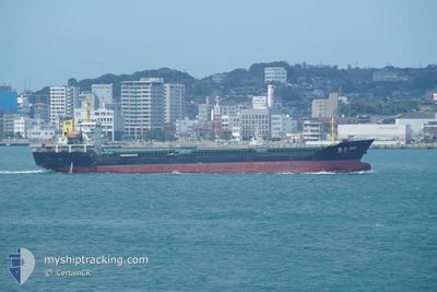
CHANG DA 368
Cargo
Current Trip
| Trip Time | 6 days |
|---|---|
| Trip Distance | 1262.94 nm |
| AVG Speed | 8.2 Knots |
| MAX Speed | 11.3 Knots |
| Draught | 7.2 m |
| AVG Wind | 13.4 knots |
| MAX Wind | 31 knots |
| MIN Temp | 18°C / 64.4°F |
| MAX Temp | 31.4°C / 88.52°F |
| Position Received | 3 d ago |
Current Position
| Longitude | 106.99636° |
|---|---|
| Latitude | 10.62797° |
| Status | Under way using engine |
| Speed | 8.2 Knots |
| Course | 354° |
| Area | South China Sea |
| Station | T-AIS |
| Position Received | 3 d ago |
Info
Information
The current position of CHANG DA 368 is in South China Sea with coordinates 10.62797° / 106.99636° as reported on 2024-04-16 02:29 by AIS to our vessel tracker app. The vessel's current speed is 8.2 Knots and is currently inside the port of PHU MY.
The vessel CHANG DA 368 (IMO: 8653047, MMSI: 312455000) is a Cargo It's sailing under the flag of [BZ] Belize.
In this page you can find informations about the vessels current position, last detected port calls, and current voyage information. If the vessels is not in coverage by AIS you will find the latest position.
The current position of CHANG DA 368 is detected by our AIS receivers and we are not responsible for the reliability of the data. The last position was recorded while the vessel was in Coverage by the Ais receivers of our vessel tracking app.
The current draught of CHANG DA 368 as reported by AIS is 7.2 meters
Weather
| Temperature | 36.6°C / 97.88°F |
|---|---|
| Wind Speed | 4 knots |
| Direction | 180° S |
| Pressure | 1009.5 hPa |
| Humidity | 37.1 % |
| Cloud Coverage | 66 % |
Featured Company
Last Port Calls
| Port | Arrival | Departure | Time In Port |
|---|---|---|---|
| 2024-04-16 01:59 | |||
| 2024-04-05 00:32 | 2024-04-09 07:05 | 4 d | |
| 2024-03-28 03:47 | 2024-03-30 11:27 | 2 d | |
| 2024-03-18 02:53 | 2024-03-21 12:28 | 3 d | |
| 2024-03-09 03:55 | |||
| 2024-02-27 02:17 | 2024-03-04 22:11 | 6 d | |
| 2024-02-09 05:29 | 2024-02-16 14:29 | 7 d | |
| 2024-02-06 11:08 |
Last Trips
| Origin | Departure | Destination | Arrival | Distance | |
|---|---|---|---|---|---|
| 2024-04-09 15:05 | 2024-04-16 08:59 | 1262.94 nm | |||
| 2024-03-30 19:27 | 2024-04-05 08:32 | 171.41 nm | |||
| 2024-03-21 19:28 | 2024-03-28 11:47 | 1241.76 nm | |||
| 2024-03-09 11:55 | 2024-03-18 09:53 | 867.18 nm | |||
| 2024-02-16 23:29 | 2024-02-27 09:17 | 2062.37 nm | |||
| 2024-02-06 20:08 | 2024-02-09 14:29 | 519.22 nm |
Events
| Time | Event | Details | Position / Dest | Info |
|---|---|---|---|---|
| 2024-04-16 03:07 | STOP Moving |
10.65539 / 107.01877
[VN] PHU MY
|
Speed: Course: 14° |
|
| 2024-04-16 02:35 | Status Changed | Default Under way using engine |
10.63550 / 107.00175
[VN] PHU MY
|
Speed: 8.2 kn Course: 354° |
| 2024-04-16 02:29 | OUT of Coverage |
10.62797 / 106.99636
South China Sea
[VN] PHU MY
|
Speed: 8.2 kn Course: 350° |
|
| 2024-04-16 02:26 | Status Changed | Under way using engine Default |
10.61982 / 106.99942
[VN] PHU MY
|
Speed: 8.7 kn Course: 310° |
| 2024-04-16 02:23 | Status Changed | Default Under way using engine |
10.61624 / 107.00379
[VN] PHU MY
|
Speed: 8.3 kn Course: 306° |
| 2024-04-16 02:17 | Change Sea Area | Vietnamese part of the South China Sea Chinese part of the South China Sea |
10.60776 / 107.01543
South China Sea
|
Speed: 8.3 kn Course: 305.4° |
| 2024-04-16 02:17 | Status Changed | Under way using engine Default |
10.60776 / 107.01543
[VN] PHU MY
|
Speed: 8.7 kn Course: 337° |
| 2024-04-16 02:11 | IN Coverage |
10.60776 / 107.01543
South China Sea
[VN] PHU MY
|
Speed: 8.3 kn Course: 305.4° |
|
| 2024-04-16 01:59 | PORT ARRIVAL |
|
10.57041 / 107.01890
[VN] PHU MY
|
Speed: 8 kn Course: 25° |
| 2024-04-15 23:03 | START Moving | 11.94 nm, South of VUNG TAU |
10.21113 / 107.01981
VN DNA
|
Speed: 6 kn Course: 21° |