
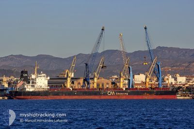
CH CLARE
Bulk Carrier
Current Trip
BR FOR
| Time Travelled | 1 day |
|---|---|
| Remaining Time | --- |
| Distance Travelled | 452.16 nm |
| Remaining Distance | --- |
| AVG Speed | 9.5 Knots |
| MAX Speed | 11.5 Knots |
| AVG Wind | 10 knots |
| MAX Wind | 16 knots |
| MIN Temp | 27.6°C / 81.68°F |
| MAX Temp | 29.5°C / 85.1°F |
| Draught | 10.3 m |
| Position Received | 1 d ago |
Current Position
| Longitude | -38.40522° |
|---|---|
| Latitude | -3.63230° |
| Status | Under way using engine |
| Speed | 11.3 Knots |
| Course | 86° |
| Area | South Atlantic Ocean |
| Station | T-AIS |
| Position Received | 1 d ago |
Info
Information
The current position of CH CLARE is in South Atlantic Ocean with coordinates -3.63230° / -38.40522° as reported on 2024-04-23 15:58 by AIS to our vessel tracker app. The vessel's current speed is 11.3 Knots
The vessel CH CLARE (IMO: 9489223, MMSI: 441698000) is a Bulk Carrier that was built in 2010 ( 14 years old ). It's sailing under the flag of [KR] Korea.
In this page you can find informations about the vessels current position, last detected port calls, and current voyage information. If the vessels is not in coverage by AIS you will find the latest position.
The current position of CH CLARE is detected by our AIS receivers and we are not responsible for the reliability of the data. The last position was recorded while the vessel was in Coverage by the Ais receivers of our vessel tracking app.
The current draught of CH CLARE as reported by AIS is 10.3 meters
Weather
| Temperature | 29°C / 84.2°F |
|---|---|
| Wind Speed | 8 knots |
| Direction | 93° E |
| Pressure | 1013.4 hPa |
| Humidity | 65.3 % |
| Cloud Coverage | 22 % |
Featured Company
Last Port Calls
| Port | Arrival | Departure | Time In Port |
|---|---|---|---|
| 2024-04-19 16:13 | 2024-04-23 14:55 | 3 d | |
| 2024-04-06 00:50 | 2024-04-07 21:20 | 1 d | |
| 2024-04-03 17:07 | 2024-04-04 00:31 | 7 h | |
| 2024-03-25 14:49 | 2024-04-02 09:59 | 7 d | |
| 2024-03-15 22:40 | 2024-03-20 04:02 | 4 d |
Last Trips
| Origin | Departure | Destination | Arrival | Distance | |
|---|---|---|---|---|---|
| 2024-04-07 18:20 | 2024-04-19 13:13 | 2685.30 nm | |||
| 2024-04-03 21:31 | 2024-04-05 21:50 | 6.17 nm | |||
| 2024-04-02 06:59 | 2024-04-03 14:07 | 52.58 nm | |||
| 2024-03-20 01:02 | 2024-03-25 11:49 | 1142.76 nm | |||
| 2024-01-31 07:00 | 2024-03-15 19:40 | 4970.40 nm |
Events
| Time | Event | Details | Position / Dest | Info |
|---|---|---|---|---|
| 2024-04-23 16:03 | Status Changed | Default Under way using engine |
-3.63153 / -38.38940
BR FOR
|
Speed: 11.3 kn Course: 86° |
| 2024-04-23 15:58 | OUT of Coverage |
-3.63230 / -38.40522
South Atlantic Ocean
|
Speed: 11.3 kn Course: 86° |
|
| 2024-04-23 14:55 | PORT DEPARTURE |
|
-3.69830 / -38.48745
BR FOR
|
Speed: 4.5 kn Course: 3° |
| 2024-04-23 14:44 | START Moving |
-3.70890 / -38.47932
[BR] FORTALEZA
|
Speed: 3.1 kn Course: 310° |
|
| 2024-04-23 14:35 | Status Changed | Under way using engine Moored |
-3.71067 / -38.47505
[BR] FORTALEZA
|
Speed: Course: 200° |
| 2024-04-23 14:25 | Status Changed | Moored Default |
-3.71082 / -38.47482
[BR] FORTALEZA
|
Speed: Course: 200° |
| 2024-04-23 14:16 | Status Changed | Default Moored |
-3.71080 / -38.47480
[BR] FORTALEZA
|
Speed: Course: 200° |
| 2024-04-23 13:07 | Status Changed | Moored Default |
-3.71083 / -38.47480
[BR] FORTALEZA
|
Speed: Course: 201° |
| 2024-04-23 13:04 | Status Changed | Default Moored |
-3.71083 / -38.47478
[BR] FORTALEZA
|
Speed: Course: 201° |
| 2024-04-23 11:43 | Status Changed | Moored Default |
-3.71077 / -38.47480
[BR] FORTALEZA
|
Speed: Course: 201° |