
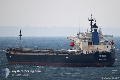
CETUS
Bulk Carrier
Current Trip
| Time Travelled | 8 days |
|---|---|
| Remaining Time | 10 h, 9 mins |
| Distance Travelled | 963.89 nm |
| Remaining Distance | 293.65 nm |
| AVG Speed | 9.5 Knots |
| MAX Speed | 19.7 Knots |
| AVG Wind | 9.2 knots |
| MAX Wind | 27.1 knots |
| MIN Temp | 11.8°C / 53.24°F |
| MAX Temp | 20.8°C / 69.44°F |
| Draught | 12.7 m |
| Position Received | 21 h, 48 m ago |
Current Position
| Longitude | 28.49782° |
|---|---|
| Latitude | 34.92207° |
| Status | Under way using engine |
| Speed | 8.5 Knots |
| Course | 138° |
| Area | Mediterranean Sea - Eastern Basin |
| Station | T-AIS |
| Position Received | 21 h, 48 m ago |
Info
Information
The current position of CETUS is in Mediterranean Sea - Eastern Basin with coordinates 34.92207° / 28.49782° as reported on 2024-04-17 18:23 by AIS to our vessel tracker app. The vessel's current speed is 8.5 Knots and is heading at the port of PORT SAID. The estimated time of arrival as calculated by MyShipTracking vessel tracking app is 2024-04-19 02:20 LT
The vessel CETUS (IMO: 9276482, MMSI: 636016823) is a Bulk Carrier that was built in 2003 ( 21 years old ). It's sailing under the flag of [LR] Liberia.
In this page you can find informations about the vessels current position, last detected port calls, and current voyage information. If the vessels is not in coverage by AIS you will find the latest position.
The current position of CETUS is detected by our AIS receivers and we are not responsible for the reliability of the data. The last position was recorded while the vessel was in Coverage by the Ais receivers of our vessel tracking app.
The current draught of CETUS as reported by AIS is 12.7 meters
Weather
| Temperature | 19°C / 66.2°F |
|---|---|
| Wind Speed | 17 knots |
| Direction | 288° WNW |
| Pressure | 1008.9 hPa |
| Humidity | 88.3 % |
| Cloud Coverage | 26 % |
Featured Company
Last Port Calls
| Port | Arrival | Departure | Time In Port |
|---|---|---|---|
| 2024-04-08 10:43 | 2024-04-10 07:38 | 1 d | |
| 2024-04-04 18:35 | 2024-04-08 10:34 | 3 d | |
| 2024-03-22 03:53 | 2024-03-22 12:45 | 8 h | |
| 2024-03-11 02:02 | |||
| 2024-02-14 04:03 | 2024-02-14 13:38 | 9 h | |
| 2024-02-01 16:31 | 2024-02-06 07:00 | 4 d |
Last Trips
| Origin | Departure | Destination | Arrival | Distance | |
|---|---|---|---|---|---|
| 2024-04-08 13:34 | 2024-04-08 13:43 | 11.99 nm | |||
| 2024-03-11 07:02 | 2024-04-04 21:35 | 4243.04 nm | |||
| 2024-03-11 07:02 | 2024-03-22 05:53 | 2673.40 nm | |||
| 2024-02-06 09:00 | 2024-02-14 06:03 | 1236.85 nm | |||
| 2024-01-04 15:54 | 2024-02-01 18:31 | 6039.49 nm |
Events
| Time | Event | Details | Position / Dest | Info |
|---|---|---|---|---|
| 2024-04-17 18:42 | Status Changed | Default Under way using engine |
34.89855 / 28.52473
PORT SAID
|
Speed: 8.5 kn Course: 138° |
| 2024-04-17 18:23 | OUT of Coverage |
34.92207 / 28.49782
Mediterranean Sea - Eastern Basin
PORT SAID
|
Speed: 8.5 kn Course: 138° |
|
| 2024-04-17 17:55 | Status Changed | Under way using engine Default |
34.97813 / 28.43663
PORT SAID
|
Speed: 9.4 kn Course: 137° |
| 2024-04-17 17:55 | IN Coverage |
34.97813 / 28.43663
Mediterranean Sea - Eastern Basin
PORT SAID
|
Speed: 9.6 kn Course: 137° |
|
| 2024-04-17 15:53 | Status Changed | Default Under way using engine |
35.20680 / 28.16635
PORT SAID
|
Speed: 9.1 kn Course: 134° |
| 2024-04-17 15:38 | OUT of Coverage |
35.23295 / 28.13242
Mediterranean Sea - Eastern Basin
PORT SAID
|
Speed: 9.1 kn Course: 134° |
|
| 2024-04-17 11:05 | Change Sea Area | Greek part of the Mediterranean Sea - Eastern Basin Greek part of the Aegean Sea |
35.76832 / 27.54525
Mediterranean Sea - Eastern Basin
PORT SAID
|
Speed: 10.3 kn Course: 137° |
| 2024-04-16 21:32 | Destination Changed | PORT SAID GELIBULO |
37.63790 / 25.84607
PORT SAID
|
Speed: 10.7 kn Course: 178° |
| 2024-04-16 21:32 | ETA Changed | 2024/04/19 23:00 2024/04/15 18:00 |
37.63790 / 25.84607
PORT SAID
|
Speed: 10.7 kn Course: 178° |
| 2024-04-16 16:03 | Status Changed | Under way using engine Default |
38.60430 / 25.86835
GELIBULO
|
Speed: 11.1 kn Course: 250° |