
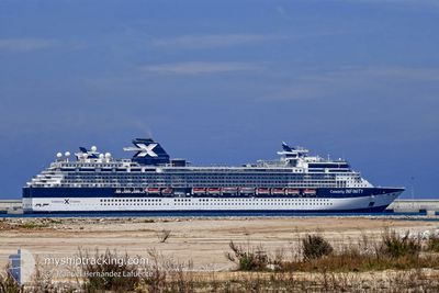
CELEBRITY INFINITY
Passengers Ship
Current Trip
| Time Travelled | 13 h, 41 mins |
|---|---|
| Remaining Time | 3 h, 10 mins |
| Distance Travelled | 214.32 nm |
| Remaining Distance | 135.05 nm |
| AVG Speed | 15.9 Knots |
| MAX Speed | 17 Knots |
| AVG Wind | 6.8 knots |
| MAX Wind | 10.2 knots |
| MIN Temp | 18.3°C / 64.94°F |
| MAX Temp | 19°C / 66.2°F |
| Draught | 8.3 m |
| Position Received | 7 h, 40 m ago |
Current Position
| Longitude | 29.94116° |
|---|---|
| Latitude | 35.68330° |
| Status | Under way using engine |
| Speed | 16.4 Knots |
| Course | 117.8° |
| Area | Mediterranean Sea - Eastern Basin |
| Station | T-AIS |
| Position Received | 7 h, 40 m ago |
Info
Information
The current position of CELEBRITY INFINITY is in Mediterranean Sea - Eastern Basin with coordinates 35.68330° / 29.94116° as reported on 2024-04-19 19:03 by AIS to our vessel tracker app. The vessel's current speed is 16.4 Knots and is heading at the port of LIMASSOL. The estimated time of arrival as calculated by MyShipTracking vessel tracking app is 2024-04-20 05:54 LT
The vessel CELEBRITY INFINITY (IMO: 9189421, MMSI: 249048000) is a Passengers Ship that was built in 2001 ( 23 years old ). It's sailing under the flag of [MT] Malta.
In this page you can find informations about the vessels current position, last detected port calls, and current voyage information. If the vessels is not in coverage by AIS you will find the latest position.
The current position of CELEBRITY INFINITY is detected by our AIS receivers and we are not responsible for the reliability of the data. The last position was recorded while the vessel was in Coverage by the Ais receivers of our vessel tracking app.
The current draught of CELEBRITY INFINITY as reported by AIS is 8.3 meters
Weather
| Temperature | 18.4°C / 65.12°F |
|---|---|
| Wind Speed | 8 knots |
| Direction | 182° S |
| Pressure | 1010.1 hPa |
| Humidity | 78.5 % |
| Cloud Coverage | 56 % |
Featured Company
Last Port Calls
| Port | Arrival | Departure | Time In Port |
|---|---|---|---|
| 2024-04-19 03:15 | 2024-04-19 13:03 | 9 h | |
| 2024-04-16 06:20 | 2024-04-17 16:24 | 1 d | |
| 2024-04-14 03:32 | 2024-04-15 14:00 | 1 d | |
| 2024-04-13 04:13 | 2024-04-13 13:57 | 9 h | |
| 2024-04-11 04:07 | 2024-04-11 16:05 | 11 h | |
| 2024-04-09 05:37 | 2024-04-09 14:54 | 9 h | |
| 2024-04-08 05:26 | 2024-04-08 17:13 | 11 h | |
| 2024-04-06 06:20 | 2024-04-07 12:02 | 1 d | |
| 2024-04-03 21:44 | 2024-04-05 13:56 | 1 d | |
| 2024-04-03 10:50 | 2024-04-03 11:10 | 19 m |
Last Trips
| Origin | Departure | Destination | Arrival | Distance | |
|---|---|---|---|---|---|
| 2024-04-17 19:24 | 2024-04-19 06:15 | 406.13 nm | |||
| 2024-04-15 17:00 | 2024-04-16 09:20 | 262.55 nm | |||
| 2024-04-13 16:57 | 2024-04-14 06:32 | 175.29 nm | |||
| 2024-04-11 19:05 | 2024-04-13 07:13 | 408.79 nm | |||
| 2024-04-09 17:54 | 2024-04-11 07:07 | 279.24 nm | |||
| 2024-04-08 20:13 | 2024-04-09 08:37 | 191.71 nm | |||
| 2024-04-07 15:02 | 2024-04-08 08:26 | 287.72 nm | |||
| 2024-04-05 16:56 | 2024-04-06 09:20 | 261.72 nm | |||
| 2024-04-03 14:10 | 2024-04-04 00:44 | 105.00 nm | |||
| 2024-04-03 13:33 | 2024-04-03 13:50 | 1.63 nm |
Events
| Time | Event | Details | Position / Dest | Info |
|---|---|---|---|---|
| 2024-04-19 19:17 | Status Changed | Default Under way using engine |
35.65467 / 30.00604
CY LMS
|
Speed: 16.4 kn Course: 117.8° |
| 2024-04-19 19:03 | Change Sea Area | Turkish part of the Mediterranean Sea - Eastern Basin Greek part of the Mediterranean Sea - Eastern Basin |
35.68330 / 29.94116
Mediterranean Sea - Eastern Basin
CY LMS
|
Speed: 16.4 kn Course: 117.8° |
| 2024-04-19 19:03 | OUT of Coverage |
35.68330 / 29.94116
Mediterranean Sea - Eastern Basin
CY LMS
|
Speed: 16.4 kn Course: 117.8° |
|
| 2024-04-19 17:48 | Status Changed | Under way using engine Default |
35.84420 / 29.57521
CY LMS
|
Speed: 16.2 kn Course: 119° |
| 2024-04-19 17:18 | Status Changed | Default Under way using engine |
35.90939 / 29.42703
CY LMS
|
Speed: 16.3 kn Course: 117.8° |
| 2024-04-19 16:55 | Change Sea Area | Greek part of the Mediterranean Sea - Eastern Basin Turkish part of the Mediterranean Sea - Eastern Basin |
35.95862 / 29.31481
Mediterranean Sea - Eastern Basin
CY LMS
|
Speed: 16.5 kn Course: 118.5° |
| 2024-04-19 16:46 | Status Changed | Under way using engine Default |
35.97896 / 29.26855
CY LMS
|
Speed: 16.4 kn Course: 118° |
| 2024-04-19 16:21 | Status Changed | Default Under way using engine |
36.03213 / 29.14721
CY LMS
|
Speed: 16.1 kn Course: 118.9° |
| 2024-04-19 14:38 | Change Sea Area | Turkish part of the Mediterranean Sea - Eastern Basin Greek part of the Mediterranean Sea - Eastern Basin |
36.25243 / 28.64421
Mediterranean Sea - Eastern Basin
CY LMS
|
Speed: 16.5 kn Course: 118.4° |
| 2024-04-19 13:03 | PORT DEPARTURE |
|
36.45251 / 28.23311
CY LMS
|
Speed: 4.5 kn Course: 177° |