
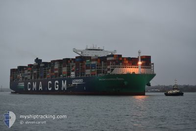
CC CHAMPS ELYSEES
Cargo A
Current Trip
| Time Travelled | 12 days |
|---|---|
| Remaining Time | --- |
| Distance Travelled | 5678.27 nm |
| Remaining Distance | --- |
| AVG Speed | 18.3 Knots |
| MAX Speed | 22 Knots |
| AVG Wind | 9.6 knots |
| MAX Wind | 23 knots |
| MIN Temp | 17.5°C / 63.5°F |
| MAX Temp | 30.5°C / 86.9°F |
| Draught | 16 m |
| Position Received | 2 h, 4 m ago |
Current Position
| Longitude | 17.92200° |
|---|---|
| Latitude | -34.50996° |
| Status | Under way using engine |
| Speed | 16.4 Knots |
| Course | 312.8° |
| Area | South Atlantic Ocean |
| Station | T-AIS |
| Position Received | 2 h, 4 m ago |
Info
Information
The current position of CC CHAMPS ELYSEES is in South Atlantic Ocean with coordinates -34.50996° / 17.92200° as reported on 2024-04-25 14:16 by AIS to our vessel tracker app. The vessel's current speed is 16.4 Knots and is heading at the port of TANGER MED. The estimated time of arrival as calculated by MyShipTracking vessel tracking app is 2024-05-07 10:00 LT
The vessel CC CHAMPS ELYSEES (IMO: 9839131, MMSI: 228386800) is a Cargo A It's sailing under the flag of [FR] France.
In this page you can find informations about the vessels current position, last detected port calls, and current voyage information. If the vessels is not in coverage by AIS you will find the latest position.
The current position of CC CHAMPS ELYSEES is detected by our AIS receivers and we are not responsible for the reliability of the data. The last position was recorded while the vessel was in Coverage by the Ais receivers of our vessel tracking app.
The current draught of CC CHAMPS ELYSEES as reported by AIS is 16 meters
Weather
| Temperature | 17.6°C / 63.68°F |
|---|---|
| Wind Speed | 18 knots |
| Direction | 154° SSE |
| Pressure | 1021.2 hPa |
| Humidity | 87.8 % |
| Cloud Coverage | 96 % |
Featured Company
Last Port Calls
| Port | Arrival | Departure | Time In Port |
|---|---|---|---|
| 2024-04-11 17:59 | 2024-04-13 04:47 | 1 d | |
| 2024-04-04 20:16 | 2024-04-06 01:32 | 1 d | |
| 2024-03-28 16:23 | 2024-03-30 14:02 | 1 d | |
| 2024-03-24 12:53 | 2024-03-26 07:40 | 1 d | |
| 2024-03-13 03:32 | 2024-03-14 17:36 | 1 d | |
| 2024-02-11 05:29 | 2024-02-13 12:56 | 2 d | |
| 2024-02-08 06:53 | 2024-02-10 11:29 | 2 d | |
| 2024-02-04 07:34 | 2024-02-07 09:38 | 3 d | |
| 2024-02-03 12:43 |
Most Visited Ports (Last year)
| Port | Arrivals | |
|---|---|---|
| 6 | ||
| 6 | ||
| 4 | ||
| 4 | ||
| 3 | ||
| 3 |
Last Trips
| Origin | Departure | Destination | Arrival | Distance | |
|---|---|---|---|---|---|
| 2024-04-06 09:32 | 2024-04-12 01:59 | 1472.99 nm | |||
| 2024-03-30 22:02 | 2024-04-05 04:16 | 905.43 nm | |||
| 2024-03-26 15:40 | 2024-03-29 00:23 | 518.43 nm | |||
| 2024-03-15 01:36 | 2024-03-24 20:53 | 2597.88 nm | |||
| 2024-02-13 13:56 | 2024-03-13 11:32 | 11697.16 nm | |||
| 2024-02-10 12:29 | 2024-02-11 06:29 | 263.72 nm | |||
| 2024-02-07 09:38 | 2024-02-08 07:53 | 275.18 nm | |||
| 2024-02-03 13:43 | 2024-02-04 07:34 | 257.81 nm |
Events
| Time | Event | Details | Position / Dest | Info |
|---|---|---|---|---|
| 2024-04-25 14:22 | Status Changed | Default Under way using engine |
-34.49111 / 17.89856
TANGER MED (MAPTM)
|
Speed: 16.4 kn Course: 312.8° |
| 2024-04-25 14:16 | OUT of Coverage |
-34.50996 / 17.92200
South Atlantic Ocean
TANGER MED (MAPTM)
|
Speed: 16.4 kn Course: 312.8° |
|
| 2024-04-25 12:36 | ETA Changed | 2024/05/07 10:00 2024/05/05 22:00 |
-34.78769 / 18.37606
TANGER MED (MAPTM)
|
Speed: 17.2 kn Course: 307.3° |
| 2024-04-25 11:59 | Status Changed | Under way using engine Default |
-34.87729 / 18.54716
TANGER MED (MAPTM)
|
Speed: 15.9 kn Course: 304° |
| 2024-04-25 11:46 | Status Changed | Default Under way using engine |
-34.91104 / 18.60866
TANGER MED (MAPTM)
|
Speed: 15.9 kn Course: 302.9° |
| 2024-04-25 11:40 | Status Changed | Under way using engine Default |
-34.92575 / 18.63505
TANGER MED (MAPTM)
|
Speed: 16 kn Course: 301° |
| 2024-04-25 11:21 | Status Changed | Default Under way using engine |
-34.96910 / 18.72433
TANGER MED (MAPTM)
|
Speed: 15.9 kn Course: 300° |
| 2024-04-25 11:08 | Status Changed | Under way using engine Default |
-34.99611 / 18.78154
TANGER MED (MAPTM)
|
Speed: 15.6 kn Course: 294° |
| 2024-04-25 10:14 | Status Changed | Default Under way using engine |
-35.00744 / 19.06562
TANGER MED (MAPTM)
|
Speed: 15.7 kn Course: 268.8° |
| 2024-04-25 10:03 | Detected in Sea | South African part of the South Atlantic Ocean |
-35.00613 / 19.12344
South Atlantic Ocean
TANGER MED (MAPTM)
|
Speed: 15.6 kn Course: 268.4° |