
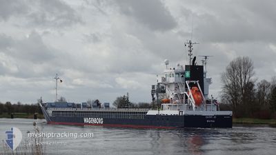
CATHY JO
General Cargo
Current Trip
| Time Travelled | 1 day |
|---|---|
| Remaining Time | 4 days |
| Distance Travelled | 263.10 nm |
| Remaining Distance | 1230.70 nm |
| AVG Speed | 10.4 Knots |
| MAX Speed | 11.4 Knots |
| AVG Wind | 12.1 knots |
| MAX Wind | 22 knots |
| MIN Temp | -4.4°C / 24.08°F |
| MAX Temp | 0.1°C / 32.18°F |
| Draught | 6.2 m |
| Position Received | 4 h, 19 m ago |
Current Position
| Longitude | 20.25001° |
|---|---|
| Latitude | 62.96592° |
| Status | Under way using engine |
| Speed | 11.2 Knots |
| Course | 194.3° |
| Area | Gulf of Bothnia |
| Station | T-AIS |
| Position Received | 4 h, 19 m ago |
Info
Information
The current position of CATHY JO is in Gulf of Bothnia with coordinates 62.96592° / 20.25001° as reported on 2024-04-23 20:54 by AIS to our vessel tracker app. The vessel's current speed is 11.2 Knots and is heading at the port of TERNEUZEN. The estimated time of arrival as calculated by MyShipTracking vessel tracking app is 2024-04-28 18:49 LT
The vessel CATHY JO (IMO: 9419278, MMSI: 246996000) is a General Cargo that was built in 2008 ( 16 years old ). It's sailing under the flag of [NL] Netherlands.
In this page you can find informations about the vessels current position, last detected port calls, and current voyage information. If the vessels is not in coverage by AIS you will find the latest position.
The current position of CATHY JO is detected by our AIS receivers and we are not responsible for the reliability of the data. The last position was recorded while the vessel was in Coverage by the Ais receivers of our vessel tracking app.
The current draught of CATHY JO as reported by AIS is 6.2 meters
Weather
| Temperature | -0.1°C / 31.82°F |
|---|---|
| Wind Speed | 11 knots |
| Direction | 238° WSW |
| Pressure | 1008.9 hPa |
| Humidity | 98 % |
| Cloud Coverage | 100 % |
Featured Company
Last Port Calls
| Port | Arrival | Departure | Time In Port |
|---|---|---|---|
| 2024-04-09 00:25 | 2024-04-22 21:56 | 13 d | |
| 2024-03-15 09:00 | 2024-03-20 21:41 | 5 d | |
| 2024-03-13 18:19 | 2024-03-13 19:14 | 54 m | |
| 2024-03-08 01:27 | 2024-03-13 11:05 | 5 d | |
| 2024-03-07 18:31 | 2024-03-07 18:54 | 22 m | |
| 2024-03-02 14:42 | 2024-03-05 19:59 | 3 d | |
| 2024-02-26 00:59 | 2024-03-01 05:26 | 4 d | |
| 2024-02-21 15:15 | 2024-02-21 15:19 | 4 m | |
| 2024-02-13 00:47 | 2024-02-19 13:35 | 6 d | |
| 2024-02-07 19:00 | 2024-02-12 12:27 | 4 d |
Most Visited Ports (Last year)
| Port | Arrivals | |
|---|---|---|
| 5 | ||
| 4 | ||
| 3 | ||
| 3 | ||
| 3 | ||
| 3 |
Last Trips
| Origin | Departure | Destination | Arrival | Distance | |
|---|---|---|---|---|---|
| 2024-03-20 22:41 | 2024-04-09 03:25 | 898.52 nm | |||
| 2024-03-13 20:14 | 2024-03-15 10:00 | 386.17 nm | |||
| 2024-03-13 12:05 | 2024-03-13 19:19 | 64.96 nm | |||
| 2024-03-07 19:54 | 2024-03-08 02:27 | 65.86 nm | |||
| 2024-03-05 21:59 | 2024-03-07 19:31 | 449.42 nm | |||
| 2024-03-01 07:26 | 2024-03-02 16:42 | 171.70 nm | |||
| 2024-02-21 16:19 | 2024-02-26 02:59 | 980.53 nm | |||
| 2024-02-19 14:35 | 2024-02-21 16:15 | 425.14 nm | |||
| 2024-02-12 13:27 | 2024-02-13 01:47 | 127.69 nm | |||
| 2024-02-02 18:58 | 2024-02-07 20:00 | 1109.29 nm |
Events
| Time | Event | Details | Position / Dest | Info |
|---|---|---|---|---|
| 2024-04-23 21:00 | Status Changed | Default Under way using engine |
62.94837 / 20.23952
NLTNZ
|
Speed: 11.2 kn Course: 194.3° |
| 2024-04-23 20:54 | OUT of Coverage |
62.96592 / 20.25001
Gulf of Bothnia
|
Speed: 11.2 kn Course: 194.3° |
|
| 2024-04-23 20:47 | Status Changed | Under way using engine Default |
62.98901 / 20.26254
NLTNZ
|
Speed: 11.1 kn Course: 193° |
| 2024-04-23 20:25 | Status Changed | Default Under way using engine |
63.05459 / 20.29649
NLTNZ
|
Speed: 11 kn Course: 194.5° |
| 2024-04-23 20:18 | Status Changed | Under way using engine Default |
63.07417 / 20.30772
NLTNZ
|
Speed: 11.1 kn Course: 194° |
| 2024-04-23 20:12 | Status Changed | Default Under way using engine |
63.09106 / 20.31731
NLTNZ
|
Speed: 11.2 kn Course: 195.1° |
| 2024-04-23 20:06 | Status Changed | Under way using engine Default |
63.11094 / 20.32876
NLTNZ
|
Speed: 11.3 kn Course: 194° |
| 2024-04-23 20:04 | Status Changed | Default Under way using engine |
63.11498 / 20.33108
NLTNZ
|
Speed: 11.3 kn Course: 191.3° |
| 2024-04-23 18:28 | Detected in Sea | Finnish part of the Gulf of Bothnia |
63.39408 / 20.51934
Gulf of Bothnia
|
Speed: 10.9 kn Course: 218.3° |
| 2024-04-23 17:49 | Status Changed | Under way using engine Default |
63.49224 / 20.66753
NLTNZ
|
Speed: 10.7 kn Course: 208° |