
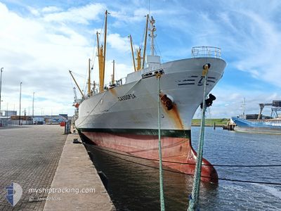
CASSIOPEA
Reefer
Current Trip
| Time Travelled | 10 days |
|---|---|
| Remaining Time | --- |
| Distance Travelled | 120.27 nm |
| Remaining Distance | --- |
| AVG Speed | 8.9 Knots |
| MAX Speed | 11.7 Knots |
| AVG Wind | 4 knots |
| MAX Wind | 13 knots |
| MIN Temp | 7.8°C / 46.04°F |
| MAX Temp | 20°C / 68°F |
| Draught | 5 m |
| Position Received | 4 d ago |
Current Position
| Longitude | -73.04800° |
|---|---|
| Latitude | -36.70558° |
| Status | At anchor |
| Speed | |
| Course | 333° |
| Area | South Pacific Ocean |
| Station | T-AIS |
| Position Received | 4 d ago |
Info
Information
The current position of CASSIOPEA is in South Pacific Ocean with coordinates -36.70558° / -73.04800° as reported on 2024-04-15 10:42 by AIS to our vessel tracker app. The vessel's current speed is 0 Knots
The vessel CASSIOPEA (IMO: 9047269, MMSI: 277397000) is a Reefer that was built in 1993 ( 31 years old ). It's sailing under the flag of [LT] Lithuania.
In this page you can find informations about the vessels current position, last detected port calls, and current voyage information. If the vessels is not in coverage by AIS you will find the latest position.
The current position of CASSIOPEA is detected by our AIS receivers and we are not responsible for the reliability of the data. The last position was recorded while the vessel was in Coverage by the Ais receivers of our vessel tracking app.
The current draught of CASSIOPEA as reported by AIS is 5 meters
Weather
| Temperature | 11.4°C / 52.52°F |
|---|---|
| Wind Speed | 3 knots |
| Direction | 236° SW |
| Pressure | 1018.5 hPa |
| Humidity | 81.6 % |
| Cloud Coverage | 100 % |
Featured Company
Last Trips
| Origin | Departure | Destination | Arrival | Distance | |
|---|---|---|---|---|---|
| 2024-02-26 18:27 | 2024-03-23 08:23 | 7437.29 nm | |||
| 2024-01-27 14:40 | 2024-02-18 01:12 | 6642.65 nm |
Events
| Time | Event | Details | Position / Dest | Info |
|---|---|---|---|---|
| 2024-04-15 10:45 | Status Changed | Default At anchor |
-36.70565 / -73.04812
TALCAHUANO
|
Speed: Course: 333° |
| 2024-04-15 10:42 | OUT of Coverage |
-36.70558 / -73.04800
South Pacific Ocean
|
Speed: Course: 21° |
|
| 2024-04-15 10:15 | Status Changed | At anchor Default |
-36.70563 / -73.04805
TALCAHUANO
|
Speed: Course: -1° |
| 2024-04-15 10:02 | IN Coverage |
-36.70563 / -73.04805
South Pacific Ocean
|
Speed: Course: 21° |
|
| 2024-04-14 03:20 | Status Changed | Default At anchor |
-36.70334 / -73.04667
TALCAHUANO
|
Speed: Course: 251° |
| 2024-04-14 03:18 | OUT of Coverage |
-36.70433 / -73.04743
South Pacific Ocean
|
Speed: Course: 339° |
|
| 2024-04-14 03:07 | Destination Changed | TALCAHUANO CORONEL |
-36.70460 / -73.04737
TALCAHUANO
|
Speed: Course: 262° |
| 2024-04-14 03:07 | ETA Changed | 2025/03/22 08:00 2024/03/22 08:00 |
-36.70460 / -73.04737
TALCAHUANO
|
Speed: Course: 262° |
| 2024-04-14 03:03 | Change Sea Area | Chilean (disputed - Chilean point of view) part of the South Pacific Ocean Argentinean part of the South Atlantic Ocean |
-36.70460 / -73.04737
South Pacific Ocean
|
Speed: Course: 348° |
| 2024-04-14 03:03 | Status Changed | At anchor Default |
-36.70460 / -73.04737
CORONEL
|
Speed: Course: 262° |