
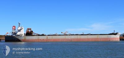
CAPE MIDORI
Bulk Carrier
Current Trip
| Time Travelled | 2 days |
|---|---|
| Remaining Time | --- |
| Distance Travelled | 426.78 nm |
| Remaining Distance | --- |
| AVG Speed | 10.9 Knots |
| MAX Speed | 14.2 Knots |
| AVG Wind | 9.4 knots |
| MAX Wind | 26.8 knots |
| MIN Temp | 14.9°C / 58.82°F |
| MAX Temp | 20.5°C / 68.9°F |
| Draught | 10.4 m |
| Position Received | 2 d ago |
Current Position
| Longitude | 134.93155° |
|---|---|
| Latitude | 34.01389° |
| Status | Under way using engine |
| Speed | 11.1 Knots |
| Course | 190.6° |
| Area | Philippine Sea |
| Station | T-AIS |
| Position Received | 2 d ago |
Info
Information
The current position of CAPE MIDORI is in Philippine Sea with coordinates 34.01389° / 134.93155° as reported on 2024-04-16 15:27 by AIS to our vessel tracker app. The vessel's current speed is 11.1 Knots and is heading at the port of ZHOUSHAN. The estimated time of arrival as calculated by MyShipTracking vessel tracking app is 2024-04-19 06:00 LT
The vessel CAPE MIDORI (IMO: 9531868, MMSI: 373615000) is a Bulk Carrier that was built in 2014 ( 10 years old ). It's sailing under the flag of [PA] Panama.
In this page you can find informations about the vessels current position, last detected port calls, and current voyage information. If the vessels is not in coverage by AIS you will find the latest position.
The current position of CAPE MIDORI is detected by our AIS receivers and we are not responsible for the reliability of the data. The last position was recorded while the vessel was in Coverage by the Ais receivers of our vessel tracking app.
The current draught of CAPE MIDORI as reported by AIS is 10.4 meters
Weather
| Temperature | 19.6°C / 67.28°F |
|---|---|
| Wind Speed | 19 knots |
| Direction | 334° NNW |
| Pressure | 1009.6 hPa |
| Humidity | 59.6 % |
| Cloud Coverage | 4 % |
Featured Company
Most Visited Ports (Last year)
| Port | Arrivals | |
|---|---|---|
| 2 | ||
| 2 | ||
| 2 | ||
| 1 | ||
| 1 | ||
| 1 |
Last Trips
| Origin | Departure | Destination | Arrival | Distance | |
|---|---|---|---|---|---|
| 2024-04-12 04:45 | 2024-04-14 08:24 | 297.85 nm | |||
| 2024-04-08 21:01 | 2024-04-10 10:11 | 406.74 nm | |||
| 2024-03-23 19:21 | 2024-04-06 22:04 | 3849.16 nm | |||
| 2024-02-22 22:11 | 2024-03-20 15:40 | 3207.33 nm | |||
| 2023-12-23 22:09 | 2024-02-17 15:15 | 8262.09 nm |
Events
| Time | Event | Details | Position / Dest | Info |
|---|---|---|---|---|
| 2024-04-16 15:31 | Status Changed | Default Under way using engine |
33.99985 / 134.92795
CN ZOS
|
Speed: 11.1 kn Course: 190.6° |
| 2024-04-16 15:27 | OUT of Coverage |
34.01389 / 134.93155
Philippine Sea
CN ZOS
|
Speed: 11.1 kn Course: 190.6° |
|
| 2024-04-16 13:56 | Change Sea Area | Japanese part of the Philippine Sea Japanese part of the Inland Sea |
34.26664 / 134.97417
Philippine Sea
CN ZOS
|
Speed: 12.4 kn Course: 184.8° |
| 2024-04-16 13:49 | Status Changed | Under way using engine Default |
34.29136 / 134.97820
CN ZOS
|
Speed: 12.4 kn Course: 194° |
| 2024-04-16 13:43 | Status Changed | Default Under way using engine |
34.30999 / 134.98384
CN ZOS
|
Speed: 12.3 kn Course: 194.2° |
| 2024-04-16 13:04 | Status Changed | Under way using engine Default |
34.43604 / 135.04470
CN ZOS
|
Speed: 12.4 kn Course: 209° |
| 2024-04-16 12:55 | Status Changed | Default Under way using engine |
34.46358 / 135.06380
CN ZOS
|
Speed: 12.5 kn Course: 209.9° |
| 2024-04-16 09:15 | PORT DEPARTURE |
|
34.76118 / 134.62559
CN ZOS
|
Speed: 6.3 kn Course: 190° |
| 2024-04-16 09:09 | START Moving |
34.76883 / 134.62776
[JP] HIRAHATA
|
Speed: 3.1 kn Course: 194° |
|
| 2024-04-16 08:52 | Status Changed | Under way using engine Moored |
34.76970 / 134.62425
[JP] HIRAHATA
|
Speed: Course: 4° |