
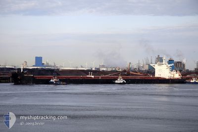
CAPE BREEZE
Bulk Carrier
Current Trip
| Time Travelled | 2 days |
|---|---|
| Remaining Time | --- |
| Distance Travelled | 731.70 nm |
| Remaining Distance | --- |
| AVG Speed | 11.7 Knots |
| MAX Speed | 12.8 Knots |
| AVG Wind | 10.3 knots |
| MAX Wind | 17.8 knots |
| MIN Temp | 27.6°C / 81.68°F |
| MAX Temp | 29.8°C / 85.64°F |
| Draught | 15.1 m |
| Position Received | 9 d ago |
Current Position
| Longitude | 75.32687° |
|---|---|
| Latitude | 10.11975° |
| Status | Under way using engine |
| Speed | 10.7 Knots |
| Course | 334° |
| Area | Laccadive Sea |
| Station | T-AIS |
| Position Received | 9 d ago |
Info
Information
The current position of CAPE BREEZE is in Laccadive Sea with coordinates 10.11975° / 75.32687° as reported on 2024-04-15 10:35 by AIS to our vessel tracker app. The vessel's current speed is 10.7 Knots and is heading at the port of JAIGAD. The estimated time of arrival as calculated by MyShipTracking vessel tracking app is 2024-04-17 02:30 LT
The vessel CAPE BREEZE (IMO: 9518919, MMSI: 209596000) is a Bulk Carrier that was built in 2010 ( 14 years old ). It's sailing under the flag of [CY] Cyprus.
In this page you can find informations about the vessels current position, last detected port calls, and current voyage information. If the vessels is not in coverage by AIS you will find the latest position.
The current position of CAPE BREEZE is detected by our AIS receivers and we are not responsible for the reliability of the data. The last position was recorded while the vessel was in Coverage by the Ais receivers of our vessel tracking app.
The current draught of CAPE BREEZE as reported by AIS is 15.1 meters
Weather
| Temperature | 28.9°C / 84.02°F |
|---|---|
| Wind Speed | 9 knots |
| Direction | 37° NE |
| Pressure | 1006.1 hPa |
| Humidity | 77.4 % |
| Cloud Coverage | 18 % |
Featured Company
Most Visited Ports (Last year)
| Port | Arrivals | |
|---|---|---|
| 5 | ||
| 2 | ||
| 2 | ||
| 1 | ||
| 1 | ||
| 1 |
Last Trips
| Origin | Departure | Destination | Arrival | Distance | |
|---|---|---|---|---|---|
| 2024-03-23 22:01 | 2024-04-17 12:18 | 6445.95 nm | |||
| 2024-02-25 15:46 | 2024-03-22 15:47 | 4305.53 nm | |||
| 2024-02-15 11:23 | 2024-02-23 12:41 | 567.16 nm | |||
| 2023-12-20 13:17 | 2024-02-12 07:18 | 10455.54 nm |
Events
| Time | Event | Details | Position / Dest | Info |
|---|---|---|---|---|
| 2024-04-22 10:56 | START Moving | 1.62 nm, West of MORMUGAO |
15.41920 / 73.78255
JAIGARH
|
Speed: 6 kn Course: 263° |
| 2024-04-22 10:46 | PORT DEPARTURE |
|
15.41920 / 73.78255
JAIGARH
|
Speed: 1.7 kn Course: 322° |
| 2024-04-17 07:13 | STOP Moving |
17.30662 / 73.20876
[IN] JAIGAD
|
Speed: 0.2 kn Course: 208° |
|
| 2024-04-17 06:48 | PORT ARRIVAL |
|
17.31003 / 73.20097
[IN] JAIGAD
|
Speed: 4.3 kn Course: 104° |
| 2024-04-15 10:49 | Status Changed | Default Under way using engine |
10.15755 / 75.30913
JAIGARH
|
Speed: 10.7 kn Course: 334° |
| 2024-04-15 10:35 | OUT of Coverage |
10.11975 / 75.32687
Laccadive Sea
JAIGARH
|
Speed: 10.7 kn Course: 334° |
|
| 2024-04-15 10:29 | Status Changed | Under way using engine Default |
10.10355 / 75.33448
JAIGARH
|
Speed: 10.6 kn Course: 335° |
| 2024-04-15 10:29 | IN Coverage |
10.10947 / 75.33172
Laccadive Sea
JAIGARH
|
Speed: 10.7 kn Course: 335° |
|
| 2024-04-15 02:05 | Status Changed | Default Under way using engine |
8.75862 / 75.99204
JAIGARH
|
Speed: 10.3 kn Course: 330° |
| 2024-04-15 01:41 | OUT of Coverage |
8.69770 / 76.02822
Laccadive Sea
JAIGARH
|
Speed: 10.3 kn Course: 330° |