
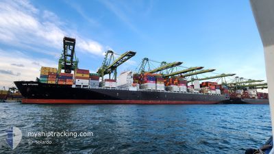
CAPE ARTEMISIO
Cargo
Current Trip
| Time Travelled | 9 days |
|---|---|
| Remaining Time | 13 days |
| Distance Travelled | 2933.12 nm |
| Remaining Distance | 6125.77 nm |
| AVG Speed | 16.4 Knots |
| MAX Speed | 19.9 Knots |
| AVG Wind | 9.3 knots |
| MAX Wind | 25 knots |
| MIN Temp | 14.6°C / 58.28°F |
| MAX Temp | 25.5°C / 77.9°F |
| Draught | 14.4 m |
| Position Received | 7 d ago |
Current Position
| Longitude | -46.29052° |
|---|---|
| Latitude | -23.98643° |
| Status | Under way using engine |
| Speed | 6.1 Knots |
| Course | 215.2° |
| Area | South Atlantic Ocean |
| Station | T-AIS |
| Position Received | 7 d ago |
Info
Information
The current position of CAPE ARTEMISIO is in South Atlantic Ocean with coordinates -23.98643° / -46.29052° as reported on 2024-04-16 03:51 by AIS to our vessel tracker app. The vessel's current speed is 6.1 Knots and is heading at the port of SINGAPORE. The estimated time of arrival as calculated by MyShipTracking vessel tracking app is 2024-05-07 04:41 LT
The vessel CAPE ARTEMISIO (IMO: 9777175, MMSI: 248140000) is a Cargo It's sailing under the flag of [MT] Malta.
In this page you can find informations about the vessels current position, last detected port calls, and current voyage information. If the vessels is not in coverage by AIS you will find the latest position.
The current position of CAPE ARTEMISIO is detected by our AIS receivers and we are not responsible for the reliability of the data. The last position was recorded while the vessel was in Coverage by the Ais receivers of our vessel tracking app.
The current draught of CAPE ARTEMISIO as reported by AIS is 14.4 meters
Weather
| Temperature | 17.9°C / 64.22°F |
|---|---|
| Wind Speed | 10 knots |
| Direction | 246° WSW |
| Pressure | 1014.6 hPa |
| Humidity | 87.8 % |
| Cloud Coverage | 52 % |
Featured Company
Last Port Calls
| Port | Arrival | Departure | Time In Port |
|---|---|---|---|
| 2024-04-13 21:57 | 2024-04-13 22:47 | 50 m | |
| 2024-04-10 23:15 | 2024-04-11 13:47 | 14 h | |
| 2024-04-09 20:14 | 2024-04-10 05:14 | 8 h | |
| 2024-03-30 15:07 | 2024-04-01 04:36 | 1 d | |
| 2024-03-28 14:26 | 2024-03-29 10:41 | 20 h | |
| 2024-03-20 21:41 | 2024-03-23 23:09 | 3 d | |
| 2024-03-19 17:20 | 2024-03-19 18:00 | 39 m | |
| 2024-03-18 01:22 | 2024-03-18 02:21 | 58 m | |
| 2024-02-23 00:44 | 2024-02-24 19:04 | 1 d | |
| 2024-02-17 10:51 | 2024-02-18 04:54 | 18 h |
Most Visited Ports (Last year)
| Port | Arrivals | |
|---|---|---|
| 10 | ||
| 8 | ||
| 7 | ||
| 6 | ||
| 5 | ||
| 5 |
Last Trips
| Origin | Departure | Destination | Arrival | Distance | |
|---|---|---|---|---|---|
| 2024-04-11 10:47 | 2024-04-13 18:57 | 220.07 nm | |||
| 2024-04-10 02:14 | 2024-04-10 20:15 | 107.48 nm | |||
| 2024-04-01 01:36 | 2024-04-09 17:14 | 942.15 nm | |||
| 2024-03-29 07:41 | 2024-03-30 12:07 | 148.24 nm | |||
| 2024-03-23 20:09 | 2024-03-28 11:26 | 842.79 nm | |||
| 2024-03-19 15:00 | 2024-03-20 18:41 | 169.49 nm | |||
| 2024-03-17 23:21 | 2024-03-19 14:20 | 6.02 nm | |||
| 2024-02-25 03:04 | 2024-03-17 22:22 | 8992.15 nm | |||
| 2024-02-18 12:54 | 2024-02-23 08:44 | 1468.04 nm | |||
| 2024-02-06 02:53 | 2024-02-17 18:51 | 1437.57 nm |
Events
| Time | Event | Details | Position / Dest | Info |
|---|---|---|---|---|
| 2024-04-16 03:55 | Status Changed | Default Under way using engine |
-23.99202 / -46.29665
SGSIN PWBGA
|
Speed: 6.1 kn Course: 215.2° |
| 2024-04-16 03:51 | OUT of Coverage |
-23.98643 / -46.29052
South Atlantic Ocean
SGSIN PWBGA
|
Speed: 6.1 kn Course: 215.2° |
|
| 2024-04-16 03:14 | Draught Changed | 14.4 12.4 |
-23.92739 / -46.32893
SGSIN PWBGA
|
Speed: 7.3 kn Course: 107.3° |
| 2024-04-16 03:14 | Destination Changed | SGSIN PWBGA BRSSZ |
-23.92739 / -46.32893
SGSIN PWBGA
|
Speed: 7.3 kn Course: 107.3° |
| 2024-04-16 03:14 | ETA Changed | 2024/05/06 02:00 2024/04/13 21:45 |
-23.92739 / -46.32893
SGSIN PWBGA
|
Speed: 7.3 kn Course: 107.3° |
| 2024-04-16 03:03 | START Moving | 3.16 nm, North West of SANTOS |
-23.91944 / -46.34779
BRSSZ
|
Speed: 4.6 kn Course: 87° |
| 2024-04-16 02:48 | Status Changed | Under way using engine Default |
-23.92036 / -46.35382
BRSSZ
|
Speed: Course: 101° |
| 2024-04-16 02:48 | IN Coverage |
-23.92027 / -46.35374
South Atlantic Ocean
|
Speed: 0.5 kn Course: 69.4° |
|
| 2024-04-14 14:55 | Status Changed | Default Moored |
-23.92090 / -46.35012
BRSSZ
|
Speed: Course: 101° |
| 2024-04-14 14:49 | OUT of Coverage |
-23.92097 / -46.35018
South Atlantic Ocean
|
Speed: Course: 139.4° |